2000–01 Australian region cyclone season
The 2000–01 Australian region cyclone season was a below average tropical cyclone season. It began on 1 November 2000 and ended on 30 April 2001. The regional tropical cyclone operational plan also defines a tropical cyclone year separately from a tropical cyclone season, which runs from 1 July 2000 to 30 June 2001.
| 2000–01 Australian region cyclone season | |
|---|---|
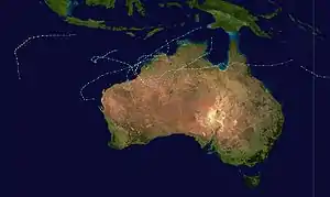 Season summary map | |
| Seasonal boundaries | |
| First system formed | 3 December 2000 |
| Last system dissipated | 23 April 2001 |
| Strongest storm | |
| Name | Sam |
| • Maximum winds | 205 km/h (125 mph) (10-minute sustained) |
| • Lowest pressure | 935 hPa (mbar) |
| Seasonal statistics | |
| Tropical lows | 9+ |
| Tropical cyclones | 8 |
| Severe tropical cyclones | 3 |
| Total fatalities | 2 total |
| Total damage | $12.8 million (2001 USD) |
| Related articles | |
Tropical cyclones in this area are monitored by four Tropical Cyclone Warning Centres (TCWCs): the Australian Bureau of Meteorology in Perth, Darwin, and Brisbane; and TCWC Port Moresby in Papua New Guinea.[1]
Season timeline

Systems
Severe Tropical Cyclone Sam
| Category 5 severe tropical cyclone (Australian scale) | |
| Category 3 tropical cyclone (SSHWS) | |
  | |
| Duration | 3 December – 10 December |
|---|---|
| Peak intensity | 205 km/h (125 mph) (10-min) 935 hPa (mbar) |
Sam originated from a tropical low that formed in the Arafura Sea on 28 November. Tracking generally westward, the initial low-pressure area remained generally weak until it entered the Timor Sea, by which time it had strengthened into a tropical cyclone on 5 December. Though a subtropical ridge was forcing the cyclone westward at the time,[2] an approaching shortwave trough caused Sam to track southward the following day, towards the Australian coast.[3][4] During its southward progression, Sam rapidly intensified, and reached its peak intensity on 7 December.[2][3][4] The next day, the storm made landfall near Lagrange, Western Australia at the same intensity.[5] Once inland, Sam was slow to weaken as it recurved eastward, and persisted for nearly a week inland before dissipating on 14 December.[4]
Throughout its existence, Cyclone Sam brought heavy rainfall to a wide swath of northern Australia.[3][4] Rainfall peaked at520 mm (20 in) in Shelamar over a 48-hour period ending on 11 December. Upon making landfall, damage was considerable, albeit localized.[4] Most of the destruction wrought by Sam occurred near the coast, particularly in Bidyadanga and Anna Springs Station.[3][4][6] Some buildings sustained considerable damage, and trees and power lines were felled, resulting in some power outages.[2] Offshore, 163 illegal immigrants aboard two vessels were feared to have drowned, which would make Sam one of the deadliest cyclones in Australian history.[2][7] However, these people were later accounted for.[8]
Tropical Cyclone Terri
| Category 2 tropical cyclone (Australian scale) | |
| Tropical storm (SSHWS) | |
  | |
| Duration | 27 January – 31 January |
|---|---|
| Peak intensity | 110 km/h (70 mph) (10-min) 975 hPa (mbar) |
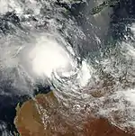
Terri formed on 27 January 2001 near the northern Kimberley coast. The storm paralleled the coast, reaching Category 2 strength before making landfall near Pardoo early on 31 January. The storm dissipated Late on the same day.[9]
Tropical Cyclone Vincent
| Category 1 tropical cyclone (Australian scale) | |
| Tropical storm (SSHWS) | |
  | |
| Duration | 7 February – 15 February |
|---|---|
| Peak intensity | 85 km/h (50 mph) (10-min) 980 hPa (mbar) |
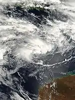
Cyclone Vincent formed on 7 February 2001, 900 km northwest of Onslow, Western Australia from an active monsoonal trough. Wind shear prevented the tropical low from intensifying for a few days, but once the storm formed it began to move southeast and intensify. Due to wind shear, Vincent peaked with sustained winds of 85 km/h (50 mph), and did not reach Category 2 intensity.[10] Cyclone Vincent crossed the Western Australia coast as a tropical low, a few kilometres south of Broome, Western Australia.
Tropical Cyclone Winsome
| Category 1 tropical cyclone (Australian scale) | |
| Tropical storm (SSHWS) | |
  | |
| Duration | 8 February – 14 February |
|---|---|
| Peak intensity | 75 km/h (45 mph) (10-min) 981 hPa (mbar) |
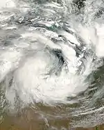
Winsome was a weak system that developed from a low in the Gulf of Carpentaria on 8 February.
Torrential rains produced by the storm in the Northern Territory resulted in severe flooding which killed two people.[11]
Tropical Cyclone Wylva
| Category 1 tropical cyclone (Australian scale) | |
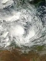  | |
| Duration | 14 February – 22 February |
|---|---|
| Peak intensity | 75 km/h (45 mph) (10-min) 988 hPa (mbar) |
Wylva formed from a low in the Gulf of Carpentaria on 15 February. Wylva briefly became a Category 1 tropical cyclone before making landfall near Booroloola in the morning of 16 February. Even though the system made landfall in a remote area, the remnants of the system caused $13 million in damage and around 700 people had to be evacuated. The remnants of Wylva dissipated on 22 February near Nanutarra.
Tropical Low 10P (07F)
| Tropical low (Australian scale) | |
| Tropical storm (SSHWS) | |
  | |
| Duration | 16 February – 16 February (exited basin) |
|---|---|
| Peak intensity | 55 km/h (35 mph) (10-min) 1000 hPa (mbar) |
This storm moved from Brisbane's area of responsibility into Fiji's on 16 February. It dissipated on the 18th.
Severe Tropical Cyclone Abigail
| Category 3 severe tropical cyclone (Australian scale) | |
| Tropical storm (SSHWS) | |
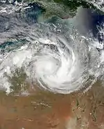  | |
| Duration | 24 February – 8 March |
|---|---|
| Peak intensity | 120 km/h (75 mph) (10-min) 970 hPa (mbar) |
On 24 February 2001, Cyclone Abigail formed about 80 km northeast of Cairns, Australia. It then made landfall in Queensland as a Category 1 storm.
Severe Tropical Cyclone Walter
| Category 3 severe tropical cyclone (Australian scale) | |
| Category 2 tropical cyclone (SSHWS) | |
  | |
| Duration | 1 April – 8 April |
|---|---|
| Peak intensity | 150 km/h (90 mph) (10-min) 940 hPa (mbar) |
Walter was a storm that formed east of Christmas Island and tracked westward at a low latitude.
On 3 April, Cocos Island was placed under a cyclone watch as Walter approached the island.[12] Throughout 5 April, heavy rains and high winds, estimated up to 90 km/h (56 mph) battered the area as Walter bypassed the island.[13]
Tropical Cyclone Alistair
| Category 2 tropical cyclone (Australian scale) | |
| Category 1 tropical cyclone (SSHWS) | |
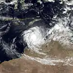  | |
| Duration | 15 April – 23 April |
|---|---|
| Peak intensity | 110 km/h (70 mph) (10-min) 975 hPa (mbar) |
The second most damaging cyclone of the 2000–01 cyclone season, Alistair made landfall close to Carnarvon on 24 April 2001 as a poorly organized cyclone. The centre passed just to the north of town with a wind gust to 67 kilometres per hour from the northeast recorded at 4:11 am. Minimum pressure of 1002.9 hPa was recorded at 5 am, followed by the peak recorded wind gust of 90 kilometres per hour from the southeast at 6 am. A total of 24 mm of rainfall was reported in Carnarvon. Plantations to the north of Carnarvon reported 30-40% crop losses, with wind estimates of 100 to 110 kilometres per hour.[14]
Season effects
This is a table of all of the storms that have formed in the 2000–01 Australian region cyclone season. It includes their duration, names, landfall(s)–denoted by bold location names – damages, and death totals. Damage and deaths include totals while the storm was extratropical, a wave, or a low, and all of the damage figures are in 2001 AUD and USD.
| Name | Dates | Peak intensity | Areas affected | Damages (AU$) |
Damages (US$) |
Deaths | |||
|---|---|---|---|---|---|---|---|---|---|
| Category | Wind speed (km/h (mph)) |
Pressure (hPa) | |||||||
| Sam | 3 – 10 December | Category 5 severe tropical cyclone | 205 km/h (125 mph) | 935 hPa (27.61 inHg) | Western Australia | Minor | Minor | None | |
| Terri | 27 – 31 January | Category 2 tropical cyclone | 110 km/h (70 mph) | 975 hPa (28.79 inHg) | Western Australia | None | None | None | |
| Vincent | 7 – 15 February | Category 1 tropical cyclone | 85 km/h (50 mph) | 980 hPa (28.93 inHg) | Western Australia | None | None | None | |
| Winsome | 8 – 14 February | Category 1 tropical cyclone | 75 km/h (40 mph) | 981 hPa (28.96 inHg) | Northern Territory | None | None | 2 | |
| Wylva | 14 – 22 February | Category 1 tropical cyclone | 75 km/h (45 mph) | 988 hPa (29.18 inHg) | Queensland, Northern Territory, Western Australia | None | None | None | |
| 10P | 16 – 16 February | Tropical Low | 55 km/h (35 mph) | 1000 hPa (29.53 inHg) | None | None | None | None | |
| Abigail | 24 February – 8 March | Category 3 severe tropical cyclone | 120 km/h (75 mph) | 970 hPa (28.64 inHg) | Queensland, Northern Territory, Western Australia | None | None | None | |
| Walter | 1 – 8 April | Category 3 severe tropical cyclone | 150 km/h (90 mph) | 940 hPa (27.75 inHg) | Cocos Islands | None | None | None | |
| Alistair | 15 – 23 April | Category 2 tropical cyclone | 110 km/h (70 mph) | 975 hPa (28.79 inHg) | New Guinea, Northern Territory, Western Australia | None | None | None | |
| Season aggregates | |||||||||
| 9 systems | 3 December – 23 April | 205 km/h (125 mph) | 935 hPa (27.61 inHg) | $12.8 million | 2 | ||||
See also
References
- Padgett, Gary; Kersemakers, Mark; Smith, Carl (December 2000). "December, 2000". Monthly Global Tropical Cyclone Summary. Australiansevereweather.com. Severe Tropical Cyclone Sam (TC-03S). Retrieved 8 August 2013.
- Chappel, Lori-Carmen; Bate, Peter W. (November 2002). "The South Pacific and southeast Indian Ocean tropical cyclone season 2000-01" (PDF). Australian Meteorological Magazine. Darwin, Australia: Bureau of Meteorology. 52 (1): 33–47. Archived from the original (PDF) on 21 March 2012. Retrieved 8 August 2013.
- Perth Tropical Cyclone Warning Centre. Severe Tropical Cyclone Sam (PDF). Bureau of Meteorology Tropical Cyclone Report (Report). Perth, Australia: Bureau of Meteorology. Retrieved 8 August 2013.
- United States Pacific Meteorology and Oceanography Center (2001). Annual Tropical Cyclone Report For 2001 (PDF). Annual Tropical Cyclone Report (Report). Pearl Harbor, Hawaii: Joint Typhoon Warning Center. pp. 199–200, 258, 306. Retrieved 8 August 2013.
- "Cyclone Sam Lashes Australia Coast". Perth, Australia. Associated Press. 8 December 2000. Retrieved 9 August 2013.
- "163 Feared Dead in Australian Boat Tragedy". Canberra, Australia. American Broadcasting Channel. 13 December 2000. Retrieved 9 August 2013.
- Fyfe, Melissa (4 January 2001). "Missing refugees alive, says Ruddock". The Age. Melbourne, Australia. (subscription required)
- "Season 2000-2001 Tropical Cyclone TERRI Track Map". australiasevereweather.com. Retrieved 19 October 2010.
- Meteorology, corporateName=Bureau of. "Tropical Cyclones". www.bom.gov.au. Retrieved 11 August 2017.
- James Wakelin and Alice Burton (14 February 2001). "Storm chaos: 2 feared dead; High winds lash Top End". Northern Territory News.
- "Cocos Cyclone". The Advertiser. 4 April 2001. p. 34.
- "Cyclone Walter hits Cocos". The Daily Telegraph. 6 April 2001. p. 17.
- "Western Australia Tropical Cyclone Season Summary 2000–01". Bom.gov.au. Retrieved 17 August 2012.
External links
- Joint Typhoon Warning Center (JTWC).
- Australian Government Bureau of Meteorology.
- World Meteorological Organization
- WMO Annual Summary of Global Tropical Cyclone Seasons 2000
- WMO Annual Summary of Global Tropical Cyclone Seasons 2001
- Joint Typhoon Warning Center 1999 ATCR
- Raw cyclone track data
- BoM Monthly Significant Weather Summaries
- July 2000 to June 2001 Tropical Cyclone Summaries and Operational Track Data
- Gary Padgett's Southern Hemisphere 2000-2001 Tropical Cyclone Season Review