A25 road (Belgium)
| ||||
|---|---|---|---|---|
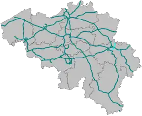
 Motorways in Belgium with A25 lighter. | ||||
| Route information | ||||
| Part of | ||||
| Maintained by the Roads and Traffic Agency of the Flemish government [1] and the Transport Agency of the Walloon government | ||||
| Length | 15 km[2] (9 mi) | |||
| Major junctions | ||||
| North end | ||||
| South end | ||||
| Highway system | ||||
Motorways in Belgium
| ||||
The A25 road is a motorway in Belgium.
History
Exit list
| Province | Municipality | km | mi | Exit | Destinations | Notes | |
|---|---|---|---|---|---|---|---|
| Limburg | Voeren | — | Border with the Netherlands; this road continues as the Dutch A2; north end of E 25 overlap | ||||
| Limburg–Liège provincial line | Voeren–Visé municipal line | 1 | |||||
| Liège | Visé | 2 | |||||
| 2a | Southbound entrance and northbound exit only | ||||||
| 3 | |||||||
| 4 | |||||||
| Visé–Liège municipal line | — | South end of E 25 overlap | |||||
| Liège | 5 | ||||||
| 6 | |||||||
| 7 | |||||||
| — | This road continues south as the N610 southbound and the N90 northbound | ||||||
1.000 mi = 1.609 km; 1.000 km = 0.621 mi
| |||||||
References
| Wikimedia Commons has media related to A25 (Belgium). |
- "Over het Agentschap Wegen en Verkeer" [About the Roads and Traffic Agency]. Roads and Traffic Agency of the Flemish government. Retrieved 29 December 2016.
- Google (October 2013). "A25". Google Street View. Google. Retrieved 29 December 2016.
This article is issued from Wikipedia. The text is licensed under Creative Commons - Attribution - Sharealike. Additional terms may apply for the media files.
