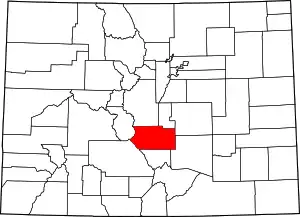
Adelaide, Fremont County, Colorado
Adelaide, Colorado[2] (formerly Robinson) is a former mining camp and railroad water stop along what is now known as Phantom Canyon Road in Fremont County, Colorado. The elevation of the ghost town is 6,950 feet (2,118 m). The Adelaide Bridge is located just north of the townsite.[3]
Adelaide | |
|---|---|
 Adelaide Location within the state of Colorado | |
| Coordinates: 38°33′36″N 105°05′27″W | |
| Country | United States |
| State | Colorado |
| County | Fremont |
| Elevation | 6,950 ft (2,120 m) |
| Population (2010) | |
| • Total | 0 |
| Time zone | UTC-7 (Mountain (MST)) |
| • Summer (DST) | UTC-6 (MDT) |
| GNIS feature ID | 191344[1] |
History
Prior to the construction of the railroad bridge, the town was named "Robinson."[4] A post office was established at Adelaide in 1894, and remained in operation until 1901.[5]
In 1894, the Adelaide Bridge was constructed as a 210-foot-long, 20-foot-wide narrow-gauge railroad passage for the Florence and Cripple Creek Railroad to carry gold mined in the region. The bridge and track were abandoned in 1912 and the railroad went out of business in 1915. The bridge was added to the National Register of Historic Places in 1985.[3]
References
- "Adelaide, Fremont County, Colorado". Geographic Names Information System. United States Geological Survey. 13 October 1978. Retrieved 21 March 2020.
- "Adelaide". Geographic Names Information System. United States Geological Survey.
- James Baughn (2007). "Adelaide Bridge". Bridgehunter. Retrieved 21 March 2020.
- "Adelaide". fremontcolorado.com. Retrieved 21 March 2020.
- "Place Names of Colorado" (PDF). Colorado Council of Genealogical Societies. 1999. p. 3. Retrieved 1 July 2019.Archive index at the Wayback Machine
