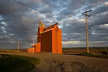
Admiral, Saskatchewan
Admiral (2016 population: 20) is a special service area[1] within the Rural Municipality of Wise Creek No. 77 in Saskatchewan, Canada. Originally incorporated as a village in 1914,[2] it relinquished its status when it dissolved on August 17, 2006.[7]
Admiral | |
|---|---|
Special service area[1] | |
.jpg.webp) Admiral, Saskatchewan | |
 Admiral  Admiral | |
| Coordinates: 49.713°N 108.003°W | |
| Country | Canada |
| Province | Saskatchewan |
| Region | Southwest Saskatchewan |
| Census division | 17 |
| Rural municipality | Wise Creek No. 77 |
| Federal riding | Cypress Hills—Grasslands |
| Post office founded | February 1, 1911 |
| Incorporated (village) | 1914[2] |
| Restructured | August 17, 2006 |
| Elevation | 840 m (2,750 ft) |
| Time zone | CST |
| Postal code | S0N 0B0 |
| Area code(s) | 306 |
| Highways | Highway 13 Highway 629 |
| [3][4][5][6] | |
Admiral is 1.6 km (1.0 mi) south of Highway 13 (the Red Coat Trail)[8] on the Great Western Railway,[9] approximately 65 km (40 mi) south of Swift Current. It is approximately 30 km (19 mi) equidistant from Shaunavon and Ponteix to the west and east respectively. Local services are limited to a post office[10] and Roman Catholic church.[11]
Demographics
| Canada census – Admiral, Saskatchewan community profile | |||
|---|---|---|---|
| 2016 | |||
| Population: | 20 (0% from 2011) | ||
| Land area: | 1.96 km2 (0.76 sq mi) | ||
| Population density: | 10.2/km2 (26/sq mi) | ||
| Median age: | Not Available (M: Not Available, F: Not Available) | ||
| Total private dwellings: | 10 | ||
| Median household income: | $Not Available | ||
| References: 2016[12] earlier[13] | |||
Economy

The economy of the Rural Municipality of Wise Creek No. 77 is predominantly based on agriculture including crop farming and livestock operations.[1]
Infrastructure
Saskatchewan Transportation Company provided intercity bus service to Admiral prior to its dissolution in 2017.[14][15]
See also
References
- "Welcome To The RM of Wise Creek No.77!". RM Wise Creek. Retrieved 2020-09-27.
- "Encyclopedia of Saskatchewan". University of Regina. Retrieved 2020-09-28.
- National Archives, Archivia Net, Post Offices and Postmasters, archived from the original on 2006-10-06
- Government of Saskatchewan, MRD Home, Municipal Directory System, archived from the original on December 11, 2007
- Canadian Textiles Institute. (2005), CTI Determine your provincial constituency, archived from the original on 2007-09-11
- Commissioner of Canada Elections, Chief Electoral Officer of Canada (2005), Elections Canada On-line, archived from the original on 2007-04-21
- Restructured Villages, Saskatchewan Ministry of Municipal Affairs, archived from the original on March 25, 2008, retrieved 2008-02-10
- 2018/2019 Saskatchewan Official Road Map (Map). Tourism Saskatchewan. 2019. Retrieved October 4, 2020.
- "Map". Great Western Railway. Retrieved October 4, 2020.
- "Admiral Post Office details". Canada Post. Retrieved 2020-09-27.
- "Holy Family Parish details". Archdiocise of Regina. Retrieved 2020-09-27.
- "2016 Community Profiles". 2016 Canadian Census. Statistics Canada. February 21, 2017. Retrieved 2020-09-28.
- "2001 Community Profiles". 2001 Canadian Census. Statistics Canada. February 17, 2012.
- "STC Route map" (PDF). Archived from the original (PDF) on 2013-10-04. Retrieved 2010-06-21.
- "A year after the last ride, STC enthusiasts still miss the bus". Regina Leader Post. Retrieved 2020-09-25.
