Aghione
Aghione is a commune in the Haute-Corse department of France on the island of Corsica.
Aghione | |
|---|---|
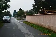
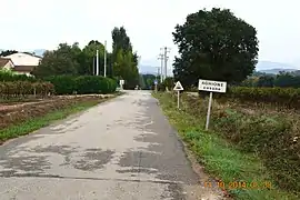 The road into Aghione | |
Location of Aghione 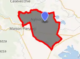
| |
 Aghione  Aghione | |
| Coordinates: 42°06′45″N 9°24′05″E | |
| Country | France |
| Region | Corsica |
| Department | Haute-Corse |
| Arrondissement | Corte |
| Canton | Ghisonaccia |
| Intercommunality | Oriente |
| Government | |
| • Mayor (2014-2020) | André Casanova |
| Area 1 | 33.88 km2 (13.08 sq mi) |
| Population (2017-01-01)[1] | 241 |
| • Density | 7.1/km2 (18/sq mi) |
| Time zone | UTC+01:00 (CET) |
| • Summer (DST) | UTC+02:00 (CEST) |
| INSEE/Postal code | 2B002 /20270 |
| Elevation | 17–459 m (56–1,506 ft) (avg. 66 m or 217 ft) |
| 1 French Land Register data, which excludes lakes, ponds, glaciers > 1 km2 (0.386 sq mi or 247 acres) and river estuaries. | |
The inhabitants of the commune are known as Aghionais or Aghionaises[2]
Geography
Aghion is located on the eastern plains of Corsica 5 km west of Aleria. It can be accessed by the D343 road which comes from the National Highway N198 in the south east and passes west though the southern plain of the commune to Maison Pierraggi in the west and continues on to Vezzani in the Tagnone Valley 25 km away. From the D343 the D443 branches north at the hamlet of Samuleto and continues to the village before continuing north by a tortuous mountain route to Casevecchie.[3]
The commune is watered by the Tagnon, a tributary of Tavignano that separates an area of hills to the north from the plain, which is larger in area, to the south. There is a large dam with a large lake in the south of the commune.[3]
Neighbouring communes and villages
History
During the Second World War Aghione aerodrome was used by the 306th Fighter Wing of the 15th US Air Force from 10–21 August 1944 to support Operation Dragoon (the Invasion of Southern France).
Administration
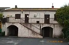
List of Successive Mayors of Aghione[4]
| From | To | Name | Party | Position |
|---|---|---|---|---|
| 2001 | 2008 | Jean Bladovini | DVD | |
| 2008 | Current | André Casanova | DVD |
(Not all data is known)
Population
|
| |||||||||||||||||||||||||||||||||||||||||||||||||||||||||||||||||||||||||||||||||
| Source: EHESS[5] and INSEE[6] | ||||||||||||||||||||||||||||||||||||||||||||||||||||||||||||||||||||||||||||||||||
Economy
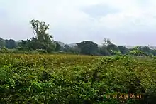
The commune of Aghione is predominantly agricultural. The hills are used for grazing goats, sheep, and pigs; while the plain is planted with vines and fruit trees (kiwifruit, Mandarins). There is no farm of significant size located in the commune. In particular the grapes are collected by neighbouring wineries - mainly by the Aleria cooperative.
There are no longer any trades or services in the commune. The people find everything necessary at Aleria (10 km away) or Ghisonaccia (20 km away).
The commune has no access to the sea yet is close by (Alzitone is 5 kilometres from the coast). Aghione has no tourist facilities and does not have any second homes.
Sites and Monuments
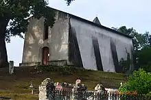
- The Sulphurous water source of Puzzichello (site now abandoned)
- Alzitone Reservoir (artificial lake)
- An old railway line on the eastern plain
See also
- Communes of the Haute-Corse department
- Cantons of the Haute-Corse department
- Arrondissements of the Haute-Corse department
External links
- Official website of Aghione (in French)
- Aghione on Lion1906
- Aghione on Géoportail, National Geographic Institute (IGN) website (in French)
Notes and references
Notes
References
- "Populations légales 2017". INSEE. Retrieved 6 January 2020.
- Inhabitants of Haute-Corse (in French)
- Google Maps
- List of Mayors of France (in French)
- Des villages de Cassini aux communes d'aujourd'hui: Commune data sheet Aghione, EHESS. (in French)
- Population en historique depuis 1968, INSEE
| Wikimedia Commons has media related to Aghione. |