Awala-Yalimapo
Awala-Yalimapo is a commune on the north coast of French Guiana, close to the border with Suriname. The seat of the commune is the settlement of Awala where the town hall is located. Other settlements in the commune are: Yalimapo, Ayawande, and Piliwa. The majority of the inhabitants are Kaliña Amerindian people.[2]
Awala-Yalimapo | |
|---|---|
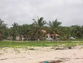
 Settlement of Yalimapo as seen from the beach of Plage des Hattes | |
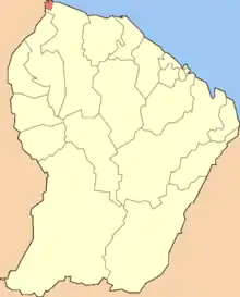
 Location of the commune (in red) within French Guiana | |
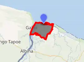
Location of Awala-Yalimapo 
| |
| Coordinates: 5°44′28″N 53°55′40″W | |
| Country | France |
| Overseas region and department | French Guiana |
| Arrondissement | Saint-Laurent-du-Maroni |
| Intercommunality | CC Ouest Guyanais |
| Government | |
| • Mayor (2020–2026) | Jean-Paul Féreira |
| Area 1 | 187.4 km2 (72.4 sq mi) |
| Population (2017-01-01)[1] | 1,411 |
| • Density | 7.5/km2 (20/sq mi) |
| Time zone | UTC−03:00 |
| INSEE/Postal code | 97361 /97319 |
| 1 French Land Register data, which excludes lakes, ponds, glaciers > 1 km2 (0.386 sq mi or 247 acres) and river estuaries. | |
History
The commune of Awala-Yalimapo was created on 31 December 1988 by detaching its territory from the commune of Mana. The commune is a protected area for its ecology, flora, and fauna (ZNIEFF).[2]
Nature
Awala and Yalimapo are French Guiana's northernmost settlements, located just to the south of the région's northernmost point, the beach of Plage des Hattes, the world's largest leatherback turtle nesting site.[3] The Amana Nature Reserve has been established in 1988 to protect the turtles. The reserve covers 14,800 hectares.[4]
See also
References
- "Populations légales 2017". INSEE. Retrieved 6 January 2020.
- "Guyane, Historie". Petit Futé (in French). Retrieved 4 June 2020.
- "Mana, précurseurse depuis toujours". Le Jour du Seigneur (in French). Retrieved 4 June 2020.
- "L'Amana Réserve naturelle nationale". L'Inventaire National du Patrimoine Naturel (in French). Retrieved 4 June 2020.