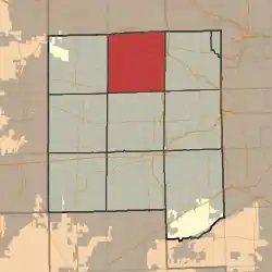
Bloomingdale Township, DuPage County, Illinois
Bloomingdale Township is one of nine townships in DuPage County, Illinois, USA. As of the 2010 census, its population was 111,899 and it contained 42,395 housing units.[2]
Bloomingdale Township | |
|---|---|
 Location in DuPage County | |
 DuPage County's location in Illinois | |
| Coordinates: 41°56′40″N 88°05′20″W | |
| Country | |
| State | |
| County | DuPage |
| Settled | November 6, 1849 |
| Government | |
| • Supervisor | Michael D. Hovde, Jr. |
| Area | |
| • Total | 35.3 sq mi (91 km2) |
| • Land | 34.01 sq mi (88.1 km2) |
| • Water | 1.29 sq mi (3.3 km2) 3.65% |
| Elevation | 781 ft (238 m) |
| Population (2010) | |
| • Estimate (2016)[1] | 112,158 |
| • Density | 3,290.6/sq mi (1,270.5/km2) |
| Time zone | UTC-6 (CST) |
| • Summer (DST) | UTC-5 (CDT) |
| ZIP codes | 60101, 60103, 60108, 60137, 60133, 60139, 60143, 60148, 60157, 60172, 60185, 60188, 60190 |
| FIPS code | 17-043-06600 |
| Website | www |
Geography
According to the 2010 census, the township has a total area of 35.3 square miles (91 km2), of which 34.01 square miles (88.1 km2) (or 96.35%) is land and 1.29 square miles (3.3 km2) (or 3.65%) is water.[2]
Cities, towns, villages
- Addison (west quarter)
- Bloomingdale
- Carol Stream (partial)
- Glendale Heights (vast majority)
- Hanover Park (partial)
- Itasca (partial)
- Lombard (north edge)
- Roselle (partial)
- Schaumburg (partial)[3]
- Winfield (north edge)
Unincorporated towns
- Cloverdale at 41.939473°N 88.120349°W
- Keeneyville at 41.967528°N 88.12035°W
- Medinah at 41.981417°N 88.051181°W
- Swift at 41.920307°N 88.042290°W
- Glen Ellyn Countryside at 41.9099°N 88.0645°W
(This list is based on USGS data and may include former settlements.)
Cemeteries
The township contains these seven cemeteries: Bloomingdale, Cloverdale, Freinenigreit, Old Ontarioville, St. Andrew Ukrainian Orthodox, St. Isidore's and St. Luke's Lutheran.
Major highways
Airports and landing strips
- Clarke Heliport
- Mitchell Field (historical)
- Schaumburg Regional Airport (partial)
Lakes
- Kadijah Lake
- Mallard Lake
Political districts
- Illinois's 6th congressional district
- State House District 45
- State House District 55
- State House District 56
- State Senate District 23
- State Senate District 28
Notes
- "Population and Housing Unit Estimates". Retrieved June 9, 2017.
- "Population, Housing Units, Area, and Density: 2010 - County -- County Subdivision and Place -- 2010 Census Summary File 1". United States Census. Archived from the original on 2020-02-12. Retrieved 2013-05-28.
- "A Look at Township Government". Bloomingdale Township. Retrieved 8 October 2015.
- "Census of Population and Housing". Census.gov. Retrieved June 4, 2016.
References
External links
This article is issued from Wikipedia. The text is licensed under Creative Commons - Attribution - Sharealike. Additional terms may apply for the media files.