Brinton, Norfolk
Brinton is a village and a civil parish in the English county of Norfolk.[2] The village is 10.8 miles east-north-east of the town of Fakenham, 13.1 miles west south-west of Cromer and 125 miles north-north-east of London. The nearest railway station is at Sheringham for the Bittern Line which runs between Sheringham, Cromer and Norwich. The nearest airport is Norwich International Airport.
| Brinton | |
|---|---|
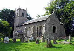
 St Andrew Parish Church Brinton, Norfolk | |
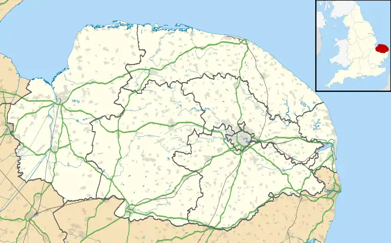
 Brinton Location within Norfolk | |
| Area | 6.13 km2 (2.37 sq mi) |
| Population | 222 (Including Sharrington, 2011 census)[1] |
| • Density | 36/km2 (93/sq mi) |
| OS grid reference | TG030350 |
| • London | 125 miles (201 km) |
| Civil parish |
|
| District | |
| Shire county | |
| Region | |
| Country | England |
| Sovereign state | United Kingdom |
| Post town | MELTON CONSTABLE |
| Postcode district | NR24 |
| Dialling code | 01263 |
| Police | Norfolk |
| Fire | Norfolk |
| Ambulance | East of England |
| UK Parliament | |
History
Brinton has an entry in the Domesday Book of 1086[3] under the name ‘’Bruntuna’’, and it is said to be in the ownership of Bishop William.
Description
The village is situated in a shallow valley and the dwellings site either side of quiet narrow lanes. In the village is Brinton Hall which was constructed in the Georgian era to replace an earlier 16th-century house. The house seen today was rebuilt in 1822 by Brereton family. The interior has a fine wainscot staircase, installed in 1911.[4] Award-winning work at Brinton Hall includes remodelling of the west front and renovation of all interior rooms. In the grounds there are formal gardens, the hall also has a walled kitchen garden with a hot greenhouse. The property is surrounded by parkland with ha-ha wall, lake, woods and meadows. The village and some of its houses were once used as a backdrop for the BBC television series Dangerfield.
Parish church
The parish church is dedicated to St Andrew and parts date back to the 14th century.[5] The church register dates from 1547. The church tower dates from c.1400 and has one bell. There is a statue of Saint Andrew in a niche above the transept which dates from the Medieval period. The statue only survives because it had been screened with plasterwork to hide it. It was rediscovered in 1871.
References
| Wikimedia Commons has media related to Brinton, Norfolk. |
- "Parish population 2011". Retrieved 31 August 2015.
- OS Explorer Map 24 - Norfolk Coast Central. ISBN 0-319-21726-4.
- The Domesday Book, Englands Heritage, Then and Now, Editor: Thomas Hinde, Norfolk page 187 ISBN 1-85833-440-3
- Investigation of the history of Nelson's Staircase Archived 2008-11-20 at the Wayback Machine
- Norfolk 1: Norwich and North-East, By Nikolaus Pevsner and Bill Wilson, Brinton entry. ISBN 0-300-09607-0