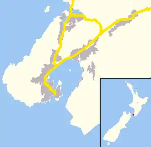
Broadmeadows, New Zealand
Broadmeadows is a minor western suburb of Wellington, New Zealand. It is located to the north of Khandallah and south of Johnsonville.[1][2] It is located 7 kilometres (4.3 mi) from the Wellington central business district. Broadmeadows has a population of 1,635.
Broadmeadows | |
|---|---|
Suburb | |
 Broadmeadows  Broadmeadows | |
| Coordinates: 41.2373317°S 174.7961818°E | |
| Country | New Zealand |
| Local authority | Wellington City |
| Electoral ward | Onslow-Western Ward |
| Area | |
| • Land | 64 ha (158 acres) |
| Population (2018)[1] | |
| • Total | 1,635 |
| Postcode(s) | 6035, 6037 |
| Johnsonville | Johnsonville, Newlands | |
| Mount Kaukau |
|
Ngauranga |
| Khandallah |
Facilities
Parks and reserves
The Skyline Walkway provides access to Mount Kaukau.[3]
Politics
Local government
In local government Broadmeadows forms part of the Onslow-Western Ward. The ward is represented by Diane Calvert, Simon Woolf and Rebecca Matthews as of 2020.[4]
National government
In national government Broadmeadows is part of the Ōhāriu general electorate represented by Greg O'Connor of the New Zealand Labour Party since 2017. Broadmeadows is in the Te Tai Tonga Māori electorate represented by Rino Tirikatene (Labour) since 2011.[5]
Transport
Broadmeadows is connected to central Wellington by Metlink buses. Bus 24 connect Johnsonville and Broadmeadows to the CBD until Miramar Heights.
References
- "Community profile - Broadmeadows". ID The Population Experts. Retrieved 9 September 2020.
- "Broadmeadows, Wellington". NZ Topo Map. Retrieved 9 September 2020.
- "Enjoy the outdoors - Skyline Walkway". Wellington City Council. Retrieved 9 September 2020.
- "Mayor and Councillors". Wellington City Council. Retrieved 9 September 2020.
- "Find your electorate on a map". Electoral Commission. Retrieved 9 September 2020.