Brownsville, Mississippi
Brownsville is an unincorporated community located on Mississippi Highway 22 in northern Hinds County, Mississippi. Brownsville is approximately 12 miles (19 km) southwest of Flora and approximately 8 miles (13 km) north of Bolton.
Brownsville, Mississippi | |
|---|---|
 Brownsville  Brownsville | |
| Coordinates: 32°26′56″N 90°26′13″W | |
| Country | United States |
| State | Mississippi |
| County | Hinds |
| Elevation | 295 ft (90 m) |
| Time zone | UTC-6 (Central (CST)) |
| • Summer (DST) | UTC-5 (CDT) |
| ZIP code | 39041 |
| Area code(s) | 601 |
| GNIS feature ID | 667652[1] |
Brownsville is part of the Jackson Metropolitan Statistical Area.
References
Municipalities and communities of Hinds County, Mississippi, United States | ||
|---|---|---|
| Cities | 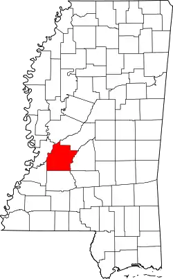 Map of Mississippi highlighting Hinds County | |
| Towns | ||
| Unincorporated communities | ||
| Footnotes | ‡ This populated place also has portions in an adjacent county or counties | |
| ||
This article is issued from Wikipedia. The text is licensed under Creative Commons - Attribution - Sharealike. Additional terms may apply for the media files.