Cairo Montenotte
Cairo Montenotte (Ligurian: Cairi or Câiru, locally Cöiri; Piedmontese: Cäiri) is a comune (municipality) in the Province of Savona in the Italian region Liguria, located about 50 kilometres (31 mi) west of Genoa and about 20 kilometres (12 mi) northwest of Savona. Located in Val Bormida, it is a member of the Comunità Montana Alta Val Bormida.
Cairo Montenotte | |
|---|---|
| Città di Cairo Montenotte | |
 Cairo Montenotte | |
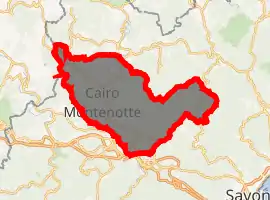
Location of Cairo Montenotte 
| |
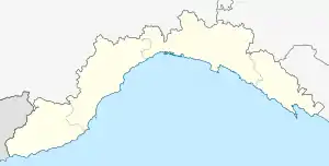
 Cairo Montenotte Location of Cairo Montenotte in Italy  Cairo Montenotte Cairo Montenotte (Liguria) | |
| Coordinates: 44°24′N 8°16′E | |
| Country | Italy |
| Region | Liguria |
| Province | Savona (SV) |
| Frazioni | Rocchetta di Cairo, Carretto, Bragno, Ferrania, San Giuseppe di Cairo, Ville, Chinelli, Bellini |
| Government | |
| • Mayor | Paolo Lambertini |
| Area | |
| • Total | 99.5 km2 (38.4 sq mi) |
| Elevation | 330 m (1,080 ft) |
| Population (31 December 2011)[2] | |
| • Total | 13,209 |
| • Density | 130/km2 (340/sq mi) |
| Demonym(s) | Cairesi |
| Time zone | UTC+1 (CET) |
| • Summer (DST) | UTC+2 (CEST) |
| Postal code | 17014 |
| Dialing code | 019 |
| Website | Official website |
It is famous as the birthplace of the patriot Giuseppe Cesare Abba.
Cairo Montenotte borders the following municipalities: Albisola Superiore, Altare, Carcare, Cengio, Cosseria, Dego, Giusvalla, Gottasecca, Pontinvrea, Saliceto, and Savona.
History
The name "Cairo" comes from the Latin "carium", which itself comes from the Ligurian stem "*kar-", meaning "stone", "rock".
This area, according to many archaeological finds, has been inhabited since the Neolithic age.
During the Roman Domination, Cairo was a stage on the Via Aemilia Scauri and via Iulia Augusta man roads.
According to the tradition, Francis of Assisi passed here in 1213, during his trip to Spain; during his journey, he built the convent near Cairo, in the village of "Ville".
In the 16th century there were some battles between Germany and France near Cairo.
In 1796 near Montenotte Napoleon Bonaparte won his first battle in the Italian campaigns, the Battle of Montenotte. A neighborhood in Cork (Ireland) was named after this battle.
References
- "Superficie di Comuni Province e Regioni italiane al 9 ottobre 2011". Istat. Retrieved 16 March 2019.
- All demographics and other statistics: Italian statistical institute Istat.