Canoe Lake (Saskatchewan)
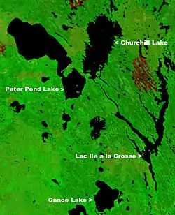
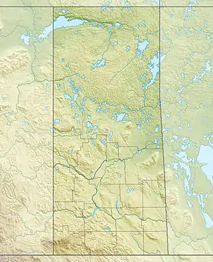
Canoe Lake is a lake in northwestern Saskatchewan, Canada. Settlements on the lake include Canoe Narrows, Cole Bay, Jans Bay. The lake is accessed by Hwy 965 and Hwy 903.
| Canoe Lake | |
|---|---|
 | |
 Canoe Lake | |
| Location | Saskatchewan |
| Coordinates | 55°10′00″N 108°15′03″W |
| Primary inflows | Arseneault Lake, Macallum Lake from the west |
| Primary outflows | Canoe River to Lac Île-à-la-Crosse |
| Catchment area | Churchill River |
| Basin countries | Canada |
| Islands | Cole Island |
| Settlements | Canoe Narrows, Cole Bay, Jans Bay |
To the west of the lake is the Primrose Lake Air Weapons Range. The Canoe River flows east from the lake to Lac Île-à-la-Crosse.[2][3]
References
- "NASA Visible Earth (BURN SCARS IN SASKATCHEWAN, CANADA) Note: Dark to light rust coloured areas are burn scars from forest fires". August 24, 2002. Retrieved 2014-09-14.
- "Natural Resources Canada-Canadian Geographical Names (Canoe Lake)". Retrieved 2014-08-29.
- "Atlas of Canada Toporama". Retrieved 2014-08-29.
This article is issued from Wikipedia. The text is licensed under Creative Commons - Attribution - Sharealike. Additional terms may apply for the media files.