Center Point, Alabama
Center Point is a city and a former census-designated place (CDP) in northeastern Jefferson County, Alabama, United States. It is part of the Birmingham metropolitan area. At the 2000 census the population was 22,784. However, after its incorporation in 2002, the city's boundaries are much smaller than those of the CDP. As of the 2010 census, the population of the incorporated city was 16,921.[4] The public high school for Center Point is Center Point High School grades 9th-12th. The public middle school for Center Point is Erwin Middle School grades 6th-8th. Center Point has 2 public elementary schools, Erwin Intermediate School grades 3rd-5th and Center Point Elementary School grades K-2nd.
Center Point | |
|---|---|
 Center Point City Hall | |
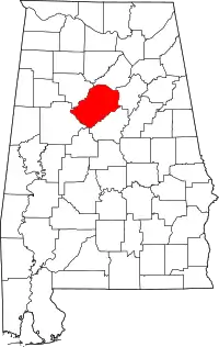
 Location of Center Point in Jefferson County, Alabama. | |
| Coordinates: 33°38′21″N 86°40′49″W | |
| Country | United States |
| State | Alabama |
| County | Jefferson |
| Area | |
| • Total | 6.28 sq mi (16.26 km2) |
| • Land | 6.27 sq mi (16.24 km2) |
| • Water | 0.01 sq mi (0.02 km2) |
| Elevation | 830 ft (250 m) |
| Population | |
| • Total | 16,921 |
| • Estimate (2019)[3] | 16,110 |
| • Density | 2,569.79/sq mi (992.20/km2) |
| Time zone | UTC-6 (Central (CST)) |
| • Summer (DST) | UTC-5 (CDT) |
| ZIP code | 35215 |
| Area code(s) | 205 & 659 |
| FIPS code | 01-13264 |
| GNIS feature ID | 0115852 |
| Website | http://www.thecityofcenterpoint.org/ |
Geography
It is located at 33°38′21″N 86°40′50″W (33.639302, -86.680437).[5] or about 12 miles (19 km).
According to the U.S. Census Bureau, the CDP had a total area of 8.1 square miles (21 km2), of which 8.1 square miles (21 km2) was land and 0.04 square miles (0.10 km2) (0.25%) was water.
Demographics
| Historical population | |||
|---|---|---|---|
| Census | Pop. | %± | |
| 1970 | 15,675 | — | |
| 1980 | 23,317 | 48.8% | |
| 1990 | 22,658 | −2.8% | |
| 2000 | 22,784 | 0.6% | |
| 2010 | 16,921 | −25.7% | |
| 2019 (est.) | 16,110 | [3] | −4.8% |
| U.S. Decennial Census[6] | |||
According to the 2010 census, there were 16,921 people living in the City of Center Point. The racial / ethnic makeup of Center Point was 32.6% White, 62.9% Black or African-American, 0.4% Asian, 0.2% Native American or Alaska Native, 0.02% Native Hawaiian, 2.8% other races, and 1.1% were two or more races. Hispanics of any race were 4.8% of the population.
At the 2000 census, there were 22,784 people, 8,826 households, and 6,434 families in the CDP. The population density was 2,830.4 people per square mile (1,092.8/km2). There were 9,292 housing units at an average density of 1,154.3 per square mile (445.7/km2). The racial makeup of the CDP was 72.90% White, 24.23% Black or African American, 0.28% Native American, 0.55% Asian, 0.03% Pacific Islander, 1.02% from other races, and 0.98% from two or more races. 2.23% of the population were Hispanic or Latino of any race.
Of the 8,826 households 35.3% had children under the age of 18 living with them, 53.7% were married couples living together, 15.4% had a female householder with no husband present, and 27.1% were non-families. 23.7% of households were one person and 8.6% were one person aged 65 or older. The average household size was 2.56 and the average family size was 3.02.
The age distribution was 26.6% under the age of 18, 8.8% from 18 to 24, 30.2% from 25 to 44, 21.3% from 45 to 64, and 13.1% 65 or older. The median age was 35 years. For every 100 females, there were 89.6 males. For every 100 females age 18 and over, there were 84.8 males.
The median household income was $40,929 and the median family income was $46,427. Males had a median income of $35,500 versus $25,544 for females. The per capita income for the CDP was $18,160. About 7.7% of families and 9.5% of the population were below the poverty line, including 12.2% of those under age 18 and 9.6% of those age 65 or over.
Notable person
- Dan Sartain, rock and roll musician[7]
References
- "2019 U.S. Gazetteer Files". United States Census Bureau. Retrieved June 29, 2020.
- "Population Estimates". United States Census Bureau. Retrieved 2014-06-07.
- "Population and Housing Unit Estimates". United States Census Bureau. May 24, 2020. Retrieved May 27, 2020.
- U.S. Census Bureau. 2010 Population Census for Incorporated Places
- "US Gazetteer files: 2010, 2000, and 1990". United States Census Bureau. 2011-02-12. Retrieved 2011-04-23.
- United States Census Bureau. "Census of Population and Housing". Archived from the original on April 26, 2015. Retrieved August 10, 2013.
- Ells, Blake. "Birmingham's Dan Sartain welcomes new record on Sunday at Bottletree". al.com. Alabama Media Group. Retrieved 29 April 2015.
