Charaña
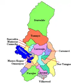
Charaña is a high elevation town in the altiplano of the La Paz Department in Bolivia. It is the seat of the Charaña Municipality, the fifth municipal section of the Pacajes Province.
Charaña | |
|---|---|
Town | |
 Charaña Location within Bolivia | |
| Coordinates: 17°36′S 69°27′W | |
| Country | |
| Department | La Paz Department |
| Province | Pacajes Province |
| Municipality | Charaña Municipality |
| Elevation | 13,310 ft (4,060 m) |
| Population (2001)[1] | |
| • Total | 817 |
| Time zone | UTC-4 (-4) |
Charaña is 2 kilometres (1.2 mi) east of the border with Chile.[2][3]
History
Charaña was the scene of the famous meeting between President Augusto Pinochet of Chile and Hugo Banzer on 8 February 1975 when they signed a Joint Declaration (Charaña Act), which restored diplomatic relations between the two countries which were broken since April 1962.
Climate
| Climate data for Charaña 4057 m asl (1981–2010 normals) | |||||||||||||
|---|---|---|---|---|---|---|---|---|---|---|---|---|---|
| Month | Jan | Feb | Mar | Apr | May | Jun | Jul | Aug | Sep | Oct | Nov | Dec | Year |
| Record high °C (°F) | 25.0 (77.0) |
24.4 (75.9) |
25.2 (77.4) |
27.5 (81.5) |
21.5 (70.7) |
21.4 (70.5) |
19.8 (67.6) |
23.0 (73.4) |
27.7 (81.9) |
28.8 (83.8) |
30.4 (86.7) |
29.4 (84.9) |
30.4 (86.7) |
| Average high °C (°F) | 19.2 (66.6) |
19.2 (66.6) |
19.5 (67.1) |
18.9 (66.0) |
16.9 (62.4) |
15.1 (59.2) |
14.9 (58.8) |
16.5 (61.7) |
17.8 (64.0) |
19.7 (67.5) |
20.6 (69.1) |
20.6 (69.1) |
18.2 (64.8) |
| Daily mean °C (°F) | 10.6 (51.1) |
10.2 (50.4) |
9.8 (49.6) |
8.1 (46.6) |
5.1 (41.2) |
3.1 (37.6) |
3.0 (37.4) |
3.4 (38.1) |
6.4 (43.5) |
8.0 (46.4) |
9.2 (48.6) |
10.3 (50.5) |
7.3 (45.1) |
| Average low °C (°F) | 1.6 (34.9) |
0.8 (33.4) |
0.3 (32.5) |
−2.6 (27.3) |
−6.7 (19.9) |
−8.5 (16.7) |
−8.7 (16.3) |
−7.6 (18.3) |
−5.2 (22.6) |
−3.3 (26.1) |
−1.7 (28.9) |
0.0 (32.0) |
−3.5 (25.7) |
| Record low °C (°F) | −6.7 (19.9) |
−8 (18) |
−7.8 (18.0) |
−10.6 (12.9) |
−16.4 (2.5) |
−16 (3) |
−18 (0) |
−17 (1) |
−15.4 (4.3) |
−11.8 (10.8) |
−10.8 (12.6) |
−11 (12) |
−18 (0) |
| Average precipitation mm (inches) | 133.1 (5.24) |
122.7 (4.83) |
119.7 (4.71) |
30.5 (1.20) |
13.2 (0.52) |
4.4 (0.17) |
9.6 (0.38) |
3.5 (0.14) |
3.9 (0.15) |
18.8 (0.74) |
25.4 (1.00) |
64.8 (2.55) |
549.6 (21.63) |
| Average precipitation days (≥ 1 mm) | 22.21 | 19.88 | 20.11 | 13.43 | 8.45 | 4.29 | 13.78 | 10.94 | 9.38 | 14.47 | 16.03 | 20.10 | 173.07 |
| Source 1: Météo climat stats[4] | |||||||||||||
| Source 2: Météo Climat [5] | |||||||||||||
References
- www.ine.gov.bo Archived October 27, 2009, at the Wayback Machine - National Institute of Statistics of Bolivia (in Spanish)
- Google Maps - Charaña
- OpenStreetMap - Charaña
- "Moyennes 1981-2010 Bolivie" (in French). Retrieved 11 November 2019.
- "Météo Climat stats for Charana". Météo Climat. Retrieved 11 November 2019.
This article is issued from Wikipedia. The text is licensed under Creative Commons - Attribution - Sharealike. Additional terms may apply for the media files.
