Cosheston
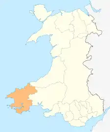
Cosheston is a village, parish and community in Pembrokeshire, Wales. It is situated on an inlet of the Daugleddau estuary, 3 km north-east of Pembroke. The parish includes the settlement of Bateman's Hill.[1] The northern part of the community is in the Pembrokeshire Coast National Park. Together with Upton and Nash, it constitutes the community of Cosheston, which had a population of 713 in 2001, increasing to 828 at the 2011 Census.[2]
| Cosheston | |
|---|---|
 Parish church of St Michael | |
 Cosheston Location within Pembrokeshire | |
| Population | 828 |
| OS grid reference | SN004037 |
| Principal area | |
| Country | Wales |
| Sovereign state | United Kingdom |
| Post town | Haverfordwest |
| Postcode district | SA62 |
| Dialling code | 01646 |
| Police | Dyfed-Powys |
| Fire | Mid and West Wales |
| Ambulance | Welsh |
| UK Parliament | |
| Senedd Cymru – Welsh Parliament | |
Parish
The parish had an area of 813 Ha. Its census populations were: 401 (1801): 551 (1851): 556 (1901): 381 (1951): 593 (1981): 828 (2011).[4]
The parish church is dedicated to St Michael and had a spire in the 19th century.[5]
The percentage of Welsh speakers was 4.9 (1891): 4.3 (1931): 2.6 (1971): 10.7 (2011).[6]
Governance
Cosheston, together with Lamphey, forms an electoral ward. The total ward population taken at the 2011 Census was 1,671.[7]
References
- "GENUKI: Cosheston Parish Map (147)". Retrieved 2 March 2018.
- "Community population 2011". Retrieved 19 April 2015.
- Charles, B. G., The Placenames of Pembrokeshire, National Library of Wales, Aberystwyth, 1992, ISBN 0-907158-58-7, pp 686
- Census 2011 http://www.nomisweb.co.uk/census/2011/qs206wa Table QS206WA
- "GENUKI: Cosheston". Retrieved 5 March 2016.
- Census 2011 http://www.nomisweb.co.uk/census/2011/qs206wa Table QS206WA
- "Ward population 2011". Retrieved 19 April 2015.

