Daradgee, Queensland
Daradgee is a rural town and locality in the Cassowary Coast Region, Queensland, Australia.[2][3] In the 2016 census, Daradgee had a population of 74 people.[1]
| Daradgee Queensland | |||||||||||||||
|---|---|---|---|---|---|---|---|---|---|---|---|---|---|---|---|
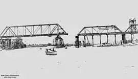 Daradgee railway bridge under construction, 1924 | |||||||||||||||
 Daradgee | |||||||||||||||
| Coordinates | 17.4875°S 146.0063°E | ||||||||||||||
| Population | 74 (2016 census)[1] | ||||||||||||||
| • Density | 7.63/km2 (19.76/sq mi) | ||||||||||||||
| Postcode(s) | 4860 | ||||||||||||||
| Area | 9.7 km2 (3.7 sq mi) | ||||||||||||||
| Time zone | AEST (UTC+10:00) | ||||||||||||||
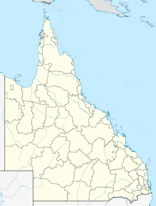
| Location |
| ||||||||||||||
| LGA(s) | Cassowary Coast Region | ||||||||||||||
| State electorate(s) | Hill | ||||||||||||||
| Federal Division(s) | Kennedy | ||||||||||||||
| |||||||||||||||
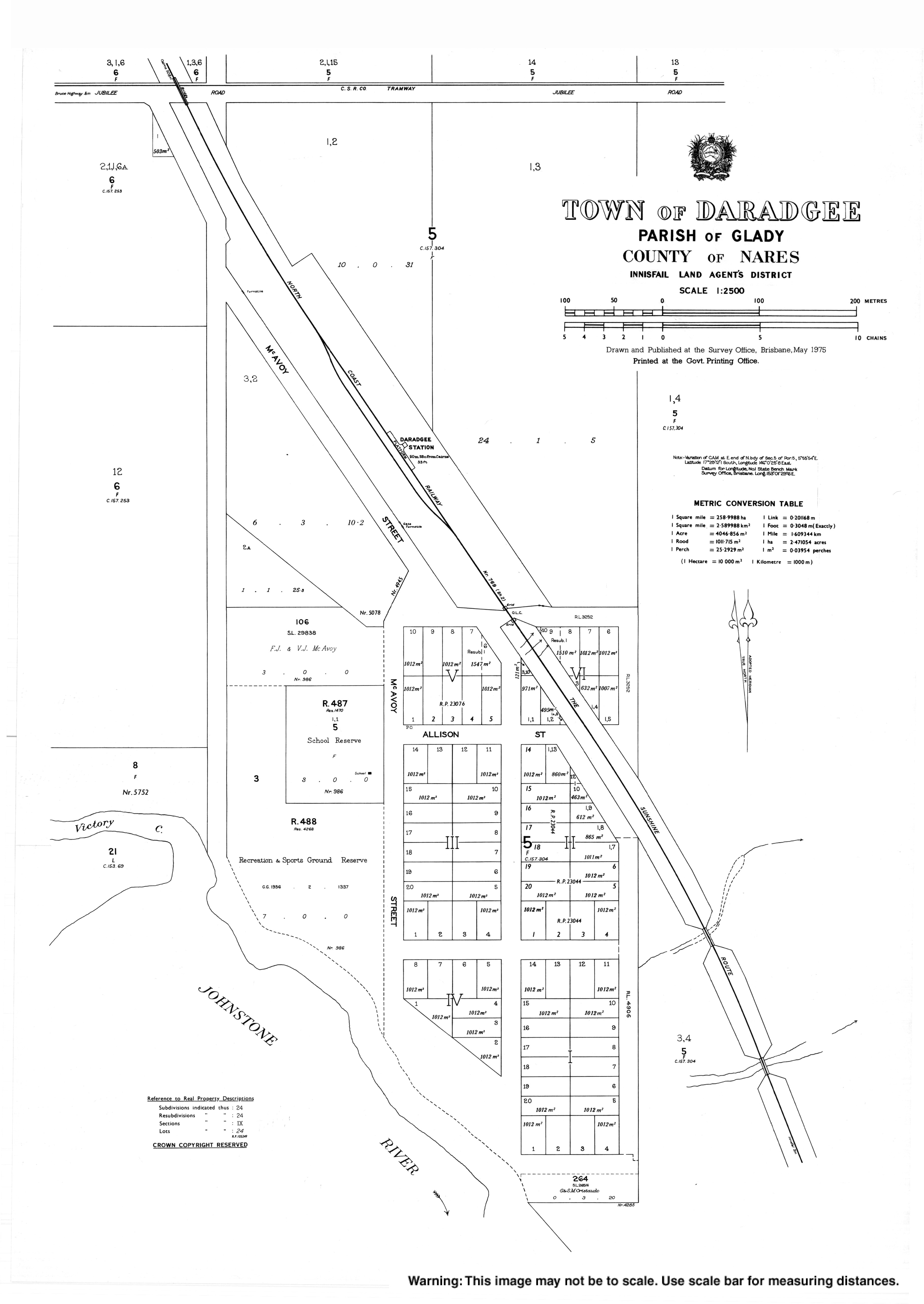
Geography
The locality is bounded in the south-east by the Johnstone River. Victory Creek flows through the locality; it is a tributary of the Johnstone River at 17.4876°S 146.0034°E.[4] Alligator Point is a point immediately across the river from the mouth of Victory Creek where the river has a sharp bend (17.4889°S 146.0030°E).[5][6]
The land is relatively flat and low-lying (approx 10 metres above sea level) and is used for cropping including sugarcane and bananas.[7]
The Bruce Highway runs through the south-west corner of the locality while the North Coast railway line runs from south to north through the locality. There is a cane tramway to deliver harvested sugarcane to the local sugar mills.[7]
History

The town name is a corruption of the original township name Daraji (used from 1905 to 1918) based on an Aboriginal word meaning burial ground.[2][3]
Daradgee Provisional School opened on 10 July 1911. In 1915 it became Daradgee State School. It closed on 14 December 1984.[8]
The final section of the North Coast railway line was the bridge at Daradgee across the Johnstone River. The bridge was opened on 8 December 1924, by the Queensland Premier, Ted Theodore, enabling rail travel from Cairns to Brisbane and from there to as far as Perth in Western Australia.[9][10][11]
In the 2016 census, Daradgee had a population of 74 people.[1]
Education
Daradgee Environmental Education Centre is a special purpose facility at McAvoy Street (17.4866°S 146.0053°E).[12][13] It operates on the site of the former Daradgee State School using some of its buildings.[14]
There are no regular schools in Daradgee. The nearest primary schools are Goondi State School in Goondi Bend to the south and Innisfail State School in Innisfail to the south-east. The nearest government secondary school is Innisfail State College in Innisfail Estate to the south-east. Catholic primary and secondary schools are in Innisfail.[7]
References
- Australian Bureau of Statistics (27 June 2017). "Daradgee (SSC)". 2016 Census QuickStats. Retrieved 20 October 2018.

- "Daradgee – town in Cassowary Coast Region (entry 9334)". Queensland Place Names. Queensland Government. Retrieved 18 September 2020.
- "Daradgee – locality in Cassowary Coast Region (entry 45692)". Queensland Place Names. Queensland Government. Retrieved 18 September 2020.
- "Victory Creek – watercourse in Cassowary Coast Regional (entry 36028)". Queensland Place Names. Queensland Government. Retrieved 18 September 2020.
- "Alligator Point – point in Cassowary Coast Regional (entry 401)". Queensland Place Names. Queensland Government. Retrieved 18 September 2020.
- "Parish of Glady" (Map). Queensland Government. 1976. Archived from the original on 30 September 2020. Retrieved 30 September 2020.
- "Queensland Globe". State of Queensland. Retrieved 30 September 2020.
- Queensland Family History Society (2010), Queensland schools past and present (Version 1.01 ed.), Queensland Family History Society, ISBN 978-1-921171-26-0
- "OFFICIAL OPENING OF THE NORTH COAST LINE". Cairns Post. XXXV (5055). Queensland, Australia. 9 December 1924. p. 5. Retrieved 15 December 2017 – via National Library of Australia.
- "DARADGEE BRIDGE". Cairns Post. XXXV (5055). Queensland, Australia. 9 December 1924. p. 5. Archived from the original on 30 September 2020. Retrieved 15 December 2017 – via National Library of Australia.
- "From Cairns to Perth". Sydney Mail. XXVI (665). New South Wales, Australia. 24 December 1924. p. 14. Archived from the original on 30 September 2020. Retrieved 15 December 2017 – via National Library of Australia.
- "State and non-state school details". Queensland Government. 9 July 2018. Archived from the original on 21 November 2018. Retrieved 21 November 2018.
- "Daradgee Environmental Education Centre". Archived from the original on 30 September 2020. Retrieved 21 November 2018.
- "About us". Daradgee Environmental Education Centre. 21 May 2019. Archived from the original on 21 March 2019. Retrieved 30 September 2020.
External links
| Wikimedia Commons has media related to Daradgee, Queensland. |