Dehri
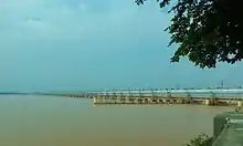
Dehri-on-Sone is a Nagar parishad and corresponding community development block in Rohtas district in the state of Bihar, India. Situated on the Son River,[2] Dehri is a large industrial town and an important railway hub. As of 2011, its population was 137,231, in 23,234 households.[3] Dehri is home to the Indrapuri Barrage, the fourth-longest barrage in the world.[4] In Swachh Survekshan 2020 Dehri On Sone (Dehri Dalmiangar Nagar Parishad) has been awarded as the cleanest city in Bihar.
Dehri
Dehri-On-Sone | |
|---|---|
Urban Area | |
 | |
 Dehri Location in Bihar, India | |
| Coordinates: 24.91°N 84.18°E | |
| Country | |
| State | Bihar |
| District | Rohtas |
| Government | |
| • Type | Municipality |
| • Body | Dehri Urban Development Authority (DUDA) |
| Elevation | 52 m (171 ft) |
| Population | |
| • Total | 137,231 |
| Languages | |
| • Official | Hindi, Urdu |
| • Others | Bhojpuri, |
| Time zone | UTC+5:30 (IST) |
| PIN | 812307,821305[1] |
| Website | rohtas |
Demographics
| Year | Pop. | ±% |
|---|---|---|
| 1941 | 8,281 | — |
| 1951 | 24,406 | +194.7% |
| 1961 | 38,092 | +56.1% |
| 1971 | 46,037 | +20.9% |
| 1981 | 90,409 | +96.4% |
| 1991 | 93,594 | +3.5% |
| 2001 | 119,057 | +27.2% |
| 2011 | 137,231 | +15.3% |
| Source: 2011 Census of India[3] | ||
According to the 2011 Census, Dehri had a population of 137,231. Males were 72,372 and females 64,859. The average literacy rate was 81.2%, higher than the national average of 74%. Male literacy was 87.54% and female literacy 74.08%. The population of children in age group 0–6 years was 19,010, of which boys were 9,886 and girls 9,124.
Economy

Important industries in Dehri include sugar production, sawmilling, ghee processing, and cement manufacturing.[2] Other important commodities include plastic pipes, light bulbs, and shoes.[3]
The headworks of the Son canal system is located in Dehri.[2][3]
Recreation
Dehri is home to a stadium, five cinemas, four auditoriums, and three public libraries.[3]
Climate
| Climate data for Dehri (1981–2009, extremes 1901–2009) | |||||||||||||
|---|---|---|---|---|---|---|---|---|---|---|---|---|---|
| Month | Jan | Feb | Mar | Apr | May | Jun | Jul | Aug | Sep | Oct | Nov | Dec | Year |
| Record high °C (°F) | 31.0 (87.8) |
36.0 (96.8) |
41.5 (106.7) |
45.0 (113.0) |
49.5 (121.1) |
47.2 (117.0) |
44.5 (112.1) |
39.4 (102.9) |
37.1 (98.8) |
39.7 (103.5) |
35.1 (95.2) |
31.7 (89.1) |
49.5 (121.1) |
| Average high °C (°F) | 23.1 (73.6) |
26.3 (79.3) |
32.8 (91.0) |
38.7 (101.7) |
40.0 (104.0) |
37.8 (100.0) |
33.6 (92.5) |
32.9 (91.2) |
32.4 (90.3) |
31.7 (89.1) |
29.2 (84.6) |
25.3 (77.5) |
32.0 (89.6) |
| Average low °C (°F) | 7.4 (45.3) |
9.6 (49.3) |
13.9 (57.0) |
19.0 (66.2) |
21.3 (70.3) |
22.4 (72.3) |
21.5 (70.7) |
20.7 (69.3) |
20.2 (68.4) |
16.4 (61.5) |
10.4 (50.7) |
6.7 (44.1) |
15.8 (60.4) |
| Record low °C (°F) | −1.0 (30.2) |
0.0 (32.0) |
1.5 (34.7) |
3.0 (37.4) |
5.0 (41.0) |
13.5 (56.3) |
11.4 (52.5) |
11.0 (51.8) |
10.8 (51.4) |
4.0 (39.2) |
0.0 (32.0) |
0.0 (32.0) |
−1.0 (30.2) |
| Average rainfall mm (inches) | 10.9 (0.43) |
21.5 (0.85) |
8.6 (0.34) |
11.7 (0.46) |
39.3 (1.55) |
125.6 (4.94) |
340.6 (13.41) |
288.6 (11.36) |
192.6 (7.58) |
44.3 (1.74) |
3.5 (0.14) |
6.3 (0.25) |
1,093.6 (43.06) |
| Average rainy days | 1.1 | 1.6 | 0.9 | 1.0 | 2.4 | 6.3 | 15.0 | 12.8 | 8.6 | 2.2 | 0.3 | 0.6 | 52.9 |
| Average relative humidity (%) (at 17:30 IST) | 62 | 57 | 42 | 31 | 37 | 54 | 75 | 78 | 79 | 72 | 61 | 60 | 58 |
| Source: India Meteorological Department[5][6] | |||||||||||||
Villages
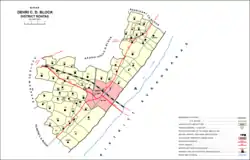
The CD block of Dehri contains 58 rural villages, all of which are inhabited:[3]
| Village name | Total land area (hectares) | Population (in 2011) |
|---|---|---|
| Panruhar | 557 | 1,803 |
| Gohi | 123 | 1,353 |
| Gonuwan | 69 | 720 |
| Maudiha | 136 | 1,727 |
| Shiwpur | 78 | 590 |
| Barawan | 279 | 4,521 |
| Ahirawan | 176 | 1,942 |
| Khudrawan | 120 | 1,439 |
| Chilbila | 97 | 1,380 |
| Parsawan | 55 | 1,307 |
| Tanrwa | 210 | 1,177 |
| Majhiawan | 195 | 1,839 |
| Ayar Kotha | 53 | 1,138 |
| Darihat | 1,123 | 11,953 |
| Bhusahula | 291 | 2,953 |
| Chainpur | 311 | 876 |
| Berkap | 454 | 2,893 |
| Bharkunria | 184 | 1,885 |
| Ahibaranpur | 121 | 2,065 |
| Hurka | 320 | 1,982 |
| Sidhauli | 22 | 2,320 |
| Gangauli | 447 | 5,279 |
| Pahleza | 338 | 6,464 |
| Shiupur | 59 | 932 |
| Deuria | 284 | 2,939 |
| Tendua Dusadhi | 239 | 2,660 |
| Mahdewa | 175 | 1,298 |
| Chormara | 74 | 25 |
| Jamuhar | 368 | 6,228 |
| Rudarpura | 210 | 1,121 |
| Chakia | 264 | 2,362 |
| Manaura | 70 | 625 |
| Mathuri | 180 | 3,581 |
| Sakhara | 405 | 5,820 |
| Suara | 267 | 2,584 |
| Dahaur | 276 | 2,802 |
| Patpura | 219 | 1,617 |
| Bharkunria | 320 | 1,737 |
| Guraila | 146 | 1,933 |
| Durgapur | 170 | 1,461 |
| Bhatauli | 162 | 1,558 |
| Wojhaulia | 19 | 731 |
| Ghonghaha | 96 | 1,865 |
| Khairaha | 135 | 1,853 |
| Bhainsaha | 64 | 2,833 |
| Bastipur | 451 | 2,159 |
| Katar | 853 | 3,368 |
| Bardiha | 94 | 1,477 |
| Sujanpur | 109 | 1,750 |
| Manikpur | 53 | 1,814 |
| Bhaluari | 475 | 6,821 |
| Nawadih | 422 | 4,000 |
| Dudhmi | 134 | 1,705 |
| Shahpur | 103 | 89 |
| Chaknaha | 155 | 1,831 |
| Shankarpur | 120 | 2,056 |
| Sikaria | 619 | 559 |
| Patanawa | 528 | 1,983 |
References
- Dehri on Sone Rohtas Pin Code, citypincode.in
- "Dehri". Encyclopaedia Britannica. Retrieved 21 May 2020.
- "Census of India 2011: Bihar District Census Handbook - Rohtas, Part A (Village and Town Directory)". Census 2011 India. pp. 33, 44–70, 1084–1123, 1191–1192, 1286–1299. Retrieved 20 May 2020.
- "Indrapuri Dam". Rohtas District. Retrieved 21 May 2020.
- "Station: Dehri Climatological Table 1981–2010" (PDF). Climatological Normals 1981–2010. India Meteorological Department. January 2015. pp. 235–236. Archived from the original (PDF) on 5 February 2020. Retrieved 18 August 2020.
- "Extremes of Temperature & Rainfall for Indian Stations (Up to 2012)" (PDF). India Meteorological Department. December 2016. p. M33. Archived from the original (PDF) on 5 February 2020. Retrieved 18 August 2020.