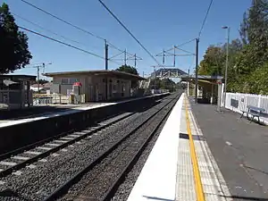
East Ipswich, Queensland
East Ipswich is a residential inner-city suburb of Ipswich in the City of Ipswich, Queensland, Australia.[2] In the 2016 census, East Ipswich had a population of 2,410 people.[1]
| East Ipswich Ipswich, Queensland | |||||||||||||||
|---|---|---|---|---|---|---|---|---|---|---|---|---|---|---|---|
 East Ipswich | |||||||||||||||
| Coordinates | 27.6066°S 152.7761°E | ||||||||||||||
| Population | 2,410 (2016 census)[1] | ||||||||||||||
| • Density | 1,420/km2 (3,670/sq mi) | ||||||||||||||
| Postcode(s) | 4305 | ||||||||||||||
| Area | 1.7 km2 (0.7 sq mi) | ||||||||||||||
| Time zone | AEST (UTC+10:00) | ||||||||||||||
| Location | |||||||||||||||
| LGA(s) | City of Ipswich | ||||||||||||||
| State electorate(s) | Ipswich | ||||||||||||||
| Federal Division(s) | Blair | ||||||||||||||
| |||||||||||||||
Geography

One of the older suburbs, East Ipswich is predominantly made up of weatherboard and fibro houses punctuated with larger heritage houses, and newer townhouses and flats.[3]
The suburb is bordered on the north and west by two sections of the Bremer River (split by the small suburb of Basin Pocket); and to the south by Brisbane Road, the city's main arterial link to the Ipswich Motorway.
The Main Line railway passes through the suburb from east (Ipswich) to west (Booval); the suburb is served by the East Ipswich railway station.[4]
A small set of shops on Jacaranda Street provides basic services, while several restaurants line Brisbane Road.
History
Ipswich East State School opened on 28 January 1958.[5]
At the 2011 census East Ipswich had a population of 2,194 people.[6]
In the 2016 census, East Ipswich had a population of 2,410 people.[1]
Transport
East Ipswich railway station provides access to regular Queensland Rail City network services to Brisbane, Ipswich and Rosewood via Ipswich.
Education
Ipswich East State School is a government primary (Prep-6) school for boys and girls at Jacaranda Street (27.6068°S 152.7769°E).[7][8] In 2017, the school had an enrolment of 373 students with 42 teachers (35 full-time equivalent) and 28 non-teaching staff (17 full-time equivalent).[9] It includes a special education program.[7][10]
Ipswich Positive Learning Centre is a specific purpose primary and secondary (5-10) school at 12 Blackwood Street (27.6057°S 152.7781°E).[7]
There is no general purpose secondary school in East Ipswich. The nearest secondary schools are Bremer State High School in Ipswich CBD and Bundamba State Secondary College in Bundamba.[4]
Sports facilities
- Hockey/mixed use field
- Vigoro ground which hosts seasonal competitions
- West End Rugby league Football Club
- Ipswich United Services Bowls Club
Places of worship
- Apostolic Church Of Queensland, Kendall Street
Heritage listings

East Ipswich has a number of heritage-listed sites, including:
References
- Australian Bureau of Statistics (27 June 2017). "East Ipswich (SSC)". 2016 Census QuickStats. Retrieved 20 October 2018.

- "East Ipswich – suburb in City of Ipswich (entry 45042)". Queensland Place Names. Queensland Government. Retrieved 26 January 2020.
- "REIQ Suburb profile - East Ipswich".
- "Queensland Globe". State of Queensland. Retrieved 11 March 2020.
- Queensland Family History Society (2010), Queensland schools past and present (Version 1.01 ed.), Queensland Family History Society, ISBN 978-1-921171-26-0
- Australian Bureau of Statistics (31 October 2012). "East Ipswich (State Suburb)". 2011 Census QuickStats. Retrieved 18 October 2011.

- "State and non-state school details". Queensland Government. 9 July 2018. Archived from the original on 21 November 2018. Retrieved 21 November 2018.
- "Ipswich East State School". Retrieved 21 November 2018.
- "ACARA School Profile 2017". Archived from the original on 22 November 2018. Retrieved 22 November 2018.
- "Ipswich East SS - Special Education Program". Retrieved 21 November 2018.
- "Kyeewa (entry 600602)". Queensland Heritage Register. Queensland Heritage Council. Retrieved 9 July 2013.
External links
| Wikimedia Commons has media related to East Ipswich, Queensland. |
- * "East Ipswich". Queensland Places. Centre for the Government of Queensland, University of Queensland.