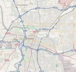
East Sacramento, Sacramento, California
East Sacramento (also known as East Sac) is a neighborhood in Sacramento, California, United States, that is east of downtown and midtown. East Sacramento is bounded by U.S. Route 50 to the south, Business Loop 80 to the west and north, Elvas Avenue to the northeast and east, and California State University, Sacramento and the American River to the southeast. East Sacramento residential development began in the 1890s, and the area was annexed into Sacramento in 1911. East Sacramento was also home to the Alhambra Theatre. East Sacramento also includes McKinley Park and the "Fabulous Forties" neighborhood.
East Sacramento | |
|---|---|
Neighborhood of Sacramento | |
| Nickname(s): East Sac | |
 East Sacramento Location within Sacramento | |
| Coordinates: 38.57°N 121.45°W | |
| Country | United States |
| State | California |
| County | Sacramento |
| City | Sacramento |
McKinley Park
McKinley Park is a major 32-acre (130,000 m2) park located in East Sacramento. The park is bordered to the north by McKinley Boulevard, to the south by H Street, by Alhambra Boulevard to the West and 33rd Street to the East. There is also a smaller, adjacent park located across 33rd Street. A branch of the Sacramento Public Library is located in the north wing of the Clunie Clubhouse, a community center located at the park. The library which serves East Sacramento, Midtown, and River Park has 45,000 volumes. There is also a small lake and 8 tennis courts. The smaller park includes the Shepard Garden and Arts Center. The park is a popular place for runners and walkers.
Quality of life: Greater East Sacramento and McKinley Park are highly sought after neighborhoods due partly to their central freeway location, proximity to the Midtown area and the State Capital corridor. East Sac home prices have seen the largest price appreciations relative to size of any area in Sacramento. Additionally the Midtown factor, an area which has seen an explosion in the number of fine dining offerings, monthly social events and public art and performance offerings, weighs heavily on the popularity of East Sac due in part to its relative ease of access to this area via bike, public transportation or just walking. Schools, community activities, a relative sense of security and the number of outdoor, social and recreational diversions make for a pleasant mix of outdoor offering that encourage and foster a strong sense of community.
Fabulous Forties
The Fab Forties neighborhood is part of the East Sacramento district. President Ronald Reagan lived at 1341 45th Street while serving most of his term as Governor of California.[1] The "Fab '40s" is the historic terminus of a once extensive streetcar network that covered nearly all the historic neighborhoods of the city. Forty-sixth street at J Street was the turnaround point for the J Street Line making it one of the widest streets in East Sacramento. The lots between 38th and 47th Streets and bordered by J Street and Folsom Boulevard are among the largest in East Sacramento, creating the concentration of larger houses that gave rise to the area's name. Up until the Great Depression, the grand homes of the "Fab '40s" were considered to be the modern day equivalent of a suburban mansion. Now they are considered architecturally spectacular large to mid-sized houses in a very pricey location. Additionally the demand for larger and more modern housing has created an interesting surge in the number of remodels and multi story additions throughout the McKinley Park and East Sacramento community. The Fab Forties neighborhood is home to a deodar cedar tree (cedrus deodara) that is over 100 years old.
Demographics
East Sacramento is somewhat diverse. The neighborhood is 74% White, 10% Hispanic, 5% Asian, 5% Black, another 6% is Mixed or Other. [2]
The area is historically a predominantly Irish-American neighborhood in the area near Sacred Heart Parish, and Italian-American in the neighborhood near St. Mary Parish.
Famous residents
- Biba Caggiano - cookbook author and restaurateur
- Kevin Johnson - former mayor of Sacramento
- Jim Kozimor - announcer for San Jose Earthquakes, former Sacramento Kings announcer
- Lloyd Levine - former assemblymember from Van Nuys and permanent Sacramento resident
- Carol Liu - California state senator from La Cañada Flintridge
- Robert S. Nelsen - president at Sacramento State University
- Nancy Reagan - wife of former U.S. President and California Governor Ronald Reagan
- Ronald Reagan - former president of the United States, former governor of California, actor
- Michelle Rhee-Johnson - former DC chancellor of schools
Political representation
- School board trustee: Ellen Cochrane
- Councilmember: Jeff Harris
- County supervisor: Phil Serna
- Assemblymember: Kevin McCarty[3]
- State senator: Richard Pan[3]
- United States representative: Doris Matsui[4]
See also
- Alhambra Theatre - a major theater that was located on Alhambra Boulevard until it was razed to build the Safeway store.
- SMUD - The public electric utility that serves all of Sacramento County and a small portion of Placer County makes its headquarters at 6201 S Street. Employs 2300 people.
- St. Francis High School - an all-female Catholic high school with over 1,000 students located on Elvas Avenue.
References
- "Ronald Reagan's Residences". Ronald Reagan Presidential Library. Retrieved 2007-07-20.
- http://www.city-data.com/city/Sacramento-California.html
- "Statewide Database". UC Regents. Retrieved February 1, 2015.
- "California's 6th Congressional District - Representatives & District Map". Civic Impulse, LLC.
