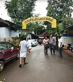
Eranad
Eranad refers to the erstwhile province in the midland area of Malabar, consisting of Malappuram and nearby regions such as Anakkayam, Manjeri, Kondotty, Nilambur, etc.
Eranad
Ernad | |
|---|---|
Erstwhile Province | |
 Ernad Taluk Office, Manjeri ഏറനാട് താലൂക്ക് ഓഫീസ്, മഞ്ചേരി | |
 Eranad Location in Kerala, India  Eranad Eranad (India) | |
| Coordinates: 11.119198°N 76.119631°E | |
| Country | |
| State | Kerala |
| District | Malappuram |
| Taluk Headquarters | Manjeri |
| Languages | |
| • Official | Malayalam, English |
| Time zone | UTC+5:30 (IST) |
| Vehicle registration | KL 10 |
Ernad had two capitals during various times, Nediyiruppu, in Kondotty under Chera rule, and Kottappadi, in Malappuram under Zamorin rule. Present-day Ernad taluk headquarters is at Manjeri.
History
Eranad (from "Erala-nadu", the Land of the Cattle, according to William Logan), was originally a province in the Chera Kingdom (9th-12th century CE) ruled by a clan known as the Eradis. Their provincial capital was at Nediyiruppu, near present-day Kondotty. The ruler of the Eralanadu was known as the Eralanadu Utaiyavar, Elar-thiri or Nediyiruppu Mooppan or Mooppil Nayar. Manavepala Manaviyan, a governor of the Eralanadu, signs himself in the famous Jewish Copper Plate (1000 CE). The Viraraghava Copper Plate (1225 CE) is also signed by the Eralanadu ruler.
After the fall of the Cheras, the region became an independent political entity. Later, the Eradis expanded their kingdom to the west and moved their capital to Calicut while setting up a regional capital at Kottappadi, Malappuram with Paranambi as the chieftain. The Eradis came to be known as the "Kings of the Oceans" (Samoothiri/Zamorin) in later times.
The Ernad taluk existed during British Colonial rule in India was under Malappuram Revenue Division, a part of Malabar District within the Madras Presidency. In the first decade after Independence, large-scale changes in the territorial jurisdiction of this region took place with the formation of new taluks. On 1 January 1957 Tirur Taluk was formed, by absorbing portions of Eranad and Ponnani taluks. Two more taluks, namely Tirurangadi taluk and Nilambur taluk, were formed later by bifurcating Tirur Taluk and Eranad taluk.
Malabar Rebellion
The region was the centre of the Malabar Rebellion of 1921. This armed uprising against British and feudal lords was put down by the Colonial government.
Eranad, the name also used by
- Eranad Cement Private Limited
- Eranad Estates Private Limited
- Eranad Travel And Tourism Private Limited
- Eranad Beverages Private Limited
- Eranad Properties Private Limited
- Eranad Floorings LLP
- Eranad Township Complex Private Limited
- Eranad Hallmarking Centre Private Limited
Transportation
The Ernad area connects with other parts of India through highway NH966. Multiple state highways connect the region with other parts of the district as well as the rest of the state. The nearest airport is at Karipur. The nearest major railway station is at Tirur.