Fukagawa-Rumoi Expressway
The Fukagawa-Rumoi Expressway (Japanese:
| |
|---|---|
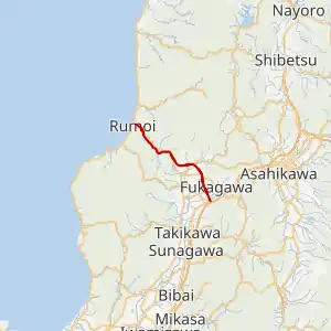
The Fukagawa-Rumoi Expressway highlighted in red | |
| Route information | |
| Maintained by East Nippon Expressway Company/Ministry of Land, Infrastructure, Transport and Tourism | |
| Length | 49.0 km[1] (30.4 mi) |
| Existed | 1998–present |
| Component highways | |
| Major junctions | |
| East end | |
| West end | |
| Highway system | |
| National highways of Japan Expressways of Japan | |

Junction list
The entire expressway is in Hokkaido.
| Location | km[1] | mi | Exit | Name | Destinations | Notes | |
|---|---|---|---|---|---|---|---|
| Fukagawa | 0 | 0.0 | 42/TB | Fukagawa | Eastern terminus | ||
| 4.4 | 2.7 | 1 | Fukagawa-nishi | Hokkaido Route 47 – Central Fukagawa, Moseushi | |||
| Chippubetsu | 11.6 | 7.2 | 2 | Chippubetsu | |||
| 13.0 | 8.1 | PA | Chippubetsu Parking Area | ||||
| Numata | 20.0 | 12.4 | 3 | Numata | |||
| Hokuryū | 27.0 | 16.8 | 4 | Hokuryū-Himawari | |||
| Rumoi | 36.0 | 22.4 | 5 | Rumoi-Horonuka | |||
| 44.9 | 27.9 | 6 | Rumoi-Owada | Westbound exit, eastbound entrance | |||
| 49.0 | 30.4 | 7 | Rumoi | Western terminus | |||
| 1.000 mi = 1.609 km; 1.000 km = 0.621 mi | |||||||
References
- Google (2 October 2020). "Route of Fukagawa-Rumoi Expressway" (Map). Google Maps. Google. Retrieved 2 October 2020.
- "Japan's Expressway Numbering System". www.mlit.go.jp.
This article is issued from Wikipedia. The text is licensed under Creative Commons - Attribution - Sharealike. Additional terms may apply for the media files.