Gefiontinde
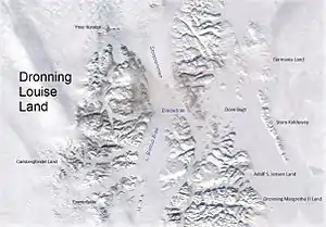
Gefiontinde (Gefion Peak) is the highest mountain in Queen Louise Land (Danish: Dronning Louise Land), NE Greenland. The peak is located in the King Frederick VIII Land area of northeastern Greenland. Administratively it is part of the Northeast Greenland National Park zone.
| Gefiontinde | |
|---|---|
 Queen Louise Land and neighbouring areas | |
| Highest point | |
| Elevation | 2,364 m (7,756 ft) [1] |
| Coordinates | 76°28′8″N 25°38′31″W [1] |
| Geography | |
 Gefiontinde | |
This peak was named after Gefion, the virgin sister of Danish deities who is said to have ploughed the whole Danish island of Zealand (Sjælland) in one night.[2]
Geography
Gefiontinde is the highest peak in a group of peaks named Gefions Tinder or Gefiontinder at the southwestern end of Queen Louise Land, between Pony Glacier and Budolfi Isstrøm.[3] The nunatak group was named Gefions Tinder or Gefiontinder by the 1912–13 Danish Expedition to Queen Louise Land and Across the North Greenland Ice Sheet led by J.P. Koch.[2]
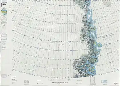
Gefiontinde is a 2,364.3-metre-high (7,757 ft) peak.[1] This mountain is marked as a 8,799-foot-high (2,682 m) peak in the Defense Mapping Agency Greenland Navigation charts.[4]
 Defense Mapping Agency map of Northeastern Greenland. |
See also
- List of mountains in Greenland
- List of mountain peaks of Greenland
- Revaltoppe, second highest mountain in Queen Louise Land
References
- Google Earth
- Higgins, Anthony K. (2010-12-21), "Exploration history and place names of northern East Greenland" (PDF), Geological Survey of Denmark and Greenland Bulletin, Copenhagen, Denmark: Geological Survey of Denmark and Greenland (GEUS), 21: 1–368, ISSN 1604-8156, retrieved 2019-12-01
- GEUS Map - Northern East Greenland; Geological Survey of Denmark and Greenland Bulletin 21 Map 4 - 1:1 000 000
- 1:1,000,000 scale Operational Navigation Chart, Sheet B-9