Gmina Choceń
Gmina Choceń is a rural gmina (administrative district) in Włocławek County, Kuyavian-Pomeranian Voivodeship, in north-central Poland. Its seat is the village of Choceń, which lies approximately 19 kilometres (12 mi) south of Włocławek and 67 km (42 mi) south-east of Toruń.
Gmina Choceń
Choceń Commune | |
|---|---|
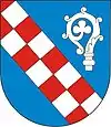
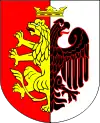
 Flag  Coat of arms | |
| Coordinates (Choceń): 52°29′5″N 19°1′3″E | |
| Country | |
| Voivodeship | Kuyavian-Pomeranian |
| County | Włocławek County |
| Seat | Choceń |
| Area | |
| • Total | 99.68 km2 (38.49 sq mi) |
| Population (2006) | |
| • Total | 7,894 |
| • Density | 79/km2 (210/sq mi) |
| Website | http://www.chocen.pl/ |
The gmina covers an area of 99.68 square kilometres (38.5 sq mi), and as of 2006 its total population is 7,894.
Villages
Gmina Choceń contains the villages and settlements of Bodzanówek, Bodzanowo, Borzymie, Borzymowice, Choceń, Czerniewice, Filipki, Gajówka, Grabówka, Janowo, Jarantowice, Jerzewo, Kępka Szlachecka (part), Krukowo, Kuźnice, Lijewo, Łopatki, Ługowiska, Lutobórz, Niemojewo, Nowa Wola, Olganowo, Pustki Śmiłowskie, Skibice, Śmiłowice, Stare Nakonowo, Stefanowo, Świerkowo, Szatki, Szczutkowo, Szczytno, Wichrowice, Wilkowice, Wilkowiczki, Wola Nakonowska, Ząbin, Zakrzewek and Zapust.
Neighbouring gminas
Gmina Choceń is bordered by the gminas of Boniewo, Chodecz, Kowal, Lubień Kujawski, Lubraniec and Włocławek.
