Homestead, Montana
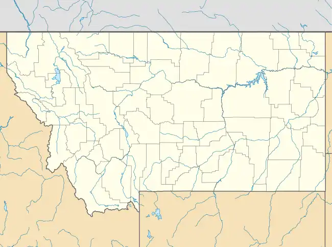
Homestead is an unincorporated community in Sheridan County, Montana, United States. Homestead is located along a railroad, 5.8 miles (9.3 km) south-southwest of Medicine Lake. The community had a post office until November 19, 1994; it still has its own ZIP code, 59242.[2][3]
Homestead, Montana | |
|---|---|
 Homestead, Montana  Homestead, Montana | |
| Coordinates: 48°25′16″N 104°32′20″W | |
| Country | United States |
| State | Montana |
| County | Sheridan |
| Elevation | 1,982 ft (604 m) |
| Time zone | UTC-7 (Mountain (MST)) |
| • Summer (DST) | UTC-6 (MDT) |
| ZIP code | 59242 |
| Area code(s) | 406 |
| GNIS feature ID | 772498[1] |
References
- "Homestead". Geographic Names Information System. United States Geological Survey.
- United States Postal Service (2012). "USPS - Look Up a ZIP Code". Retrieved 2012-02-15.
- "Postmaster Finder - Post Offices by ZIP Code". United States Postal Service. Retrieved July 8, 2014.
Municipalities and communities of Sheridan County, Montana, United States | ||
|---|---|---|
| City | 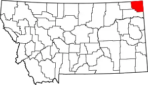 Sheridan County map | |
| Towns | ||
| CDPs | ||
| Unincorporated communities | ||
| Ghost town | ||
| Indian reservations | ||
| Footnotes | ‡This populated place also has portions in an adjacent county or counties | |
| ||
This article is issued from Wikipedia. The text is licensed under Creative Commons - Attribution - Sharealike. Additional terms may apply for the media files.