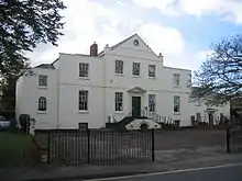
Hucclecote
Hucclecote is a village in Gloucestershire, United Kingdom, comprising a ward (population 8,826)[1] in the City of Gloucester,[2][3] and an adjacent civil parish (population 1,332)[4] in the Borough of Tewkesbury.[5][6] It is located on the periphery of the city, between Barnwood and Brockworth, along Ermin Way, an old Roman road connecting Gloucester with Cirencester and the Cotswolds.
| Hucclecote | |
|---|---|
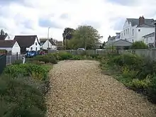
 Kingscroft Road in Hucclecote | |
 Hucclecote Location within Gloucestershire | |
| Population | 10,158 (2011) |
| OS grid reference | SO873168 |
| Shire county | |
| Region | |
| Country | England |
| Sovereign state | United Kingdom |
| Post town | GLOUCESTER |
| Postcode district | GL3 |
| Dialling code | 01452 |
| Police | Gloucestershire |
| Fire | Gloucestershire |
| Ambulance | South Western |
| UK Parliament |
|
History and background
Hucclecote has been settled since ancient times, and a Roman villa dating from the second or third century AD has been found at Hucclecote.[7]
Later, Hucclecote was a hamlet in the ancient parish of Churchdown, and is mentioned in the Domesday Book.[5]
Hucclecote was a small village until development began prior to the outbreak of World War II in 1939. Development was halted during the war and the area was bombed by the Luftwaffe due to the aircraft factories and other industrial facilities in the area, which were originally within the boundary of Brockworth. Due to redistricting, the airfield from which the world's first jet fighter, the Gloster Meteor,[8] took off for test flights is now within the boundary of Hucclecote. The area bordering Brockworth is currently undergoing redevelopment, with the derelict land that formerly housed the airfield and factory having made way for Coopers Edge, a housing development of 1,900 homes, as well as shops and a school.[9] The nearby Gloucester Business Park currently has a Tesco Supermarket, a Premier Inn, and many office buildings, with restaurants and other retail facilities currently being added.[10]

Ermin Way through Hucclecote was a major trunk route until the construction of the Brockworth Bypass in 1995. Until the construction of the Severn Bridge in 1966, this was a strategic route from the south of England to south Wales, as the lowest bridge crossing of the River Severn was at Gloucester.
Hucclecote is split into two parts; with the dividing line being the M5 Motorway bridge. The part to the west of the bridge, and thus closest to Gloucester, is the larger part, and falls under Gloucester City Council, while to the east of the bridge, the Parish of Hucclecote is part of Tewkesbury Borough Council.[11]
Origin of the name 'Hucclecote'
Possibly, though very doubtfully, Hucclecote derives from Welsh: 'Uchel'+'coed' = high wood (cf Wotton & Barnwood).
The Celtic meaning for the name 'Hucclecote' is 'tall trees, lofty woods'.
A "cote" is: A small shed or shelter for sheep or birds. [Middle English, from Old English.] cote
- 2 (k t). tr.v. cot·ed, cot·ing, cotes Obsolete. To go around by the side of; skirt.
Eilert Ekwall gives the meaning as The COT of Hucel's people.[12]
Floods of Summer 2007
During the floods of Summer 2007, Hucclecote escaped the damage on the scale that afflicted other parts of Gloucester. However, on Friday 20 July 2007, a few roads were submerged, which prevented access to many homes, and were blocked off by the Police. During the period, many homes were without water for two weeks, and some were also without electricity.[13]
The Dinglewell area was badly affected, with one house receiving 18" of brook water throughout the lower floors.[14]
Amenities

Hucclecote has many locally owned shops and two pubs; The Royal Oak and The Wagon & Horses, both operated by national chains. There's also the Community Centre Club Bar.[15] National brands such as The Co-operative and Lloyds Pharmacy have branches in the village. There are three schools in Hucclecote: Hillview primary school and Dinglewell Infants and Juniors.
In 2018, over 10,000 visitors are expected to the Hucclecote Show, a fayre held in George V playing fields and run by the Hucclecote Community Association.[16]
Economy
The average household income was £27,040 in 2012.[17]
Notes
- "Key Figures for 2011 Census: Key Statistics. Hucclecote". Office for National Statistics. Archived from the original on 4 September 2014. Retrieved 4 September 2014.
- "Ward Area Profile - Hucclecote" (PDF). Gloucester City Council. Spring 2013. Archived from the original (PDF) on 4 September 2014.
- "Hucclecote". Ordnance Survey. Archived from the original on 4 September 2014. Retrieved 4 September 2014.
- "Key Figures for 2011 Census: Key Statistics. Hucclecote". Office for National Statistics. Archived from the original on 4 September 2014. Retrieved 4 September 2014.
- "History: Hucclecote Parish". 2012. Archived from the original on 4 September 2014.
- "Hucclecote". Ordnance Survey. Archived from the original on 4 September 2014. Retrieved 4 September 2014.
- Geoff Adams (2005). Romano-Celtic Elites and Their Religion. Caeros Pty Ltd. pp. 45–. ISBN 978-0-9758445-1-9. Retrieved 4 September 2011.
- Gloster Meteor
- "Coopers Edge". Archived from the original on 25 March 2012. Retrieved 6 April 2012.
- "Whittle Square Development". Archived from the original on 25 March 2012. Retrieved 6 April 2012.
- "Hucclecote Pages 430-438 A History of the County of Gloucester: Volume 4, the City of Gloucester". British History Online. Victoria County History. Retrieved 28 August 2020.
- Ekwall, Eilert (1960). The Concise Oxford Dictionary of English Place Names. Oxford University Press. p. 255. ISBN 978-0-19-869103-7.
- "Gloucester City Council Strategic Flood Risk Assessment for Local Development Framework Level 1 Volume 1 - FINAL September 2008" (PDF). Gloucestershire County Council. Archived (PDF) from the original on 28 August 2020. Retrieved 28 August 2020.
- "Flooding in 2007 by districts". Gloucestershire County Council. Archived from the original on 28 August 2020. Retrieved 28 August 2020.
- "Social Club". Hucclecote Community Association. Archived from the original on 31 December 2019. Retrieved 28 August 2020.
- "King George V Playing Field". Hucclecote Community Association. Archived from the original on 28 August 2020. Retrieved 28 August 2020.
- "Office for National Statistics". Archived from the original on 4 September 2014. Retrieved 6 April 2012.
External links
| Wikimedia Commons has media related to Hucclecote. |
- Hucclecote parish map, archived 2014 here.