Hunt Valley, Maryland
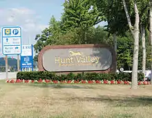
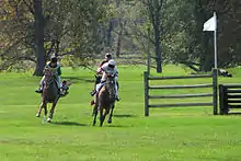
Hunt Valley is an unincorporated community in Baltimore County, Maryland, United States,[1] near the site of the Maryland Hunt Cup Steeplechase. It lies just north of the city of Baltimore, along York Road (Maryland Route 45), parallel to Interstate 83. The nearby Loch Raven Reservoir is an important landmark and drinking water resource. Its surrounding forested watershed is one of three reservoirs (along with Prettyboy and Liberty Reservoirs) established for the City of Baltimore.[2] Hunt Valley is located at a latitude of 39.5° North and longitude of 76.7° West.[3] It is served by the Cockeysville post office, and is also a neighbor of Timonium. A satellite campus of the Community College of Baltimore County is located in Hunt Valley Town Centre.
Hunt Valley, Maryland | |
|---|---|
 Hunt Valley, Maryland as seen from Gilroy Road | |
 Hunt Valley Location in Maryland  Hunt Valley Hunt Valley (the United States) | |
| Coordinates: 39°30′12″N 76°42′10″W | |
| Country | |
| State | |
| County | |
| ZIP codes | 21031, 21030 |
| Area code(s) | 410, 443 |
Business and industry
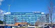
An industrial park, named The Hunt Valley Business Community,[4] was opened in 1962.[5] Hunt Valley is the home of AmTote International, Inc., Systems Alliance, Inc.,[6] BreakAway Games, Atradius North America, Sinclair Broadcast Group, McCormick & Company, AAI Corporation, Dunbar Armored,[7] TESSCO Technologies,[8] ZeniMax Online Studios, and Drchrono. The Hunt Valley Inn has been the site of Balticon in the past.
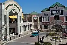
Hunt Valley Towne Centre is the main shopping area. It was built on estate formerly owned by the Grand Lodge of Ancient Free and Accepted Masons of Maryland. Before the land was the Merryman family estate, “Bonnie Blink”.[9] It was originally opened as Hunt Valley Mall in 1981,[10] and redeveloped into the current open air Towne Centre in 2005.[11]
Recreation
In 2000 the Maryland Environmental Trust acquired an area encompassing Western Run shoreline, and wetlands, creating a nature preserve and hiking area.[12]
Torrey C. Brown Rail Trail, also known as the NCR , a popular place to hike.
Oregon Ridge Park and Oregon Ridge Nature Center, also with hiking trails. The Nature Center hosts an annual bird count.
Places to see
The System Source Computer Museum houses computing artifacts from dating from ancient China to the present day.[13]
Public transportation
| Wikivoyage has a travel guide for Hunt Valley. |
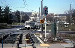
Hunt Valley is the northern terminus of the Light Rail line,[14] and is also served by the Route 93 bus.
References
- "Cities and Towns of Baltimore County". 2020. Retrieved February 17, 2020.
- "About Loch Raven". Loch Raven Trails. Retrieved February 11, 2020.
- "Hunt Valley, Maryland". Lat-Long.com. Retrieved February 10, 2020.
- Glasgow, Jesse (February 2, 1972). "The Baltimore Sun". ProQuest 536373285.
- "Industrial Park Launched". The Sun (Baltimore). May 27, 1962. ProQuest 542519802.
- "Contact Us". Systems Alliance, Inc. Retrieved February 10, 2020.
- "Dunbar Armored, Inc". Bloomberg. Retrieved February 10, 2020.
- "Tessco Support". Tessco. Retrieved February 12, 2020.
- Taylor, Stuart S. (May 4, 1973). "Group plans to develop tract on Shawan Road". The Sun (Baltimore).
- Jackson, Jacquelyn (September 16, 1981). "Hunt Valley Mall Opens Tomorrow". The Sun. ProQuest 535888303.
- Walker, Andrea K. (January 21, 2005). "1st new stores set to open at Hunt Valley". The Sun (Baltimore). ProQuest 406635926.
- Atwood, Liz (January 6, 2000). "Hunt Valley property becomes 500th parcel protected by trust". The Sun (Baltimore).
- "System Source Computer Musem". The Computer Musem. Retrieved February 14, 2020.
- "LIght Rail". Maryland Transit Administration. February 12, 2020. Retrieved February 12, 2020.
