Ichchapuram
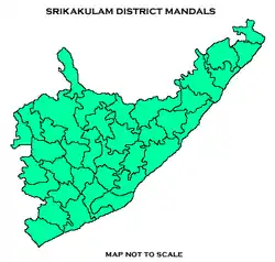
Ichapuram is a town in the Srikakulam district of the Indian state of Andhra Pradesh. A Mendal headquarters, one of India's urban local bodies (or ULBs), governs the municipality. The town is located nearly 142 km from the district capital. Ichapuram municipality is the largest ULB in the Srikakulam District. It had a population of 36,493 as of 2011.
Ichapuram | |
|---|---|
 Ichapuram railway station | |
.svg.png.webp) Ichapuram Location in Andhra Pradesh, India | |
| Coordinates: 19.12°N 84.7°E | |
| Country | India |
| State | Andhra Pradesh |
| District | Srikakulam |
| Government | |
| • Type | Municipality |
| • Body | Ichapuram Municipality, SUDA |
| • Member of Legislative Assembly | Bendalam ashok |
| Area | |
| • Total | 27.28 km2 (10.53 sq mi) |
| Elevation | 15 m (49 ft) |
| Population (2011)[3] | |
| • Total | 40,000 |
| • Density | 1,500/km2 (3,800/sq mi) |
| Languages | |
| • Official | Telugu |
| Time zone | UTC+5:30 (IST) |
| PIN | 532 312 |
| Telephone code | +91–8947 |
| Vehicle Registration | AP30 (former) AP39 (from 30 January 2019)[4] |
| Lok Sabha constituency | Srikakulam |
| Vidhan Sabha constituency | Ichchapuram |
| Website | ichapuram |
Geography
Ichapuram lies on the border of Andhra Pradesh and Odisha at 19.12°N 84.7°E.[5] It has an average elevation of 7 metres (22 feet). The town sits on the Bahuda River. The overall geographical area of Ichapuram is 27 hectares and the nearest town, Palasa Kasibugga, is 18 km away. Sonpur Beach is a 35 minute drive to the East. Ichapuram's Maa Mangala temple, not to be confused with the more famous Maa Mangala Temple located in Odisha, is located in the North East quadrant of the municipality.
Demographics
As of 2011 census, the town had a population of 36,493, with 17,716 males above the age of 6, 18,777 females above the age of 6, and 4,004 children between the ages of 0 and 6. Ichapuram's average literacy rate is 71.12% with 23,105 literate individuals. The two primary languages of the municipality are Telugu and Odia.
Government and politics
Ichapuram municipality is classified by the Indian government as a 3rd grade municipality. Ichapuram is an assembly constituency in Andhra Pradesh. Bendalam Ashok is the present MLA.[6]
Transport
National Highway 16, a part of Golden Quadrilateral highway network, bypasses the town.[7] The Ichapuram railway station is on the Howrah-Chennai main line.
Education
There are several private schools in Ichapuram, including Vidhya Bharathi English medium school, Swarna Bharathi English medium school, Gnana Bharathi English medium school, and Ravindra Bharathi English medium school.[8][9]
See also
- List of municipalities in Andhra Pradesh
References
- "STATISTICAL INFORMATION OF ULBs & UDAs" (PDF). Directorate of Town and Country Planning. Government of Andhra Pradesh. p. 1. Retrieved 24 April 2019.
- "Elevation for Rajam". Veloroutes. Retrieved 19 August 2014.
- "Census 2011". The Registrar General & Census Commissioner, India. Retrieved 19 August 2014.
- "New 'AP 39' code to register vehicles in Andhra Pradesh launched". The New Indian Express. Vijayawada. 31 January 2019. Retrieved 9 June 2019.
- Falling Rain Genomics, Inc – Ichapuram
- http://www.elections.in/andhra-pradesh/assembly-constituencies/ichchapuram.html
- "National Highways Development Project Map". National Highways Authority of India. Archived from the original on 22 April 2017. Retrieved 21 April 2017.
- "School Education Department" (PDF). School Education Department, Government of Andhra Pradesh. Archived from the original (PDF) on 27 December 2015. Retrieved 7 November 2016.
- "The Department of School Education – Official AP State Government Portal | AP State Portal". www.ap.gov.in. Archived from the original on 7 November 2016. Retrieved 7 November 2016.
