Jorat-Mézières
Jorat-Mézières is a municipality in the district of Lavaux-Oron in the canton of Vaud in Switzerland. On 1 July 2016 the former municipalities of Mézières (VD), Ferlens (VD) and Carrouge (VD) merged to form the new municipality of Jorat-Mézières.[2]
Jorat-Mézières | |
|---|---|
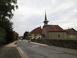
 Carrouge village, part of the municipality | |
 Coat of arms | |
Location of Jorat-Mézières 
| |
 Jorat-Mézières  Jorat-Mézières | |
| Coordinates: 46°36′N 06°46′E | |
| Country | Switzerland |
| Canton | Vaud |
| District | Lavaux-Oron |
| Government | |
| • Mayor | Syndic |
| Area | |
| • Total | 1,109 km2 (428 sq mi) |
| Elevation | 750 m (2,460 ft) |
| Population (2018-12-31)[1] | |
| • Total | 2,873 |
| • Density | 2.6/km2 (6.7/sq mi) |
| Time zone | UTC+01:00 (Central European Time) |
| • Summer (DST) | UTC+02:00 (Central European Summer Time) |
| Postal code(s) | 1076, 1083-4 |
| SFOS number | 5806 |
| Surrounded by | Vucherens, Vulliens, Montpreveyres, Ropraz |
| Website | http://www.jorat-mezieres.ch/ Profile (in French), SFSO statistics |
Geography
After the 2016 merger Jorat-Mézières had an area of 11.08 km2 (4.28 sq mi).[3]
Demographics
Jorat-Mézières has a population (as of December 2019) of 2,951.[4]
Heritage sites of national significance

Thêatre du Jorat
The Théâtre Du Jorat is listed as a Swiss heritage site of national significance.[6]
References
- "Ständige Wohnbevölkerung nach Staatsangehörigkeitskategorie Geschlecht und Gemeinde; Provisorische Jahresergebnisse; 2018". Federal Statistical Office. 9 April 2019. Retrieved 11 April 2019.
- Amtliches Gemeindeverzeichnis der Schweiz published by the Swiss Federal Statistical Office (in German) accessed 27 April 2016
- Arealstatistik Standard - Gemeindedaten nach 4 Hauptbereichen
- "Ständige und nichtständige Wohnbevölkerung nach institutionellen Gliederungen, Geburtsort und Staatsangehörigkeit". bfs.admin.ch (in German). Swiss Federal Statistical Office - STAT-TAB. 31 December 2019. Retrieved 6 October 2020.
- Swiss Federal Statistical Office STAT-TAB Bevölkerungsentwicklung nach institutionellen Gliederungen, 1850-2000 (in German) accessed 27 April 2016
- "Kantonsliste A-Objekte". KGS Inventar (in German). Federal Office of Civil Protection. 2009. Archived from the original on 28 June 2010. Retrieved 25 April 2011.
| Wikimedia Commons has media related to Jorat-Mézières. |
This article is issued from Wikipedia. The text is licensed under Creative Commons - Attribution - Sharealike. Additional terms may apply for the media files.
