Kanowit
Kanowit is a town and the capital of a district of the same name, located within the Sibu Division, Sarawak, Malaysia, comprising 2,253.5 square kilometres. As of 2010, Kanowit's population is 28,985. It is built on the mouth of Kanowit River at the bank of Rajang River, approximately 174 kilometers from the coast of South China Sea. It takes 45 minutes to reach the town by land transport and an hour by boat from Sibu. The main ethnic groups are Iban, Chinese, Malay, and Melanau.
Kanowit | |
|---|---|
| Other transcription(s) | |
| • Chinese | 加拿逸 |
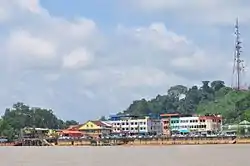 | |
 Kanowit | |
| Coordinates: 2°06′0″N 112°09′0″E | |
| Country | |
| State | |
| Population (2010) | |
| • Total | 28,985 |
| Website | http://www.kanowitdc.sarawak.gov.my/ |
The town takes its name from the Kanowit, a Melanau ethnic group called Rajang by the Ibans. (ISO 639-3: kxn). The language is still spoken by the Kanowit people living in the area.
The village where Kanowit people live is known as Kampung Bedil, a short trip by boat up the Rajang River from Kanowit town.
Etymology
The name "Kanowit" is derived from the name of the earliest ethnic group settling along the Kanowit river. The ethnic group adopted similar culture as the Melanau ethnic group. Therefore, they are often called as the "Melanau of Kanowit". Their languages is classified as the languages related to the people from Oya, Mukah, and Matu District. They had their own social rankings: aristocrats, middle class, and slaves. Their houses were 40 foot tall, although such houses no longer exists today. They were well known of their basketry which were sold in the Kanowit Bazaar (market).[1][note 1]
History
In 1846, Phlegethon ship commanded by Captain Rodney Mundy and James Brooke sail up the Rajang River to combat Dayak piracy that frequently threatened the borders of Sarawak (Kuching area). On 29 June, Rodney and James arrived at Kanowit and their first contact with the "Kanowit" people there was peaceful. In 1851, Fort Emma was built by the Brookes although Kanowit was still under the control of Bruneian empire. The fort was named after the sister of James Brooke, Emma Brooke. Emma Brooke was also the mother of the second Rajah of Sarawak, Charles Anthony Brooke.[1][note 2] In 1853, James Brooke was able to take over Rajang River and its surrounding settlements from the Brunei Sultanate.[2] Fort Emma offered protection against Dayak piracy along the Rajang river. Therefore, Hokkien Chinese from Singapore and Fujian province of China came to settle in Kanowit during the 1870s, while Sibu was still a small Malay village at that time. Chinese traders from Singapore brought clothes, jars, salt, and other daily necessities in exchange for rattan, hides of wild cattle, camphor, rhinoceros horns, and monkeys gall stones. The Cantonese people later arrived in the 1880s. They were involved in timber exports.[1][note 3] The Foochow people arrived here from Sibu in 1910.[1][note 4] Besides, Malay villages also established just immediate south to the fort.[1][note 5] In 1883, Father Edmund Dunn of St Joseph College, Mill Hill, England, established the first Roman Catholic Mission headquarters at Kanowit. The missionary at that time worked almost exclusively amongst the Iban people[1][note 6] In 1885, St Francis Xavier Church was built. The church was demolished in 1967 to pave the way for new modern building construction.[1][note 7] Later a mission hospital and a primary school was built. A boat to bring emergency cases to Sibu was provided.[1][note 8]
In June 1859, Syarif Masahor,[1][note 9] together with a "Kanowit" leader named "Sawing",[3] and a number of Malay chiefs killed two Brooke government officials, Charles Fox and Henry Steele.[1][note 10] During the last years of the Japanese occupation, the Kanowit bazaar was looted and burnt to the ground by some natives. In 1951, as the Korean war broke out, the Kanowit bazaar was overflowing with rubber sheets due to rise in rubber prices. However, on 8 November 1951, the bazaar was burnt to the ground due to a large fire.[1][note 11] Construction of the shophouses were restarted from 1952 to 1953. However, several owners were unable to pay the mortgages owed to Chartered Bank in Sibu due to low collapsing rubber prices.[1][note 12]
In the 1970s, there were 48 shophouses in Kanowit, lying parallel to the Kanowit river. There was also a market, churches, a hospital,[1][note 13] a moving picture theatre (named Capital Theatre),[1][note 14] a jetty, government offices, government resident quarters, a government clinic, and a community hall.[1][note 15] The Chinese were settled near the banks of the Rajang River. There were no roads that enter the town. Therefore, the Rajang River is the only mode of transport for people to travel to other towns.[1][note 16]
Government
.jpg.webp)
The town of Kanowit is the capital of the Kanowit District.[1][note 17] The Kanowit district is administered by a District officer, an assistant officer, administrative officers, treasurer, clerks, and other office employees.[1][note 18] Kanowit District Council was first known as Kanowit Sea Dayak Local Authority when it was established in 1949. In 1957, the council name was changed to its present name.[4] Julau was previously a sub-district under the jurisdiction of the Kanowit District. In 1973, Julau was upgraded into a district and put under the administration of Sarikei Division.[5] In the 1960s, there were 24 democratically elected representatives in the Kanowit District Council. The Kanowit District was in turn put under the jurisdiction of the Third Division of Sarawak (also known as Sibu Division today).[1][note 19] In the 1970s, the Kanowit government secondary school was the only secondary school apart from Sibu in the Rajang basin.[1][note 20]
Geography
_and_the_Rajang_river_(right_to_left).jpg.webp)
Kanowit is located at 105 miles (169 km) miles from the sea, near the Rajang River. Although the Rajang river is flowing from east to west in its general course of direction, the river is flowing from south to north in Kanowit, with the Kanowit river entering Rajang from south to north direction. The part of Rajang river near Kanowit is 0.5 miles (0.80 km) wide. The town of Kanowit is located in the north-south direction.[1][note 21]
The area around Kanowit contains mostly tertiary stage of Paleozoic rocks such as sandstones, greywicks, siltstone, shales, and slate. During the Peneplanation and Jerudong cycles, the erosions of the hills in the central Rajang basin has reduced their elevations to 200 to 300 feet, when compared to 3,000 to 5,000 feet mountains located near the Sarawak-Kalimantan border. The river banks at Kanowit are below sea level; therefore, Kanowit is subject to frequent flooding during periods of monsoon seasons.[1][note 22] There are three types of soils in the Kanowit area: acid yellow soils found in the mountainous areas, podsols derived from sandy material at the moderately high terrains, and alluvial deposits at the flood plain areas.[1][note 23]
Climate
Kanowit has a tropical rainforest climate (Af) with heavy to very heavy rainfall year-round.
| Climate data for Kanowit | |||||||||||||
|---|---|---|---|---|---|---|---|---|---|---|---|---|---|
| Month | Jan | Feb | Mar | Apr | May | Jun | Jul | Aug | Sep | Oct | Nov | Dec | Year |
| Average high °C (°F) | 30.1 (86.2) |
30.3 (86.5) |
31.3 (88.3) |
31.9 (89.4) |
32.3 (90.1) |
32.1 (89.8) |
32.0 (89.6) |
31.7 (89.1) |
31.6 (88.9) |
31.5 (88.7) |
31.3 (88.3) |
30.7 (87.3) |
31.4 (88.5) |
| Daily mean °C (°F) | 26.1 (79.0) |
26.2 (79.2) |
27.0 (80.6) |
27.2 (81.0) |
27.6 (81.7) |
27.3 (81.1) |
27.1 (80.8) |
26.9 (80.4) |
26.9 (80.4) |
27.0 (80.6) |
26.8 (80.2) |
26.4 (79.5) |
26.9 (80.4) |
| Average low °C (°F) | 22.2 (72.0) |
22.2 (72.0) |
22.7 (72.9) |
22.6 (72.7) |
22.9 (73.2) |
22.5 (72.5) |
22.2 (72.0) |
22.1 (71.8) |
22.3 (72.1) |
22.5 (72.5) |
22.4 (72.3) |
22.2 (72.0) |
22.4 (72.3) |
| Average rainfall mm (inches) | 351 (13.8) |
293 (11.5) |
315 (12.4) |
248 (9.8) |
279 (11.0) |
227 (8.9) |
177 (7.0) |
244 (9.6) |
315 (12.4) |
288 (11.3) |
288 (11.3) |
362 (14.3) |
3,387 (133.3) |
| Source: Climate-Data.org[6] | |||||||||||||
Demographics
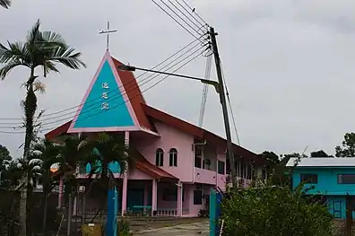 Ik Ong Methodist church
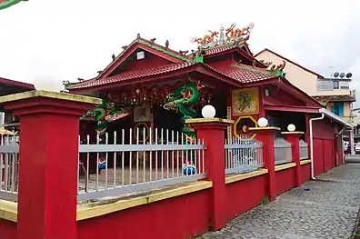 Tua Pek Kong Temple
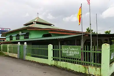 Ar-Rahman mosque
The total population in the Kanowit Bazaar (market) in 1960 was 1,555.[1][note 24] It increased by 13% to 1,720 in August 1970, where 72.7% of them were Chinese and 18.1% were the Malays. Among the Chinese, Hokkien accounted for 48.8% of the population, followed by Cantonese (21.4%), and Foochow (20.1%).[1][note 25] The Iban people made up 6.5% of the population in the Kanowit bazaar. Outside the Kanowit bazaar, the Iban people were the majority. Some Malay families may raise or adopt children from other races. Therefore, names such as "Abdul Chen" and "Aminah Lim" may appear.[1][note 26] All the ethnic groups in the Kanowit Bazaar only started arriving in the last 200 years. The "Kanowit" ethnic group, where the town is named after them, is known to be the earliest inhabitants along the Kanowit river. Few of the "Kanowit" people still staying in Kampung Bedil today.[1][note 27] The Kampung Bedil has about 40 houses with a population of 200 in the year 2015.[3]
Languages
In the 1970s, there were seven widely spoken languages in Kanowit: English, Malay, Iban, Mandarin, Hokkien, Foochow and Cantonese. About 30% of the population at that time speak English. 90% of the population in Kanowit can speak Iban, including 70 to 80% of the Chinese. Meanwhile, 18% of the Kanowit people spoke Malay.[1][note 28] Hokkien was the most widely spoken Chinese dialect in Kanowit during the 1970s. At that time, 48.8% of the Chinese spoke Hokkien, 40 to 50% of the Chinese spoke Foochow, and 90% of the Chinese spoke Mandarin. Most of the Kanowit population was able to converse in more than one languages.[1][note 29]
Economy
Kanowit acts as a middleman of trade between the town of Sibu and people from the interior of the Rajang River. Kanowit exports rural agricultural producta to the outside world. At the same time, manufactured goods from the outside world are imported for daily use by the Kanowit residents.[1][note 31] Among the items available for trade in the Kanowit bazaar are: hill rice, vegetables, chicken, pigs, fish, and fresh-water shrimp. Rubber and pepper are also cultivated in Kanowit.[1][note 32] Kanowit also produces rubber and black pepper.[1][note 33] Before 1970s, Kanowit acted as a transshipment centre for timbers coming from the Rajang upriver. After the freeze of new timber licenses in the 1970s, the effect of timber on the local economy has been reducing.[1][note 34] Majority of the businesses in Kanowit were retail grocery busiesses. Other business were: tailors,[1][note 35] coffeshops,[1][note 36] hairdressers, and food stalls.[1][note 37]
Transport

Other utilities
_Yee_Ting%252C_Kanowit.jpg.webp)
Education
The town has two primary schools:
- Sekolah Rendah Kebangsaan St. Francis Xavier (the earliest primary school in Sarawak, founded in 1883)
- Sekolah Rendah Kebangsaan Yee Ting, a Chinese-run government school
and three secondary schools:
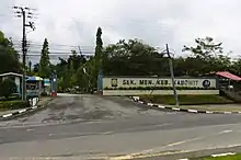
- Sekolah Menengah Kebangsaan Kanowit,
- Sekolah Menengah Kebangsaan Datuk Haji Abdul Rahman Yakub,
- Sekolah Menengah Kebangsaan Nanga Dap.
Culture and leisure

Attractions and recreational spots
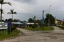
The town center consists of three streets of 1930s vintage Chinese shophouses, near the waterfront. A few new shophouses have been built. Kanowit have a dry and wet market, offering local vegetables, meats and handicrafts. The market opens everyday from 7am till 12 noon. The biggest supermarket is Hock Tong Seng. During periods of celebration, the local karaoke can often be heard from far away with the pounding basslines of trashy 80's hits in English, Malay and Chinese.
The best sight seeing can be had by walking along the riverside from town or up the Telecom Hill or Bukit Memaluh Hill.
References
- Richard C, Filder (2010). Kanowit: An overseas Chinese community in Borneo (First ed.). Sibu, Sarawak: Sarawak Chinese Cultural Association. p. xi. ISBN 978-983-9360-46-2.
- Nicholas, Tarling (17 June 2013). Southeast Asia and the Great Powers. Routledge. p. 195. ISBN 9781135229405. Retrieved 27 April 2018.
Brooke had been able to take over Rajang river in 1853, and managed to secure Mukah and surrounding rivers in 1861.
- Borneo Post Adventourous Team (BAT team). "Tracing the origin of the name Kanowit". The Borneo Post. Archived from the original on 11 February 2018. Retrieved 1 September 2018.
- "History - Kanowit District Council". Kanowit District Council. Archived from the original on 28 June 2018. Retrieved 28 June 2018. Alt URL
- "Pejabat Daerah Julau (Julau District Office)". Sarikei Divisional office. Archived from the original on 29 June 2018. Retrieved 29 June 2018. Alt URL
- "Climate: Kanowit". Climate-Data.org. Retrieved 29 October 2020.
Notes
- Richard C, 2010. Pages 47, 48
- Richard C, 2010. Page 21, 46, 47
- Richard C, 2010. Page 53
- Richard C, 2010. Page 54
- Richard C, 2010. Page 124
- Richard C, 2010. Page 124, 125
- Richard C, 2010. Page 125, 126
- Richard C, 2010. Page 127
- Richard C, 2010. Page 70
- Richard C, 2010. Page 70
- Richard C, 2010. Page 129
- Richard C, 2010. Page 130
- Richard C, 2010. Page 5
- Richard C, 2010. Page 100
- Richard C, 2010. Page 110
- Richard C, 2010. Page 5
- Richard C, 2010. Page 17
- Richard C, 2010. Page 17
- Richard C, 2010. Page 18
- Richard C, 2010. Page 155
- Richard C, 2010. Page 5
- Richard C, 2010. Page 8,9
- Richard C, 2010. Page 13
- Richard C, 2010. Page 40
- Richard C, 2010. Page 28
- Richard C, 2010. Page 60, 61
- Richard C, 2010. Page 45
- Richard C, 2010. Page 42,43
- Richard C, 2010. Page 44
- Richard C, 2010. Page 173
- Richard C, 2010. Page xi
- Richard C, 2010. Page 15
- Richard C, 2010. Pages 72 to 76
- Richard C, 2010. Page 14
- Richard C, 2010. Page 97
- Richard C, 2010. Page 101
- Richard C, 2010. Page 97
- Richard C, 2010. Page 8
External links
| Wikimedia Commons has media related to Kanowit. |