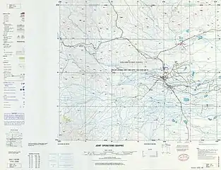
Karakeqik
Karakeqik[4][5] (Uighur: قاراكېچىك يېزىسى,[6] Chinese: 喀热克其克乡,[7] 喀热开其克乡[5][8][9]; pinyin: Kārèkèqíkè Xiāng, Kārèkāiqíkè Xiāng) is a township of Akto County in Xinjiang Uygur Autonomous Region, China. Located in the northeast of the county, the township covers an area of 108 square kilometers with a population of 5,728 (as of 2015[1]). It has 4 administrative villages under its jurisdiction. Its seat is at Bostan Village (博斯坦村).[4]
Karakeqik
قاراكېچىك يېزىسى 喀热克其克乡 Karekeqike, Karekaiqike | |
|---|---|
 Karakeqik Location of the township | |
| Coordinates: 39.2805901601°N 75.6825928885°E | |
| Country | People's Republic of China |
| Autonomous region | Xinjiang |
| Prefecture | Kizilsu |
| County | Akto |
| Area | |
| • Total | 108 km2 (42 sq mi) |
| Elevation | 1,300 m (4,300 ft) |
| Population (2015)[1] | |
| • Total | 5,728 |
| Ethnic groups | |
| • Major ethnic groups | Uyghur[3] |
| Time zone | UTC+8 (China Standard Time) |
| postal code | 844100 |
| Area code(s) | 653022 203 |
| Website | www.xjakt.gov.cn |
Name
The name of Karakeqik is from Uighur language, meaning "spring water rivulet" (泉水沟). There was once a rivulet formed by spring water in the east of the land, so it was named after that.[1]
Geography and resources
Karakeqik Township is located between 75°07′- 75°38′ east longitude and 39°00′- 39°18′ north latitude, in the alluvial fans of the Gez River (盖孜河) in the northwest of Akto County. It is bordered by Blaksu (布拉克苏乡), Saybag (萨依巴格乡) and Wupar (乌帕尔乡) townships of Shufu County to the east, south and north, by Bostanterak Township of Wuqia County and Oytak Town to the west. It has a total area of 108 square meters with arable land area of 1,694 hectares (including shelter forest). The township is 43 kilometers away from the county seat and 37 kilometers away from Kashi City. As of 2015, there were 1,431 households with 5,728 people in the township.
The average elevation of Karakeqik is 1,300 meters. The terrain is high in the southwest and low in the northeast. It is surrounded by water on three sides and has a typical temperate continental arid climate. The annual rainfall is 80–120 mm, and the frost-free period is 220 days. There are two river systems, Gez River and Wupal River (乌帕尔河). The water source is sufficient, suitable for planting crops such as wheat, corn and rice.[2]
Administrative divisions

The township has 4 administration villages and 29 unincorporated villages under its jurisdiction.[10][3]
- Binamu Village (Binamucun,[11] 比纳木村) 39°17′48″N 075°41′29″E
- Bostan Village (Bositan, 博斯坦村)
- Koshdowe Village (Kuoshiduwei, Kuoshi Duweicun,[12] 阔什都维村) 39°16′34″N 075°39′00″E
- Toprelik Village (Tuopurelike, 托普热利克村)
- Dongmahalla (墩买里)
- Mazartograk (麻扎托格拉克)
Demographics
| Year | Pop. | ±% p.a. |
|---|---|---|
| 2000 | 4,259 | — |
| 2010 | 5,299 | +2.21% |
| 2015 | 5,728 | +1.57% |
| [13][1] | ||
As of 1997, the population of the township was 75.9% Uyghur.[3]
References
- 喀热克其克乡(概况). xjakt.gov.cn. 2018-06-04. Archived from the original on 10 November 2019. Retrieved 2019-11-10 – via Internet Archive.
- 克孜勒阿克陶县民生地理. monseng.com. 2019-03-04. Archived from the original on 10 November 2019. Retrieved 2019-11-11.
- 1997年阿克陶县行政区划 [1997 Akto County Administrative Divisions] (in Chinese). XZQH.org. 31 December 2010. Archived from the original on 19 August 2019. Retrieved 20 September 2020.
喀热开其克乡 1962年成立喀热开其克公社,1967年更名东风公社,1984年改设喀热开其克乡。位于县城西北35千米。面积128平方千米,人口0.4万,其中维吾尔族占75.9%,辖江尕勒、比纳木、阔什都维、阿克墩4个行政村。
- 阿克陶县行政区划和居民地名称. xjkz.gov.cn. 2018-05-04. Archived from the original on 22 September 2020. Retrieved 2019-11-10.
喀热开其克乡 KaraKeqik xiang
- Zhong Xingqi 钟兴麒, ed. (July 2008). 西域地名考录 (in Chinese). Beijing: 国家图书馆出版社. p. 503. ISBN 978-7-5013-3628-9.
喀热开其克 kā rè kāi qí kè Karakeqik
- ئاقتۇ ناھىيە قاراكېچىك يېزىسى ئۆزگىچە ئوقۇتۇش ئۇسۇلى ئارقىلىق ئاساسى قاتلام كادىرلىرىنىڭ «قوش تىل» سەۋىيىسىنى ئۆستۈردى. People's Daily (in Uyghur). 9 June 2015. Retrieved 23 September 2020.
ئاقتۇ ناھىيە قاراكېچىك يېزىسى
- 2018年阿克陶县行政区划代码. National Bureau of Statistics of China. 2018-10-31. Archived from the original on 28 October 2019. Retrieved 2019-10-28.
喀热克其克乡
- 2019年阿克陶县行政区划代码. National Bureau of Statistics of China. 2019. Archived from the original on 23 September 2020. Retrieved 23 September 2020.
喀热开其克乡
- Fu Zhongming 符仲明 (24 October 2019). 南疆小村打造“生态田园综合体”助力村民增收脱贫. 中国经济网 (in Chinese). Retrieved 23 September 2020.
克孜勒苏柯尔克孜自治州阿克陶县喀热开其克乡比纳木村工作队,
- 2018年喀热克其克乡行政区划代码. National Bureau of Statistics of China. 2018-10-31. Retrieved 2019-11-10.
- Binamucun (Approved - N) at GEOnet Names Server, United States National Geospatial-Intelligence Agency
- Kuoshi Duweicun (Approved - N) at GEOnet Names Server, United States National Geospatial-Intelligence Agency
- 阿克陶县历史沿革. XZQH.org (in Chinese). 29 January 2019. Retrieved 7 September 2020.
2000年第五次人口普查,阿克陶县常住总人口163024人,其中:{...}喀热开其克乡4259人、{...}2010年第六次人口普查,阿克陶县常住总人口199065人,其中:{...}喀热克其克乡5299人,{...
}