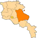
Karmirgyugh
Karmirgyugh (Armenian: Կարմիրգյուղ; meaning Red Village; also Romanized as Karmir Gyukh; until 1940 Kulali and Ghulali; also Gyukh) is a major village in the Gegharkunik Province of Armenia. The village was founded in 1831 by emigrants from Beyazid. It has two old churches of S. Astvatsatsin and S. Grigor, in ruins with khachkars, and was the discovery site of a boundary stone of King Artashes, inscribed in Aramaic. Urartian ruins are also nearby.[1]
- For the town on the east side of Lake Sevan formerly called Karmir Gyugh, see Chambarak; for the village in Azerbaijan, see Qızıloba, Khojali.
Karmirgyugh Կարմիրգյուղ | |
|---|---|
 Karmirgyugh Կարմիրգյուղ | |
| Coordinates: 40°19′50″N 45°11′02″E | |
| Country | Armenia |
| Province | Gegharkunik |
| Founded | 1831 |
| Population (2010) | |
| • Total | 5,997 |
See also
References
- Kiesling, Brady; Kojian, Raffi (2005). Rediscovering Armenia: Guide (2nd ed.). Yerevan: Matit Graphic Design Studio. p. 78. ISBN 99941-0-121-8.
- Karmirgyugh at GEOnet Names Server
- World Gazeteer: Armenia – World-Gazetteer.com
- Report of the results of the 2001 Armenian Census, Statistical Committee of Armenia
- Brady Kiesling, Rediscovering Armenia, p. 44; original archived at Archive.org, and current version online on Armeniapedia.org.
This article is issued from Wikipedia. The text is licensed under Creative Commons - Attribution - Sharealike. Additional terms may apply for the media files.
