Kilkee (parish)
Kilkee (Irish: Cill Chaoi[1]), formerly Kilfearagh, (Irish: Cill Fhiarach[2]) is a Catholic parish in County Clare, Ireland. It lies on the Loop Head peninsula between the Atlantic ocean and the Shannon Estuary. The main settlement is the resort town of Kilkee. The parish contains many ruins, some dating to the early days of Christianity in Ireland.
Kilkee − Cill Chaoi
Kilfearagh − Cill Fhiarach | |
|---|---|
Catholic parish | |
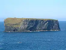
 Cliffs of Kilkee | |
 Kilkee Location in Ireland | |
| Coordinates: 52.67888°N 9.646696°W | |
| Country | Ireland |
| Province | Munster |
| County | County Clare |
| Time zone | UTC+0 (WET) |
| • Summer (DST) | UTC-1 (IST (WEST)) |
Location
Kilfearagh is named after a saint called Fiachrach, or Fiachra. There are several saints by that name in the Irish calendars. It is not known which is the patron of the parish.[3] The parish is in the barony of Moyarta, 7 miles (11 km) west of Kilrush. It is 6 by 5 miles (9.7 by 8.0 km) and covers 9,870 acres (3,990 ha).[4] The main town of Kilkee is about 14 miles (23 km) from the end of the Loop Head peninsula, which separates the Shannon Estuary from the Atlantic Ocean.[5] Kilfearagh lies between the Atlantic Ocean to the west and Poulnasharry bay of the Shannon Estuary on the east.[4]
In the 1830s, apart from farming there was a large trade in turf sent by boat from Poulanishery harbour up the River Shannon to Limerick. About 75 small boats were engaged in Atlantic fishery.[6] In 1841 the population was 7,137 in 1,162 houses.[4] The land between Kilrush and Kilkee was described in 1840 as "bleak, flat, boggy, poorly cultivated, and miserably occupied."[7] The same author described the Atlantic coast as presenting
"... an endless variety of coves, creeks, inlets, and little bays, everywhere bold, in some places awfully impending, and exhibiting striking and wonderful forms. Against the whole line of coast, the mighty billows of the Atlantic roll with incessant force; and in times of storm break and foam on the schistose rocks with inconceivable fury.[5]
Town
At first Kilkee was a small fishing village in the horseshoe-shaped Moore Bay on the Atlantic ocean. When sea bathing became popular in the late 18th century, Kilkee offered a safe beach protected by the Duggema reef. In the early 19th century a regular steamboat service along the Shannon from Limerick to nearby Kilrush made Kilkee more accessible. It ran daily in the bathing season. The town grew to meet tourist demand, first with seaside villas and later with hotels.[8]
By 1840 Kilkee was described as "a watering place of considerable importance, having been of late years greatly resorted to by the citizens of Limerick, as also by the gentry of the adjoining country." Many small houses had been built in a haphazard fashion, there was an inn and many lodging houses. Horse-drawn cars ran daily between Kilkee and Kilrush to connect to the Limerick steamers.[7]
.jpg.webp)
A Catholic church was opened in Kilkee in 1831, a Protestant church in 1843 and a Methodist church in 1900. The sea wall and embankment were built between 1846 and the 1860s, giving employment during the Great Famine. The South Clare Railway reached the town in 1892, and Kilkee boomed until the start of World War I (1914-1918). The town has changed since then, but it is still a popular day trip or vacation spot.[8]
History
The old parishes of Kilfearagh and Killard of the Roman Catholic Diocese of Killaloe were united by the late seventeenth century.[9] In 1704 Daniel Gorman is recorded as parish priest of Kilfearagh and Killard.[10] Kilfearagh was served by the mass house at Corbally Cross until 1831. That year a parish church was opened in the growing resort of Kilkee. In 1854 the combined parish was redivided into the parishes of Kilkee and Doonbeg, with roughly the same boundaries as the medieval Kilfearagh and Killard.[9]
The first church in Kilkee had a cruciform barn structure, with two octagonal towers framing the entrance. Furnishing and decorating the church was a slow process, and seating in the main aisle was not installed until 1885. After many delays, a new church in Kilkee with a modern design was completed in 1963, and the first church was torn down.[9] Today the Catholic parish is served by the Church of the Immaculate Conception and St. Senan in Kilkee and by St. Flannan’s Church in Lisdeen.[11] The Parish Schools are Moyasta National School, built in 1961 and expanded in 2002; Scoil Réalt na Mara National School, a mixed school opened in 1999; and Kilkee Community College, a mixed secondary school.[12]
Antiquities

The old church of Kilfearagh has been leveled to the ground, but the large cemetery that surrounds it remains. There is another graveyard in the townland of Kildimo, dedicated to a Saint Dioma, no longer used. A third, named Cill-na-mban-órtha or "church of the pious women", is in the townland of Bawnmore. Near this church there is a holy well with the same name. There was a Church of the Nuns in the townland of Killnagalliagh, founded by Saint Senán, but no traces remain.[3]
There is a small cemetery at Kilkee, which gives the town its name. The town contains a well dedicated to Saint Senán. About 2 miles (3.2 km) from Kilkee, on the edge of the cliff opposite Bishops Island, there is a holy well dedicated to Saint Caoidhe. Bishops Island has two small buildings, an oratory and cell, dating to the early days of Christianity in Ireland.[3] There is a large fort or rath near Kilkee, said to have been built by the Danes.[6]
The parish today has graveyards at Baunmore, Emlagh, Farrihy, Kilfearagh and Kilnagalliagh.[13]
Townlands
Townlands are Ballyonan or Doonaghboy, Baunmore, Corbally, Dough, Emlagh, Farrihy, Foohagh, Garraun, Kildeema, Kilfearagh, Kilkee Lower, Kilkee Upper, Kilnagalliagh, Knockroe, Leaheen, Lisdeen, Lisluinaghan, Moyasta, Termon East and Termon West.[14] Proprietors of these townlands in 1641 on the eve of the English Civil War were Teige, Murtagh and Charles Cahane, Sir Daniel O'Brien, Barnabas O'Brien, 6th Earl of Thomond, Hugh Clancy and Hugh MacSweeney.[15]
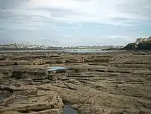
 Kilkee sea front
 Kilkee from the beach
 Kilkee from the distance
References
Citations
- Cill Chaoi, Placenames Database of Ireland.
- Cill Fhiarach, Placenames Database of Ireland.
- Frost 1893, p. 90.
- Parliamentary Gazetteer of Ireland 1845.
- Fraser 1844, p. 392.
- Lewis 1837.
- Fraser 1844, p. 390.
- Kilkee Historical Background.
- Kilkee (Kilfearagh), Killaloe Diocese.
- Frost 1893, p. 560.
- Churches: Kilkee Parish.
- Schools, Kilkee Parish.
- Mitchell 1990, p. 35.
- Map of Kilfearagh Parish showing Townlands.
- Frost 1893, p. 504-505.
Sources
- "Churches". Kilkee Parish. Retrieved 10 April 2014.
- "Cill Chaoi". Placenames Database of Ireland. Retrieved 10 April 2014.
- "Cill Fhiarach". Placenames Database of Ireland. Retrieved 10 April 2014.
- Fraser, James (1844). A Hand Book for Travellers in Ireland: Descriptive of Its Scenery, Towns, Seats, Antiquities, Etc., with Various Statistical Tables. Also an Outline of Its Mineral Structure, a Brief View of Its Botany, and Information for Anglers. W. Curry. Retrieved 11 April 2014.CS1 maint: ref=harv (link)
- Frost, James (1893). The History and Topography of the County of Clare: From the Earliest Times to the Beginning of the 18th Century. author. p. 90. Retrieved 11 April 2014.CS1 maint: ref=harv (link)
- Lewis, Samuel (1837). "Kilfieragh". County Clare: A History and Topography. Retrieved 10 April 2014.
- Mitchell, Brian (1990). A Guide to Irish Churches and Graveyards. Genealogical Publishing Com. ISBN 978-0-8063-1266-8. Retrieved 11 April 2014.CS1 maint: ref=harv (link)
- "Kilfearagh". Parliamentary Gazetteer of Ireland 1845. Retrieved 10 April 2014.
- "Kilkee Historical Background". Clare County Linrary. Retrieved 10 April 2014.
- "Kilkee (Kilfearagh)". Killaloe Diocese. Retrieved 10 April 2014.
- "Map of Kilfearagh Parish showing Townlands". Clare County Library. Retrieved 10 April 2014.
- "Schools". Kilkee Parish. Retrieved 10 April 2014.