Klias Peninsula
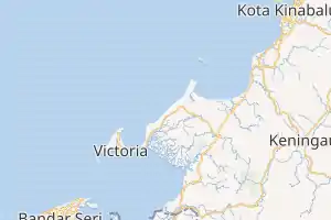
The Klias Peninsula (Malay: Semenanjung Klias) is a peninsula in western of Sabah, Malaysia. It consists of coastal wetlands which become the largest mangrove and nipa swamp area in Sabah's west coast and serves as a major nurturing ground for fisheries resources in the Brunei Bay and Kimanis Bay.[1][2][3]

Location of Klias Peninsula in Sabah | |
 Klias Peninsula Location of Klias Peninsula in Malaysia | |
| Etymology | Semenanjung Klias |
|---|---|
| Geography | |
| Location | Interior Division |
| Coordinates | 5°23′9.139″N 115°34′46.448″E |
| Archipelago | Maritime Southeast Asia |
| Adjacent bodies of water | South China Sea |
| Administration | |
| State | |
Geology
Miocene cobble conglomerates deposited in a tidally-influenced channel define a major sequence boundary exposed on the peninsula that can be correlated to paleo-shelf edge gorges imaged offshore on seismic data.[4] Recent beach deposits on the area at 20 metre elevation indicate youthful uplift which offer a stellar example of drainage capture and facies variability in an active tropical foreland basin.[4]
Climate and biodiversity
The peninsula coastal area comprising the Kuala Penyu and Beaufort generally received mean annual rainfall ranging from 2,000 millimetres to 2,500 millimetres while towards the east annual rainfall reached between 2,500 millimetres and 3,000 millimetres.[5] It consists of four forest reserve areas of Binsuluk, Klias, Menumbok and Padas Damit with much of its coastline is lined with mangroves.[2] The area support large population of water birds together with 134 species from 59 tree families were recorded as well the population of proboscis monkeys.[6][7]
References
- Annual Report of the Geological Survey Department. publisher not identified. 1950.
- "Findings - Klias Peninsula in General" (PDF). Sabah Biodiversity Conservation Project, Identification of Potential Protected Areas, Klias Peninsula - Final Report. Ministry of Culture, Environment and Tourism, Government of Sabah. p. 12. Archived from the original (PDF) on 31 May 2019. Retrieved 31 May 2019.
- "Assessment of Coastal Fisheries in the Malaysian – Sabah portion of the Sulu Sulawesi Marine Ecoregion (SSME)" (PDF). Department of Fisheries, Government of Sabah. Archived from the original (PDF) on 31 May 2019. Retrieved 31 May 2019. Cite journal requires
|journal=(help) - Andrew B. Cullen (2010). "The Klias Peninsula and Padas River: NW Borneo, An Example of Drainage Capture in an Active Tropical Foreland Basin". Online Journal for E&P Geoscientists – via American Association of Petroleum Geologists.
- "Annual rainfall pattern of Sabah [Klias Peninsula]". Government of Sabah. Retrieved 31 May 2019.
- "Klias peninsula [Data Zone MY028]". BirdLife International. 2003. Retrieved 31 May 2019. Cite journal requires
|journal=(help) - Jason Munshi-South; Henry Bernard (2011). "Genetic Diversity and Distinctiveness of the Proboscis Monkeys (Nasalis larvatus) of the Klias Peninsula, Sabah, Malaysia". Journal of Heredity. 102 (3). doi:10.1093/jhered/esr013 – via Oxford University Press.