Koyoshi River
Koyoshi River (Japanese:
| Koyoshi River 子吉川 | |
|---|---|
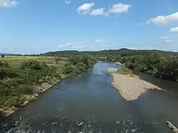 Koyoshi River in 2012 | |
| Location | |
| Country | Japan |
| State | Honshu |
| Region | Akita |
| Physical characteristics | |
| Source | Mount Chōkai [1][2] |
| • elevation | 2,236[3] m (7,336 ft) |
| Mouth | Sea of Japan |
• coordinates | 39°23′26″N 140°00′51″E |
| Length | 61[1][2] km (38 mi) |
| Basin size | 1,190[1][2] km2 (460 sq mi) |
References
- "日本の川 - 東北 - 子吉川 - 国土交通省水管理・国土保全局" (in Japanese). Ministry of Land, Infrastructure, Transport and Tourism, Japan. Retrieved December 28, 2017.
- "子吉川(こよしがわ)とは - コトバンク" (in Japanese). kotobank. Retrieved December 28, 2017.
- "気象庁 鳥海山" (in Japanese). Japan Meteorological Agency. Retrieved December 28, 2017.
- "一級河川水系別延長等" (in Japanese). Ministry of Land, Infrastructure, Transport and Tourism, Japan. Retrieved December 28, 2017.
| Wikimedia Commons has media related to Koyoshi River. |
| |||||||||||||||
| |||||||||||||||
| |||||||||||||||
| |||||||||||||||
| |||||||||||||||
| Authority control |
|---|
This article is issued from Wikipedia. The text is licensed under Creative Commons - Attribution - Sharealike. Additional terms may apply for the media files.