Kuyto
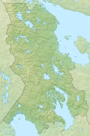
The Kuyto (Russian: Куйто Finnish: Kuittijärvet) are three lakes in the Republic of Karelia, in the northwestern part of Russia. The Kuyto lakes are connected by natural canals, and are used for timber rafting.
- Upper Kuyto (Russian: Верхнее Куйто, Finnish: Ylä-Kuittijärvi) is located at 65.05°N 30.75°E. It has an area of 198 km², surface elevation of 103 m and a maximum depth of 44 m.
| Middle Kuyto | |
|---|---|
 Middle Kuyto | |
| Location | Republic of Karelia |
| Coordinates | 65°08′00″N 31°15′00″E |
| Basin countries | Russia |
| Surface area | 257 km2 (99 sq mi) |
| Max. depth | 34 m (112 ft) |
| Surface elevation | 101 m (331 ft) |
- Middle Kuyto (Russian: Среднее Куйто, Finnish: Keski-Kuittijärvi) is located at 65.1333333°N 31.25°E and has an area of 257 km², surface elevation of 101 m and a maximum depth of 34 m.
- Lower Kuyto (Russian: Нижнее Куйто, Finnish: Ala-Kuittijärvi) is located at 64.9333333°N 31.75°E and has an area of 141 km², surface elevation of 100 m and a maximum depth of 33 m. Lower Kuyto terminates at a dam built in 1956, below which flows the Kem River.
There are numerous islands on Kuyto Lakes.
This article is issued from Wikipedia. The text is licensed under Creative Commons - Attribution - Sharealike. Additional terms may apply for the media files.