Lake Huangqi
Lake Huangqi, also known by its Chinese name as the Huangqi Hai, is a lake in Chahar Right Front Banner, Ulanqab Prefecture, Inner Mongolia, China.
| Lake Huangqi 黄旗海 | |
|---|---|
 Lake Huangqi 黄旗海 | |
| Location | Chahar Right Front Banner, Ulanqab Prefecture, Inner Mongolia, China |
| Coordinates | 40°50′17″N 113°16′49″E |
| Basin countries | China |
| Max. length | 20 km (12 mi) |
| Max. width | 9 km (6 mi) |
| Surface area | 110–113 km2 (42–44 sq mi) |
| Average depth | 4–10 m (13–33 ft) |
| Max. depth | 35 m (115 ft) |
| Water volume | 460–500 million cubic meters (370,000–410,000 acre⋅ft) |
| Lake Huangqi | |||||||||
|---|---|---|---|---|---|---|---|---|---|
| Traditional Chinese | 黃旗海 | ||||||||
| Simplified Chinese | 黄旗海 | ||||||||
| Literal meaning | Yellow Banner Sea | ||||||||
| |||||||||
Name
The present name dates to the Qing, when it was named after one of the Eight Banners.
Geography
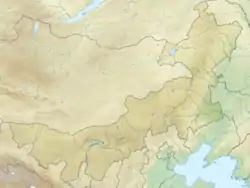
Lake Huangqi is a lake in Chahar Right Front Banner, Ulanqab Prefecture, Inner Mongolia, China. It forms an irregular inverted triangle of about 110–113 km2 (42–44 sq mi), with an east-west distance of about 20 kilometers (12 mi) and a north-south distance of about 9 kilometers (6 mi). Having an average depth of 4–10 meters (13–33 ft) and a maximal depth of 35 meters (115 ft), it holds 460–500 million cubic meters (370,000–410,000 acre⋅ft) of water.
History
Under the Qin, Huangqi and Dai lakes formed the northern boundaries of Yanmen Commandery, marking part of the northern frontier of the Chinese empire.[1]
References
Citations
- Hua & al. (2017), s.v. "Yanmen".
Bibliography
- Li Shizhen (2017), Hua Linfu; et al. (eds.), Ben Cao Gang Mu Dictionary, Vol. II: Geographical and Administrative Designations, Berkeley: University of California Press, ISBN 9780520291966.
External links
| Five Great Lakes | ||
|---|---|---|
| Notable freshwater lakes |
| |
| Notable salt lakes | ||
| National Parks |
| |
| Protected wetlands | ||
| Nature Reserves | ||
| Major urban lakes | ||
| Reservoirs | ||