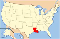
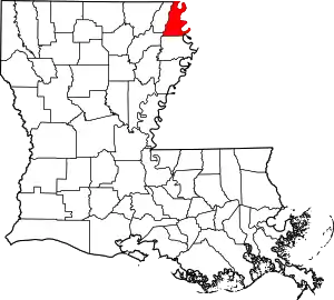
Lake Providence Commercial Historic District
The Lake Providence Commercial Historic District is a 8 acres (3.2 ha) historic district in Lake Providence, Louisiana which was listed on the National Register of Historic Places on December 6, 1979.[1]
Lake Providence Historic District | |
  | |
| Location | Lake Street, Riverside Drive, and Scarborough Street, Lake Providence, Louisiana |
|---|---|
| Coordinates | 32°48′17″N 91°10′14″W |
| Area | 8 acres (3.2 ha) |
| Built | 1900 |
| Architectural style | Early Commercial |
| MPS | Lake Providence MRA |
| NRHP reference No. | 79001063[1] |
| Added to NRHP | December 6, 1979 |
The chosen district name was initially Lake Providence Historic District. The district was added "Commercial" after being included in the Lake Providence MRA on October 3, 1980, in order to distinguish it from the newly created Lake Providence Residential Historic District.[2][3]
The district included 33 contributing buildings which, except for three gaps, enclosed Lake Street. They were late 19th and early 20th century brick commercial buildings, mostly just one story in height.[4][5]
Most of the building seem to have disappeared after the listing. Of the original 33 contributing properties, only 11 are still standing, with several being in very bad condition.[lower-alpha 1]
See also
References
- "National Register Information System". National Register of Historic Places. National Park Service. November 2, 2013.
- "Lake Providence Multiple Resource Area" (PDF). State of Louisiana's Division of Historic Preservation. 1980. Archived from the original (PDF) on February 1, 2018. Retrieved June 3, 2017. with four photos and two maps Archived 2018-02-01 at the Wayback Machine
- East Carroll Parish Historical Society in cooperation with Louisiana Division of Archaeology and Historic Preservation (April 1980). "National Register of Historic Places Multiple Property Documentation: Historic Resources of Lake Providence". National Park Service. Retrieved June 3, 2017.
- "Lake Providence Historic District" (PDF). State of Louisiana's Division of Historic Preservation. 1979. Retrieved June 5, 2017. with two maps
- Mrs. Elizabeth Reed. "National Register of Historic Places Inventory/Nomination Form: Lake Providence Historic District". National Park Service. Retrieved May 17, 2018. With 23 photos from 1979.
Notes
- Compare modern satellite imagery and Street View of the area with photographs and maps present in NRHP form.


