List of Colorado county high points
This article includes a sortable table of the 64 counties of the U.S. State of Colorado with their points of highest elevation.
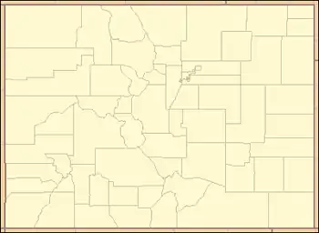
Table
See also
- Colorado
- List of counties in Colorado
- List of mountains in Colorado
- Mountain peaks of Colorado
- Mountain ranges of Colorado
Notes
- The summit of Mount Elbert is the highest point of the Rocky Mountains, the State of Colorado, and Lake County.
- The elevation of Mount Elbert includes an adjustment of +1.995 m (6.55 ft) from NGVD 29 to NAVD 88.
- The summit of Mount Harvard is the highest point of the Collegiate Peaks and Chaffee County, Colorado.
- The elevation of Mount Harvard includes an adjustment of +2.084 m (6.84 ft) from NGVD 29 to NAVD 88.
- The summit of Blanca Peak is the highest point of the Sierra Blanca Massif, the Sangre de Cristo Mountains, Alamosa County and Costilla County, Colorado.
- The elevation of Blanca Peak includes an adjustment of +1.754 m (5.75 ft) from NGVD 29 to NAVD 88.
- The Blanca Peak Tripoint is the highest point of Huerfano County, Colorado..
- The elevation of Blanca Peak Tripoint includes an adjustment of +1.755 m (5.76 ft) from NGVD 29 to NAVD 88.
- The summit of Uncompahgre Peak is the highest point of the San Juan Mountains and Hinsdale County, Colorado.
- The elevation of Uncompahgre Peak includes an adjustment of +1.967 m (6.45 ft) from NGVD 29 to NAVD 88.
- The summit of Crestone Peak is the highest point of the northern Sangre de Cristo Mountains and Saguache County, Colorado.
- The elevation of Crestone Peak includes an adjustment of +1.76 m (5.77 ft) from NGVD 29 to NAVD 88.
- The summit of Mount Lincoln is the highest point of the Mosquito Range and Park County, Colorado.
- The elevation of Mount Lincoln includes an adjustment of +2.098 m (6.88 ft) from NGVD 29 to NAVD 88.
- The summit of Castle Peak is the highest point of the Elk Mountains, Gunnison County and Pitkin County, Colorado.
- The elevation of Castle Peak includes an adjustment of +2.165 m (7.1 ft) from NGVD 29 to NAVD 88.
- The summit of Grays Peak is the highest point of the Front Range, the Continental Divide of North America, Clear Creek County and Summit County, Colorado.
- The elevation of Grays Peak includes an adjustment of +1.881 m (6.17 ft) from NGVD 29 to NAVD 88.
- The summit of Crestone East Peak is the highest point of Custer County, Colorado.
- The elevation of Crestone East Peak includes an adjustment of +1.762 m (5.78 ft) from NGVD 29 to NAVD 88.
- The summit of Longs Peak is the highest point of the northern Front Range, Rocky Mountain National Park, and Boulder County, Colorado.
- The elevation of Longs Peak includes an adjustment of +1.652 m (5.42 ft) from NGVD 29 to NAVD 88.
- The summit of Mount Wilson is the highest point of the San Miguel Mountains and Dolores County, Colorado.
- The elevation of Mount Wilson includes an adjustment of +1.899 m (6.23 ft) from NGVD 29 to NAVD 88.
- The summit of Mount Sneffels is the highest point of the Sneffels Range and Ouray County, Colorado.
- The elevation of Mount Sneffels includes an adjustment of +1.879 m (6.16 ft) from NGVD 29 to NAVD 88.
- The summit of Pikes Peak is the highest point of the southern Front Range and El Paso County, Colorado.
- Pikes Peak is the easternmost 14,000-foot (4,267 m) summit of the United States. Pikes Peak was the inspiration for the lyrics of America the Beautiful..
- The elevation of Pikes Peak includes an adjustment of +1.678 m (5.51 ft) from NGVD 29 to NAVD 88.
- The summit of Windom Peak is the highest point of the Needle Mountains and La Plata County, Colorado.
- Mount Eolus may be higher than Windom Peak..
- The elevation of Windom Peak includes an adjustment of +1.785 m (5.86 ft) from NGVD 29 to NAVD 88.
- The summit of Wilson Peak is the highest point of San Miguel County, Colorado.
- The elevation of Wilson Peak includes an adjustment of +1.877 m (6.16 ft) from NGVD 29 to NAVD 88.
- The summit of Mount of the Holy Cross is the highest point of the northern Sawatch Range and Eagle County, Colorado.
- The summit elevation of Mount of the Holy Cross includes a vertical offset of +0.61 m (2 ft) from the station benchmark.
- The elevation of Mount of the Holy Cross includes an adjustment of +1.926 m (6.32 ft) from NGVD 29 to NAVD 88.
- The summit of Phoenix Peak is the highest point of Mineral County, Colorado.
- The elevation of Phoenix Peak includes an adjustment of +2.027 m (6.65 ft) from NGVD 29 to NAVD 88.
- The summit of Vermilion Peak is the highest point of San Juan County, Colorado.
- The elevation of Vermilion Peak includes an adjustment of +1.827 m (5.99 ft) from NGVD 29 to NAVD 88.
- The summit of West Spanish Peak is the highest point of Las Animas County, Colorado.
- West Spanish Peak is the easternmost 13,000-foot (4,000 m) summit of the United States..
- The elevation of West Spanish Peak includes an adjustment of +1.469 m (4.82 ft) from NGVD 29 to NAVD 88.
- The summit of Hagues Peak is the highest point of the Mummy Range and Larimer County, Colorado.
- The elevation of Hagues Peak includes an adjustment of +1.719 m (5.64 ft) from NGVD 29 to NAVD 88.
- The summit of Pettingell Peak is the highest point of Grand County, Colorado.
- The elevation of Pettingell Peak includes an adjustment of +1.864 m (6.12 ft) from NGVD 29 to NAVD 88.
- The summit of Summit Peak is the highest point of the southern San Juan Mountains and Archuleta County, Colorado.
- The summit elevation of Summit Peak includes a vertical offset of -0.15 m (-0.5 ft) from the station benchmark.
- The elevation of Summit Peak includes an adjustment of +1.877 m (6.16 ft) from NGVD 29 to NAVD 88.
- The summit of James Peak is the highest point of Gilpin County, Colorado.
- The elevation of James Peak includes an adjustment of +1.789 m (5.87 ft) from NGVD 29 to NAVD 88.
- The summit of Hesperus Mountain is the highest point of the La Plata Mountains and Montezuma County, Colorado.
- The elevation of Hesperus Mountain includes an adjustment of +1.65 m (5.41 ft) from NGVD 29 to NAVD 88.
- The summit of Bennett Peak is the highest point of Rio Grande County, Colorado.
- The elevation of Bennett Peak includes an adjustment of +1.782 m (5.85 ft) from NGVD 29 to NAVD 88.
- The summit of Conejos Peak is the highest point of Conejos County, Colorado.
- The elevation of Conejos Peak includes an adjustment of +1.792 m (5.88 ft) from NGVD 29 to NAVD 88.
- The summit of Bushnell Peak is the highest point of Fremont County, Colorado.
- The elevation of Bushnell Peak includes an adjustment of +1.737 m (5.7 ft) from NGVD 29 to NAVD 88.
- The summit of Devils Playground is the highest point of Teller County, Colorado.
- The elevation of Devils Playground includes an adjustment of +1.611 m (5.29 ft) from NGVD 29 to NAVD 88.
- The summit of Clark Peak is the highest point of the Medicine Bow Mountains and Jackson County, Colorado.
- The summit elevation of Clark Peak includes a vertical offset of +1.83 m (6 ft) from the station benchmark.
- The elevation of Clark Peak includes an adjustment of +1.628 m (5.34 ft) from NGVD 29 to NAVD 88.
- The summit of Flat Top Mountain is the highest point of the Flat Tops and Garfield County, Colorado.
- The elevation of Flat Top Mountain includes an adjustment of +1.698 m (5.57 ft) from NGVD 29 to NAVD 88.
- The summit of Greenhorn Mountain is the highest point of the Wet Mountains and Pueblo County, Colorado.
- The elevation of Greenhorn Mountain includes an adjustment of +1.401 m (4.6 ft) from NGVD 29 to NAVD 88.
- The summit of Mount Zirkel is the highest point of the Park Range and Routt County, Colorado.
- The elevation of Mount Zirkel includes an adjustment of +1.632 m (5.35 ft) from NGVD 29 to NAVD 88.
- The elevation of Blanco Point includes an adjustment of +1.69 m (5.54 ft) from NGVD 29 to NAVD 88.
- The summit of Buffalo Peak is the highest point of Jefferson County, Colorado.
- The elevation of Buffalo Peak includes an adjustment of +1.394 m (4.57 ft) from NGVD 29 to NAVD 88.
- The summit of Castle Rock is the highest point of Montrose County, Colorado.
- The elevation of Castle Rock includes an adjustment of +1.638 m (5.37 ft) from NGVD 29 to NAVD 88.
- The summit of Mount Lamborn is the highest point of Delta County, Colorado.
- The elevation of Mount Lamborn includes an adjustment of +1.648 m (5.41 ft) from NGVD 29 to NAVD 88.
- The summit of Leon Peak is the highest point of Mesa County, Colorado.
- The elevation of Leon Peak includes an adjustment of +1.666 m (5.47 ft) from NGVD 29 to NAVD 88.
- The elevation of Black Mountain includes an adjustment of +1.537 m (5.04 ft) from NGVD 29 to NAVD 88.
- The summit of Thunder Butte is the highest point of Douglas County, Colorado.
- The elevation of Thunder Butte includes an adjustment of +1.216 m (3.99 ft) from NGVD 29 to NAVD 88.
- The elevation of Elbert County High Point includes an adjustment of +1.218 m (4 ft) from NGVD 29 to NAVD 88.
- The elevation of Weld County High Point includes an adjustment of +1.035 m (3.4 ft) from NGVD 29 to NAVD 88.
- The summit of Smoky Hill Ridge is the highest point of Arapahoe County, Colorado.
- The elevation of Smoky Hill Ridge includes an adjustment of +0.967 m (3.17 ft) from NGVD 29 to NAVD 88.
- The elevation of Lincoln County High Point includes an adjustment of +0.931 m (3.05 ft) from NGVD 29 to NAVD 88.
- The elevation of Broomfield High Point includes an adjustment of +1.017 m (3.34 ft) from NGVD 29 to NAVD 88.
- The elevation of Denver High Point includes an adjustment of +0.941 m (3.09 ft) from NGVD 29 to NAVD 88.
- The elevation of Adams County High Point includes an adjustment of +0.928 m (3.04 ft) from NGVD 29 to NAVD 88.
- The elevation of Washington County High Point includes an adjustment of +0.814 m (2.67 ft) from NGVD 29 to NAVD 88.
- The elevation of Kit Carson County High Point includes an adjustment of +0.73 m (2.4 ft) from NGVD 29 to NAVD 88.
- The east slope of Carrizo Mountain is the highest point of Baca County, Colorado..
- The elevation of Carrizo Mountain East Slope includes an adjustment of +0.769 m (2.52 ft) from NGVD 29 to NAVD 88.
- Dry Bluff Southeast is the highest point of Otero County, Colorado..
- The elevation of Dry Bluff Southeast includes an adjustment of +0.83 m (2.72 ft) from NGVD 29 to NAVD 88.
- Overland Benchmark East is the highest point of Cheyenne County, Colorado..
- The elevation of Overland Benchmark East includes an adjustment of +0.725 m (2.38 ft) from NGVD 29 to NAVD 88.
- The elevation of Crowley County High Point includes an adjustment of +0.838 m (2.75 ft) from NGVD 29 to NAVD 88.
- The elevation of Logan County High Point includes an adjustment of +0.693 m (2.27 ft) from NGVD 29 to NAVD 88.
- The summit of Shannon Benchmark is the highest point of Morgan County, Colorado.
- The elevation of Shannon Benchmark includes an adjustment of +0.757 m (2.48 ft) from NGVD 29 to NAVD 88.
- The elevation of Bent County High Point includes an adjustment of +0.696 m (2.28 ft) from NGVD 29 to NAVD 88.
- The south summit of Two Buttes is the highest point of Prowers County, Colorado..
- The elevation of Two Buttes South includes an adjustment of +0.593 m (1.95 ft) from NGVD 29 to NAVD 88.
- The elevation of Kiowa County High Point includes an adjustment of +0.668 m (2.19 ft) from NGVD 29 to NAVD 88.
- The elevation of Yuma County High Point includes an adjustment of +0.608 m (1.99 ft) from NGVD 29 to NAVD 88.
- The elevation of Sedgwick County High Point includes an adjustment of +0.53 m (1.74 ft) from NGVD 29 to NAVD 88.
- The elevation of Phillips County High Point includes an adjustment of +0.535 m (1.76 ft) from NGVD 29 to NAVD 88.
References
- "Mount Elbert". Datasheet for NGS Station KL0637. U.S. National Geodetic Survey. Retrieved September 23, 2014.
- "Mount Elbert". Peakbagger.com. Retrieved September 23, 2014.
- "Sawatch Range". Mountain Ranges of the World. peakbagger.com. Retrieved October 7, 2014.
- "Mount Harvard". Datasheet for NGS Station JL0879. U.S. National Geodetic Survey. Retrieved September 23, 2014.
- "Mount Harvard". Peakbagger.com. Retrieved September 23, 2014.
- "Blanca Peak". Peakbagger.com. Retrieved November 15, 2014.
- "Sangre de Cristo Mountains". Mountain Ranges of the World. peakbagger.com. Retrieved November 15, 2014.
- "Blanca Peak Tripoint". Peakbagger.com. Retrieved November 15, 2014.
- "Uncompahgre Peak". Datasheet for NGS Station JL0798. U.S. National Geodetic Survey. Retrieved September 23, 2014.
- "Uncompahgre Peak". Peakbagger.com. Retrieved September 23, 2014.
- "San Juan Mountains". Mountain Ranges of the World. peakbagger.com. Retrieved October 7, 2014.
- "Crestone Peak". Peakbagger.com. Retrieved September 23, 2014.
- "Mount Lincoln". Datasheet for NGS Station KL0627. U.S. National Geodetic Survey. Retrieved September 23, 2014.
- "Mount Lincoln". Peakbagger.com. Retrieved September 23, 2014.
- "Mosquito Range". Mountain Ranges of the World. peakbagger.com. Retrieved September 25, 2014.
- "Castle Peak". Datasheet for NGS Station KL0659. U.S. National Geodetic Survey. Retrieved September 23, 2014.
- "Castle Peak". Peakbagger.com. Retrieved September 23, 2014.
- "Elk Mountains". Mountain Ranges of the World. peakbagger.com. Retrieved September 25, 2014.
- "Grays Peak". Datasheet for NGS Station KK2036. U.S. National Geodetic Survey. Retrieved September 23, 2014.
- "Grays Peak". Peakbagger.com. Retrieved September 23, 2014.
- "Front Range". Mountain Ranges of the World. peakbagger.com. Retrieved November 15, 2014.
- "Crestone East Peak". Peakbagger.com. Retrieved November 15, 2014.
- "Longs Peak". Datasheet for NGS Station LL1346. U.S. National Geodetic Survey. Retrieved September 23, 2014.
- "Longs Peak". Peakbagger.com. Retrieved September 23, 2014.
- "Mount Wilson". Peakbagger.com. Retrieved September 23, 2014.
- "San Miguel Mountains". Mountain Ranges of the World. peakbagger.com. Retrieved September 25, 2014.
- "Mount Sneffels". Datasheet for NGS Station JL0826. U.S. National Geodetic Survey. Retrieved September 23, 2014.
- "Mount Sneffels". Peakbagger.com. Retrieved September 23, 2014.
- "Pikes Peak". Datasheet for NGS Station JK1242. U.S. National Geodetic Survey. Retrieved November 15, 2014.
- "Pikes Peak". Peakbagger.com. Retrieved November 15, 2014.
- "Windom Peak". Peakbagger.com. Retrieved September 25, 2014.
- "Needle Mountains". Mountain Ranges of the World. peakbagger.com. Retrieved September 25, 2014.
- "Wilson Peak". Peakbagger.com. Retrieved September 23, 2014.
- "MT HOLY CROSS ET". Datasheet for NGS Station KL0649. U.S. National Geodetic Survey. Retrieved October 7, 2014.
- "Mount of the Holy Cross". Peakbagger.com. Retrieved October 7, 2014.
- "Phoenix Peak". Peakbagger.com. Retrieved September 23, 2014.
- "La Garita Mountains". Mountain Ranges of the World. peakbagger.com. Retrieved September 25, 2014.
- "Vermilion Peak". Peakbagger.com. Retrieved September 24, 2014.
- "West Spanish Peak". Peakbagger.com. Retrieved September 24, 2014.
- "Spanish Peaks". Mountain Ranges of the World. peakbagger.com. Retrieved September 25, 2014.
- "Hagues Peak". Datasheet for NGS Station LL1350. U.S. National Geodetic Survey. Retrieved September 23, 2014.
- "Hagues Peak". Peakbagger.com. Retrieved September 23, 2014.
- "Mummy Range". Mountain Ranges of the World. peakbagger.com. Retrieved September 25, 2014.
- "Pettingell Peak". Peakbagger.com. Retrieved September 23, 2014.
- "SUMMIT". Datasheet for NGS Station HL0503. U.S. National Geodetic Survey. Retrieved October 7, 2014.
- "Summit Peak". Peakbagger.com. Retrieved October 7, 2014.
- "James Peak". Peakbagger.com. Retrieved November 15, 2014.
- "Hesperus Mountain". Peakbagger.com. Retrieved September 23, 2014.
- "La Plata Mountains". Mountain Ranges of the World. peakbagger.com. Retrieved September 25, 2014.
- "Bennett Peak". Peakbagger.com. Retrieved September 23, 2014.
- "Conejos Peak". Datasheet for NGS Station HL0502. U.S. National Geodetic Survey. Retrieved September 23, 2014.
- "Conejos Peak". Peakbagger.com. Retrieved September 23, 2014.
- "Bushnell Peak". Datasheet for NGS Station JK1305. U.S. National Geodetic Survey. Retrieved September 23, 2014.
- "Bushnell Peak". Peakbagger.com. Retrieved September 23, 2014.
- "Devils Playground". Peakbagger.com. Retrieved September 23, 2014.
- "CLARK". Datasheet for NGS Station LL1388. U.S. National Geodetic Survey. Retrieved October 7, 2014.
- "Clark Peak". Peakbagger.com. Retrieved October 7, 2014.
- "Medicine Bow Mountains". Mountain Ranges of the World. peakbagger.com. Retrieved October 7, 2014.
- "Flat Top Mountain". Datasheet for NGS Station LM0694. U.S. National Geodetic Survey. Retrieved September 24, 2014.
- "Flat Top Mountain". Peakbagger.com. Retrieved September 24, 2014.
- "Flat Tops". Mountain Ranges of the World. peakbagger.com. Retrieved November 12, 2014.
- "Greenhorn Mountain". Datasheet for NGS Station HK0512. U.S. National Geodetic Survey. Retrieved September 23, 2014.
- "Greenhorn Mountain". Peakbagger.com. Retrieved September 23, 2014.
- "Wet Mountains". Mountain Ranges of the World. peakbagger.com. Retrieved September 25, 2014.
- "Mount Zirkel". Peakbagger.com. Retrieved September 23, 2014.
- "Park Range". Mountain Ranges of the World. peakbagger.com. Retrieved September 25, 2014.
- "Blanco Point". Peakbagger.com. Retrieved November 12, 2014.
- "Buffalo Peak". Peakbagger.com. Retrieved September 23, 2014.
- "Kenosha Mountains". Mountain Ranges of the World. peakbagger.com. Retrieved September 25, 2014.
- "Castle Rock". Peakbagger.com. Retrieved September 23, 2014.
- "Mount Lamborn". Datasheet for NGS Station JL0893. U.S. National Geodetic Survey. Retrieved September 29, 2014.
- "Mount Lamborn". Peakbagger.com. Retrieved September 29, 2014.
- "West Elk Mountains". Mountain Ranges of the World. peakbagger.com. Retrieved September 29, 2014.
- "Leon Peak". Datasheet for NGS Station KL0712. U.S. National Geodetic Survey. Retrieved September 23, 2014.
- "Leon Peak". Peakbagger.com. Retrieved September 23, 2014.
- "Grand Mesa". Mountain Ranges of the World. peakbagger.com. Retrieved September 25, 2014.
- "Black Mountain". Peakbagger.com. Retrieved September 24, 2014.
- "Elkhead Mountains". Mountain Ranges of the World. peakbagger.com. Retrieved September 25, 2014.
- "Thunder Butte". Datasheet for NGS Station KK1953. U.S. National Geodetic Survey. Retrieved September 23, 2014.
- "Thunder Butte". Peakbagger.com. Retrieved September 23, 2014.
- "Rampart Range". Mountain Ranges of the World. peakbagger.com. Retrieved September 25, 2014.
- "Elbert County High Point". Peakbagger.com. Retrieved September 23, 2014.
- "Palmer Divide". Mountain Ranges of the World. peakbagger.com. Retrieved September 25, 2014.
- "Weld County High Point". Peakbagger.com. Retrieved September 23, 2014.
- "High Plains". Mountain Ranges of the World. peakbagger.com. Retrieved September 25, 2014.
- "Smoky Hill Ridge". Peakbagger.com. Retrieved September 23, 2014.
- "Lincoln County High Point". Peakbagger.com. Retrieved September 23, 2014.
- "Broomfield High Point". Peakbagger.com. Retrieved September 23, 2014.
- "Denver High Point". Peakbagger.com. Retrieved September 23, 2014.
- "Adams County High Point". Peakbagger.com. Retrieved September 23, 2014.
- "Washington County High Point". Peakbagger.com. Retrieved September 23, 2014.
- "Kit Carson County High Point". Peakbagger.com. Retrieved September 23, 2014.
- "Carrizo Mountain East Slope". Peakbagger.com. Retrieved September 23, 2014.
- "Dry Bluff Southeast". Peakbagger.com. Retrieved September 23, 2014.
- "Overland Benchmark East". Peakbagger.com. Retrieved September 23, 2014.
- "Crowley County High Point". Peakbagger.com. Retrieved September 23, 2014.
- "Logan County High Point". Peakbagger.com. Retrieved September 23, 2014.
- "Shannon Benchmark". Datasheet for NGS Station LL1197. U.S. National Geodetic Survey. Retrieved September 23, 2014.
- "Shannon Benchmark". Peakbagger.com. Retrieved September 23, 2014.
- "Bent County High Point". Peakbagger.com. Retrieved September 23, 2014.
- "Two Buttes South". Peakbagger.com. Retrieved September 23, 2014.
- "Kiowa County High Point". Peakbagger.com. Retrieved September 23, 2014.
- "Yuma County High Point". Peakbagger.com. Retrieved September 23, 2014.
- "Sedgwick County High Point". Peakbagger.com. Retrieved September 23, 2014.
- "Phillips County High Point". Peakbagger.com. Retrieved September 23, 2014.
External links
- National Geodetic Survey (NGS)
- United States Geological Survey (USGS)
- Colorado Geological Survey
- Rocky Mountains @ peakbagger.com
- World Mountain Encyclopedia @ peakware.com
- peaklist.org
- summitpost.org

This article is issued from Wikipedia. The text is licensed under Creative Commons - Attribution - Sharealike. Additional terms may apply for the media files.