List of airports in the Northwest Territories

This is a list of airports in the Northwest Territories. It includes all Nav Canada certified and registered water and land airports, aerodromes and heliports in the Canadian territory of the Northwest Territories.[1][2] Airports names in italics are part of the National Airports System.[3]

Northwest Territories

List of airports and heliports

Yellowknife Water Aerodrome
Yellowknife Airport
Tungsten (Cantung) Airport
Tulita Airport
Tuktoyaktuk/James Gruben Airport
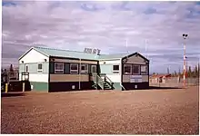
Paulatuk (Nora Aliqatchialuk Ruben) Airport
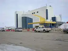
Norman Wells Airport
Inuvik (Mike Zubko) Airport
Hay River/Merlyn Carter Airport
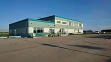
Fort Liard Airport
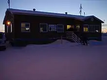
Déline Airport

The list is sorted by the name of the community served, click the sort buttons in the table header to switch listing order.

Community   Airport name   ICAO   TC LID   IATA   Coordinates  
AklavikAklavik/Freddie Carmichael AirportCYKDLAK68°13′24″N 135°00′21″W
AklavikAklavik Water AerodromeCER668°13′21″N 134°59′30″W
Behchokǫ̀Rae/Edzo AirportCRE262°46′00″N 116°05′01″W
Colville LakeColville Lake/Tommy Kochon AerodromeCYVLYCK67°02′00″N 126°05′00″W
Colville LakeColville Lake Water AerodromeCED767°03′00″N 126°06′00″W
DelineDéline AirportCYWJYWJ65°12′40″N 123°26′11″W
DelineDéline Water AerodromeCEN765°11′00″N 123°25′00″W
Diavik Diamond MineDiavik AirportCDK264°30′41″N 110°17′22″W
Ekati Diamond MineEkati AirportCYOAYOA64°41′56″N 110°36′53″W
Ford Bay, Great Bear LakeFord Bay AirportCBC266°02′15″N 124°42′54″W
Ford Bay, Great Bear LakeFord Bay Water AerodromeCEL766°02′00″N 124°41′00″W
Fort Good HopeFort Good Hope AirportCYGHYGH66°14′27″N 128°39′03″W
Fort LiardFort Liard AirportCYJFYJF60°14′08″N 123°28′12″W
Fort McPhersonFort McPherson AirportCZFMZFM67°24′27″N 134°51′38″W
Fort ProvidenceFort Providence AirportCYJP61°19′09″N 117°36′22″W
Fort RelianceFort Reliance Water AerodromeCJN862°42′00″N 109°10′00″W
Fort ResolutionFort Resolution AirportCYFRYFR61°10′51″N 113°41′23″W
Fort SimpsonFort Simpson AirportCYFSYFS61°45′37″N 121°14′11″W
Fort SimpsonFort Simpson (Great Slave No. 1) HeliportCFS261°50′18″N 121°19′35″W
Fort SimpsonFort Simpson (Great Slave No. 2) HeliportCFD861°50′12″N 121°19′30″W
Fort SimpsonFort Simpson Island AirportCET461°52′00″N 121°21′58″W
Fort SimpsonFort Simpson Island Water AerodromeCEZ761°52′00″N 121°22′00″W
Fort SmithFort Smith AirportCYSMYSM60°01′13″N 111°57′43″W
Fort SmithFort Smith (District) HeliportCEC560°00′11″N 111°54′34″W
Frank ChannelFrank Channel (Forestry) HeliportCFB262°47′10″N 115°56′45″W
Gahcho Kue Diamond Mine ProjectGahcho Kue AerodromeCGK263°26′07″N 109°08′41″W
GamètiGamètì/Rae Lakes AirportCYRAYRA64°06′58″N 117°18′35″W
Graham LakeGraham Lake (Yellow Dog Lodge) Water AerodromeCYD262°53′26″N 113°52′04″W
Great Bear LakeGreat Bear Lake AirportCFF4DAS66°42′11″N 119°43′02″W
Great Bear LakeGreat Bear Lake Water AerodromeCES966°42′30″N 119°41′00″W
Great Slave LakeTaltheilei Narrows AirportCFA762°35′50″N 111°32′28″W
Great Slave LakeTaltheilei Narrows Water AerodromeCED962°36′00″N 111°31′00″W
Hay RiverHay River/Merlyn Carter AirportCYHYYHY60°50′23″N 115°46′58″W
Hay RiverHay River (District) HeliportCET560°47′04″N 115°49′33″W
Hay RiverHay River Water AerodromeCEF860°51′07″N 115°43′50″W
InuvikInuvik (Mike Zubko) AirportCYEVYEV68°18′14″N 133°28′59″W
InuvikInuvik/Shell Lake Water AerodromeCEE368°19′00″N 133°37′00″W
Jean Marie RiverJean Marie River AirportCET961°31′21″N 120°37′30″W
Kasba LakeKasba Lake AirportCJL860°17′27″N 102°30′11″W
Kasba LakeKasba Lake Water AerodromeCJP560°17′00″N 102°31′00″W
Lutselk'eLutselk'e AirportCYLK62°25′06″N 110°40′56″W
Lutselk'eLutselk'e Water AerodromeCEB962°24′00″N 110°45′00″W
Nahanni ButteNahanni Butte AirportCBD661°01′47″N 123°23′20″W
Nahanni National Park ReserveVirginia Falls Water AerodromeCFV561°36′00″N 125°45′00″W
Namushka LodgeNamushka Lodge Water AerodromeCEP962°25′00″N 113°21′00″W
Norman WellsNorman Wells AirportCYVQYVQ65°16′54″N 126°47′54″W
Norman WellsNorman Wells Water AerodromeCEU865°15′26″N 126°41′07″W
North of Sixty Fishing CampsObre Lake/North of Sixty AirportCKV4YDW60°18′56″N 103°07′54″W
North of Sixty Fishing CampsObre Lake/North of Sixty Water AerodromeCKP860°19′13″N 103°07′36″W
PaulatukPaulatuk (Nora Aliqatchialuk Ruben) AirportCYPCYPC69°21′38″N 124°04′33″W
PaulatukPaulatuk Water AerodromeCEW869°21′00″N 124°04′00″W
Prairie CreekPrairie Creek AirportCBH461°33′53″N 124°48′54″W
Sachs HarbourSachs Harbour (David Nasogaluak Jr. Saaryuaq) AirportCYSYYSY71°59′38″N 125°14′33″W
Sambaa K'eSambaa K'e AerodromeCEU960°25′25″N 121°16′11″W
Sambaa K'eSambaa K'e Water AerodromeCEG960°26′00″N 121°15′00″W
Snap Lake Diamond MineSnap Lake AirportCSK663°35′37″N 110°54′20″W
Snare RiverSnare River AirportCEV963°26′00″N 116°11′00″W
Taltson RiverTaltson River AirportCFW560°23′39″N 111°20′50″W
TuktoyaktukTuktoyaktuk/James Gruben AirportCYUBYUB69°26′00″N 133°01′35″W
TulitaTulita AirportCZFNZFN64°54′35″N 125°34′21″W
Tundra Mine/Salamita MineTundra Mine/Salamita Mine AerodromeCTM764°04′22″N 111°09′48″W
TungstenTungsten (Cantung) AirportCBX561°57′25″N 128°12′10″W
UlukhaktokUlukhaktok/Holman AirportCYHIYHI70°45′46″N 117°48′22″W
WekweetiWekweètì AirportCYWE64°11′27″N 114°04′36″W
WhatìWhatì AirportCEM363°07′54″N 117°14′46″W
WhatìWhatì Water AerodromeCEQ863°09′00″N 117°16′00″W
WrigleyWrigley AirportCYWYYWY63°12′34″N 123°26′12″W
YellowknifeYellowknife AirportCYZFYZF62°27′46″N 114°26′25″W
YellowknifeYellowknife Water AerodromeCEN962°28′00″N 114°21′00″W

Defunct airports

Community   Airport name   ICAO   TC LID   IATA   Coordinates  
Colomac MineColomac AirportCFY864°23′06″N 115°07′29″W
Fort SmithFitzgerald (Fort Smith) Water AerodromeCEJ759°51′00″N 111°36′00″W
Fort McPhersonFort McPherson Water AerodromeCEU767°27′00″N 134°53′00″W
Fort ProvidenceFort Providence Water AerodromeCEX761°21′00″N 117°40′00″W
Hay RiverHay River/Brabant Lodge Water AerodromeCEA861°03′00″N 116°36′00″W
Nahanni ButteNahanni Butte Water AerodromeCET861°02′00″N 123°21′00″W
Prince Patrick IslandMould Bay AirportCYMDYMD76°14′21″N 119°19′07″W
Thor LakeThor Lake AerodromeCTH262°06′03″N 112°37′32″W
TsiigehtchicArctic Red River Water AerodromeCES667°27′00″N 133°45′00″W

See also

References

  1. Canada Flight Supplement. Effective 0901Z 16 July 2020 to 0901Z 10 September 2020.
  2. Nav Canada's Water Aerodrome Supplement. Effective 0901Z 26 March 2020 to 0901Z 22 April 2021.
  3. National Airports System
This article is issued from Wikipedia. The text is licensed under Creative Commons - Attribution - Sharealike. Additional terms may apply for the media files.