Listed buildings in Leeds
There are 3,300 listed buildings in Leeds.[1] Full lists can be found at Grade I listed buildings in West Yorkshire and Grade II* listed buildings in Leeds. Those buildings with articles are listed below, subdivided by ward. The grade of each building (I, II* or II) is shown after its name. Clicking on the entry number for each will show the full listing description from Historic England.
List of buildings
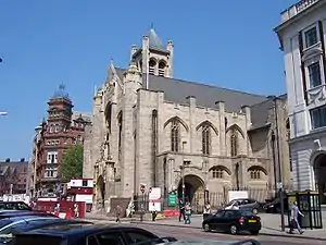
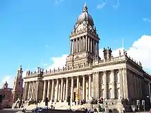
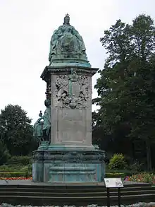
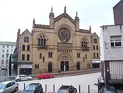
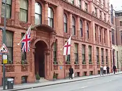
City centre (Little London and Woodhouse)
_001.jpg.webp)
.png.webp)

.jpg.webp)
.JPG.webp)

.jpg.webp)


_012.jpg.webp)
.JPG.webp)
.jpg.webp)


_(5060307425).jpg.webp)
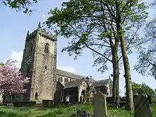
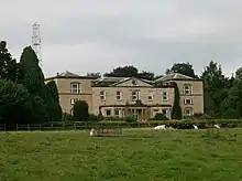
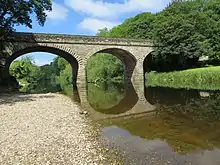
Adel & Wharfedale
| Name | Location | Type | Completed [note 1] | Date designated | Grid ref.[note 2] Geo-coordinates |
Entry number [note 3] | Image |
|---|---|---|---|---|---|---|---|
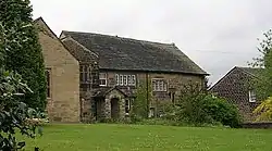
| The Nunnery (II*) | Arthington, Leeds | House | 1585 | 6 February 1952 | SE2887845151 53°54′06″N 1°33′43″W |
1262941 |  The Nunnery (II*) |
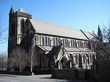
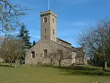
| Church of St John the Baptist (I) | Adel, Leeds | Anglican Church | 1150-1170 | 26 September 1963 | SE2746240235 53°51′27″N 1°35′02″W |
1255610 | 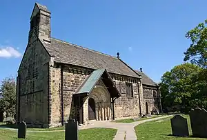 Church of St John the Baptist (I) |
| Creskeld Hall (II) | Arthington, West Yorkshire | House | 19th century | 6 February 1952 | SE2597044308 53°53′39″N 1°36′23″W |
1253367 | 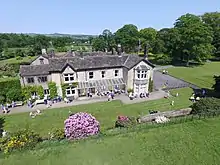 Creskeld Hall (II) |
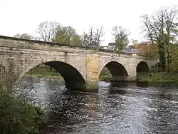
| Wharfedale Viaduct (II) | Arthington, West Yorkshire & Castley, North Yorkshire | Viaduct | 1849 | 7 April 1988 | SE2634445585 53°54′21″N 1°36′02″W |
1253368 |  Wharfedale Viaduct (II) |
Armley
| Name | Location | Type | Completed [note 1] | Date designated | Grid ref.[note 2] Geo-coordinates |
Entry number [note 3] | Image |
|---|---|---|---|---|---|---|---|
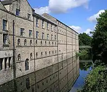
| Armley Mills Main Range (II*) | Armley, Leeds | Mill | 1797 | 19 October 1951 | SE2756434137 53°48′10″N 1°34′59″W |
1255747 | 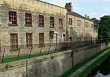 Armley Mills Main Range (II*) |
| Armley Park • Gate piers (II) • War memorial (II) • Fountain (II) • Plaque east of fountain (II) • Plaque west of fountain (II) • Mansion (II) |
Leeds | Elements of park | 11 September 1996 | SE2654833941 53°48′04″N 1°35′54″W |
 Armley Park • Gate piers (II) • War memorial (II) • Fountain (II) • Plaque east of fountain (II) • Plaque west of fountain (II) • Mansion (II) | ||
| Armley Prison (II*) | Armley, Leeds | Tower | 1847 | 5 August 1976 | SE2805533360 53°47′45″N 1°34′32″W |
1256248 1256249 | 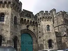 Armley Prison (II*) |
| Church of St Bartholomew (II*) | Armley, Leeds | Anglican Church | 1872-1877 | 26 September 1963 | SE2730133209 53°47′40″N 1°35′13″W |
1255697 | _geograph.jpg.webp) Church of St Bartholomew (II*) |
Beeston & Holbeck
| Name | Location | Type | Completed [note 1] | Date designated | Grid ref.[note 2] Geo-coordinates |
Entry number [note 3] | Image |
|---|---|---|---|---|---|---|---|
| Round Foundry (II*) | Holbeck, Leeds | Garage | C20 | 19 June 1986 | SE2878833213 53°47′40″N 1°33′52″W |
1255725 |  Round Foundry (II*) |
| Stank Hall (II) Stank Hall Barn (II*) |
Beeston | House | Late 15th century | 19 October 1951 | SE2852629104 53°45′27″N 1°34′08″W |
1375338 1375339 |  Stank Hall (II) Stank Hall Barn (II*) |
| Temple Works (I) | Holbeck | Fireproof Factory | 1838-1840 | 19 October 1951 | SE2952532691 53°47′23″N 1°33′12″W |
1375162 |  Temple Works (I) |
| Tower Works • Boiler House Chimney (II*) • Giotto Tower (II*) • Engine House (II) • Entrance range (II) |
Holbeck, Leeds | Chimney | 1864 | 5 August 1976 | SE2958833018 53°47′34″N 1°33′08″W |
1256246 1256247 | 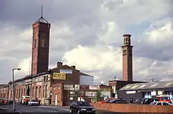 Tower Works • Boiler House Chimney (II*) • Giotto Tower (II*) • Engine House (II) • Entrance range (II) |
Burmantofts & Richmond Hill
| Name | Location | Type | Completed [note 1] | Date designated | Grid ref.[note 2] Geo-coordinates |
Entry number [note 3] | Image |
|---|---|---|---|---|---|---|---|
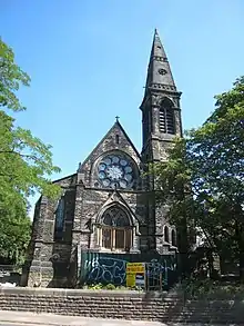
| Church of St Saviour (I) | Richmond Hill, Leeds | Anglican Church | 1842-1845 | 26 September 1963 | SE3129032944 53°47′31″N 1°31′35″W |
1375400 | |
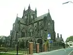
| St Mary's Convent Church (II*) | Richmond Hill, Leeds | Roman Catholic Church | 1852 | 5 August 1976 | SE3130433169 53°47′38″N 1°31′35″W |
1255558 | 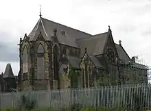 St Mary's Convent Church (II*) |
Calverley and Farsley
| Name | Location | Type | Completed [note 1] | Date designated | Grid ref.[note 2] Geo-coordinates |
Entry number [note 3] | Image |
|---|---|---|---|---|---|---|---|
| Calverley Old Hall (I) | Calverley | House | 14th - 16th century | 25 May 1966 | SE2079636877 53°49′40″N 1°41′08″W |
1265966 |
Chapel Allerton
| Name | Location | Type | Completed [note 1] | Date designated | Grid ref.[note 2] Geo-coordinates |
Entry number [note 3] | Image |
|---|---|---|---|---|---|---|---|
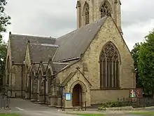
| Church of St Matthew (II*) | Chapel Allerton, Leeds | Anglican Church | 1897-1898 | 23 September 1963 | SE3030237373 53°49′54″N 1°32′28″W |
1255680 | 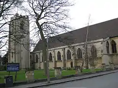 Church of St Matthew (II*) |
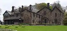
| Gledhow Grove (II) | Chapel Allerton | Mansion | 1840 | 5 August 1976 | SE3106536655 53°49′31″N 1°31′46″W |
1256047 | 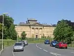 Gledhow Grove (II) |
| Northern School of Contemporary Dance (II) | Chapeltown, Leeds | Synagogue | 1932 | 22 November 1991 | SE3082835317 53°48′48″N 1°32′00″W |
1255639 | |
| Sugarwell Court (II) | Meanwood Beck | Tannery | 1866 | 5 February 1987 | SE2964535921 53°49′07″N 1°33′06″W |
1375170 |  Sugarwell Court (II) |

Garforth & Swillington
| Name | Location | Type | Completed [note 1] | Date designated | Grid ref.[note 2] Geo-coordinates |
Entry number [note 3] | Image |
|---|---|---|---|---|---|---|---|
| Church of St Mary (II*) | Swillington, Leeds | Parish Church | Late 14th century | 3 February 1967 | SE3849430469 53°46′09″N 1°25′03″W |
1247710 | 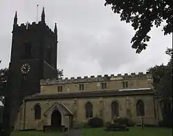 Church of St Mary (II*) |
Gipton & Harehills
| Name | Location | Type | Completed [note 1] | Date designated | Grid ref.[note 2] Geo-coordinates |
Entry number [note 3] | Image |
|---|---|---|---|---|---|---|---|
| Church of St Aidan (II*) | Harehills, Leeds | Anglican Church | 1891-1894 | 26 September 1963 | SE3165635254 53°48′45″N 1°31′15″W |
1256175 | 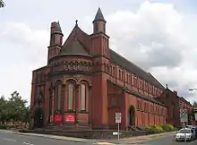 Church of St Aidan (II*) |
| Church of the Epiphany (I) | Gipton, Leeds | Anglican Church | 1936-1938 | 25 June 1993 | SE3356435305 53°48′47″N 1°29′30″W |
1255904 | |
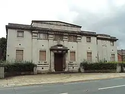
| Thackray Medical Museum (II) | Sheepscar, Leeds | Workhouse | 1858 | 22 November 1974 | SE3180034758 53°48′29″N 1°31′06″W |
1256272 |
Guiseley & Rawdon
| Name | Location | Type | Completed [note 1] | Date designated | Grid ref.[note 2] Geo-coordinates |
Entry number [note 3] | Image |
|---|---|---|---|---|---|---|---|
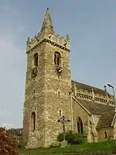
| Church of St Oswald (I) | Guiseley | Church | 11th century | 19 October 1962 | SE1941542145 53°52′31″N 1°42′22″W |
1135598 |
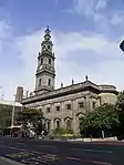
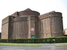
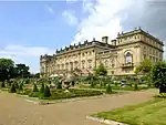
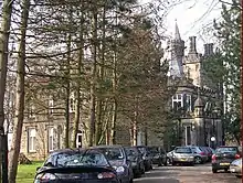
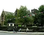
Harewood
.jpg.webp)

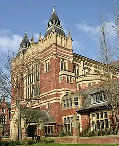
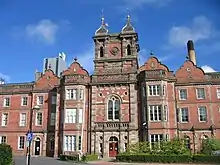
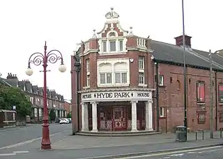
Headingley & Hyde Park
.jpg.webp)


Hunslet & Riverside
| Name | Location | Type | Completed [note 1] | Date designated | Grid ref.[note 2] Geo-coordinates |
Entry number [note 3] | Image |
|---|---|---|---|---|---|---|---|
| Alf Cooke printworks (II) | Hunslet, Leeds | Industrial building | 1881 | 5 August 1976 | SE3063432592 53°47′20″N 1°32′11″W |
1255574 | 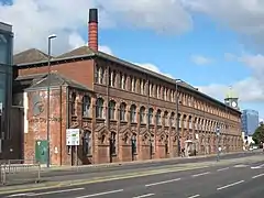 Alf Cooke printworks (II) |
| Hunslet Mill (II*) | Hunslet, Leeds | Flax Mill | c1842 (after 1838) | 10 January 1986 | SE3130432156 53°47′05″N 1°31′35″W |
1256253 | 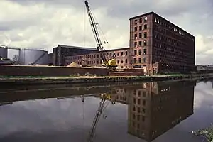 Hunslet Mill (II*) |
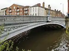
Kirkstall


.jpg.webp)
.jpg.webp)
Moortown
| Name | Location | Type | Completed [note 1] | Date designated | Grid ref.[note 2] Geo-coordinates |
Entry number [note 3] | Image |
|---|---|---|---|---|---|---|---|
| Carr Manor (II) | Leeds | House | 1881 | 26 September 1963 | SE2946137885 53°50′11″N 1°33′14″W |
1255958 |  Carr Manor (II) |
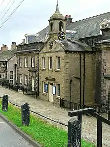
Morley
| Name | Location | Type | Completed [note 1] | Date designated | Grid ref.[note 2] Geo-coordinates |
Entry number [note 3] | Image |
|---|---|---|---|---|---|---|---|
| Morley Town Hall (I) | Morley town centre | Town Hall | 1892-95 | 12 March 1980 | SE2633527783 53°44′45″N 1°36′08″W |
1135112 | 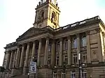 Morley Town Hall (I) |
Otley & Yeadon
| Name | Location | Type | Completed [note 1] | Date designated | Grid ref.[note 2] Geo-coordinates |
Entry number [note 3] | Image |
|---|---|---|---|---|---|---|---|
| Parish Church of All Saints (I) | Otley town centre | Church | Saxon | 30 July 1951 | SE2015745363 53°54′15″N 1°41′41″W |
1200290 |
Pudsey
| Name | Location | Type | Completed [note 1] | Date designated | Grid ref.[note 2] Geo-coordinates |
Entry number [note 3] | Image |
|---|---|---|---|---|---|---|---|
| Fulneck Moravian Church (I) | Fulneck Moravian Settlement, Pudsey | Moravian Settlement | 1746-48 | 17 May 1972 | SE2221031999 53°47′02″N 1°39′52″W |
1135096 |
Rothwell
| Name | Location | Type | Completed [note 1] | Date designated | Grid ref.[note 2] Geo-coordinates |
Entry number [note 3] | Image |
|---|---|---|---|---|---|---|---|
| Church of St John the Evangelist (II*) | Oulton | Church | 1827-9 | 5 June 1964 | SE3597228095 53°44′53″N 1°27′22″W |
1135676 |

Roundhay
| Name | Location | Type | Completed [note 1] | Date designated | Grid ref.[note 2] Geo-coordinates |
Entry number [note 3] | Image |
|---|---|---|---|---|---|---|---|
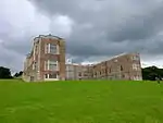
| Gledhow Hall (II*) | Gledhow, Leeds | Apartment | 1975 | 22 September 1975 | SE3156637049 53°49′44″N 1°31′19″W |
1256270 | 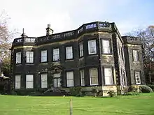 Gledhow Hall (II*) |
Temple Newsam
| Name | Location | Type | Completed [note 1] | Date designated | Grid ref.[note 2] Geo-coordinates |
Entry number [note 3] | Image |
|---|---|---|---|---|---|---|---|
| Austhorpe Hall (II*) | Austhorpe, Leeds | Country House | 1694 | 26 September 1963 | SE3698634131 53°48′08″N 1°26′24″W |
1256314 | 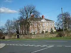 Austhorpe Hall (II*) |
| Church of St Mary (I) | Whitkirk | Anglican Church | 15th century | 26 September 1963 | SE3635033582 53°47′50″N 1°26′59″W |
1375130 | |
| Church of St Wilfrid (II*) | Halton, Leeds | Anglican Church | 1938 | 19 March 1981 | SE3470233680 53°47′54″N 1°28′29″W |
1256092 | 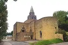 Church of St Wilfrid (II*) |
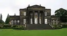
| Temple Newsam House (I) | Temple Newsam, Leeds | Country House | Early 16th century | 19 October 1951 | SE3571232108 53°47′03″N 1°27′34″W |
1255943 |
Weetwood
| Name | Location | Type | Completed [note 1] | Date designated | Grid ref.[note 2] Geo-coordinates |
Entry number [note 3] | Image |
|---|---|---|---|---|---|---|---|
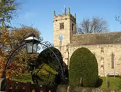
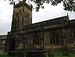
| Church of St Chad (II*) | Far Headingley, Leeds | Church | 1868 | 26 September 1963 | SE2733536897 53°49′39″N 1°35′10″W |
1375301 | 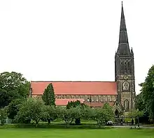 Church of St Chad (II*) |
Wetherby
.jpg.webp)

.jpg.webp)
.jpg.webp)

References
- "Listed Buildings". www.leeds.gov.uk. Leeds City Council. Retrieved 20 February 2019.
Notes
- The date given is the date used by Historic England as significant for the initial building or that of an important part in the structure's description.
- Sometimes known as OSGB36, the grid reference is based on the British national grid reference system used by the Ordnance Survey.
- The "List Entry Number" is a unique number assigned to each listed building and scheduled monument by Historic England.
| Topics | |||||||||||||
|---|---|---|---|---|---|---|---|---|---|---|---|---|---|
| Events | |||||||||||||
| Culture |
| ||||||||||||
| Politics |
| ||||||||||||
| Transport |
| ||||||||||||
| Sport | |||||||||||||
| Parks, gardens & squares | |||||||||||||
| Areas |
| ||||||||||||
| |||||||||||||
This article is issued from Wikipedia. The text is licensed under Creative Commons - Attribution - Sharealike. Additional terms may apply for the media files.