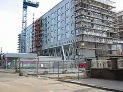
London Riverside
The London Riverside is a redevelopment area on the north side of the River Thames in East London, England and part of the larger Thames Gateway redevelopment zone. The London Riverside area forms part of the Green Enterprise District, a project to create a low-carbon economy region in Greater London. Land available for redevelopment is owned by GLA Land and Property. From 2004 to 2013 the redevelopment of London Riverside and the Lower Lea Valley was the responsibility of the London Thames Gateway Development Corporation. There is also a London Riverside business improvement district which covers a smaller area.

Geography
The area of the London Riverside development stretches from Beckton in the London Borough of Newham in the west to Wennington in the London Borough of Havering in the east.[1] The development spans the River Thames adjacent sections of these boroughs and the London Borough of Barking and Dagenham. Much of the development will re-use brownfield industrial land on the river. The area totals 35 km². It is expected that by 2016 the London Riverside will provide 20,000 new homes and 25,000 jobs.
The boundaries of the London Riverside have expanded somewhat over time. The original area was bounded by the River Thames to the south and the former A13 road (now the A1306) to the north and stretched only as far west as Barking Reach. It has since expanded to include East Beckton and Barking Town. A smaller area constitutes the London Riverside business improvement district.
Planned developments
Since October 2005, the London Thames Gateway Development Corporation has taken over planning functions from the local councils for this area. The redevelopment plans include:
- East London Transit – a transport scheme connecting the area to Barking and Ilford[2]
- In Barking and Dagenham:
- Barking Town – £500 million redevelopment, planned to be strategic centre of London Riverside development
- Barking Riverside – 1.8 km², new community with 10,800 new homes, facilities and DLR extension[3]
- Creekmouth
- Dagenham Dock – 1.33 km², environmentally sustainable business cluster called London Sustainable Industries Park
- South Dagenham – mixed use site
- In Havering:
- Beam Reach – area for intensification of manufacturing companies, including plans for a new railway station
- Rainham, South Hornchurch and Orchard Village
- Wildspace, also known as the London Riverside Conservation Park, – 6.4 km², a conservation, recreation and amenity zone at Rainham[4]
References
- "Ideas for London Riverside" (PDF). The London Borough of Havering. Archived from the original (PDF) on 6 April 2008. Retrieved 20 March 2008.
- Transport for London – East London Transit
- DLR extension for Barking Riverside. Building Design, 17 March 2006 Issue 1713
- 24dash.com Archived 26 September 2007 at the Wayback Machine – 'World-class' riverside conservation park for Thames Gateway
External links
- London Thames Gateway Development Corporation – London Riverside
- "London Riverside". The London Borough of Barking and Dagenham. Archived from the original on 7 February 2008. Retrieved 20 March 2008.
- BBC London – London Riverside
- blitzandblight.com / Barking Riverside