Mahesail
Mahesail is a village and a gram panchayat in Suti II CD Block in Jangipur subdivision of Murshidabad district in the state of West Bengal, India.
Mahesail | |
|---|---|
Village | |
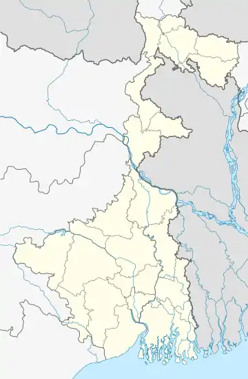 Mahesail Location in West Bengal, India  Mahesail Mahesail (India) | |
| Coordinates: 24.5893°N 88.0092°E | |
| Country | |
| State | West Bengal |
| District | Murshidabad |
| Elevation | 26 m (85 ft) |
| Population (2011) | |
| • Total | 16,178 |
| Languages | |
| • Official | Bengali, English |
| Time zone | UTC+5:30 (IST) |
| PIN | 742201 (Aurangabad) |
| Telephone/STD code | 03485 |
| Lok Sabha constituency | Jangipur |
| Vidhan Sabha constituency | Suti |
| Website | murshidabad |
Demographics
As per the 2011 Census of India, Mahesail had a total population of 16,178, of which 8,233 (51%) were males and 7,945 (49%) were females. Population below 6 years was 3,006. The total number of literates in Mahesail was 6,648 (50.47% of the population over 6 years).[1]
Healthcare
Mahesail Rural Hospital functions with 30 beds.[3]
References
- "C.D. Block Wise Primary Census Abstract Data(PCA)". West Bengal – District-wise CD Blocks. Registrar General and Census Commissioner, India. Retrieved 9 September 2017.
- Google maps
- "Health & Family Welfare Department". Health Statistics. Government of West Bengal. Retrieved 19 September 2017.
Cities, towns and locations in Murshidabad District | |||||||||||
|---|---|---|---|---|---|---|---|---|---|---|---|
| Cities, municipal and census towns |
| ||||||||||
| Locations other than cities and towns |
| ||||||||||
| Neighbourhoods | |||||||||||
| Related topics |
| ||||||||||
This article is issued from Wikipedia. The text is licensed under Creative Commons - Attribution - Sharealike. Additional terms may apply for the media files.