Malá Úpa
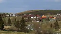
Malá Úpa (German: Kleinaupa) is a village and municipality in the Czech Republic located in eastern part of the Krkonoše Mountains.
Malá Úpa | |
|---|---|
Village | |
 | |
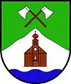
 Flag  Coat of arms | |
 Malá Úpa Location in the Czech Republic | |
| Coordinates: 50°44′40″N 15°49′11″E | |
| Country | Czech Republic |
| Region | Hradec Králové |
| District | Trutnov |
| Little District | Trutnov |
| Founded | 16th century |
| Government | |
| • Mayor | Lubomír Mocl |
| Area | |
| • Total | 26.65 km2 (10.29 sq mi) |
| Elevation | 1,041 m (3,415 ft) |
| Population (2019) | |
| • Total | 139[1] |
| Time zone | UTC+1 (CET) |
| • Summer (DST) | UTC+2 (CEST) |
| Postal code | 542 27 |
| Website | malaupa.cz |
References
- "Počet Obyvatel v Obcích - Population of Municipalities" (in Czech). Czech Statistical Office. p. 70. Retrieved 28 February 2020.
![]() Media related to Malá Úpa at Wikimedia Commons
Media related to Malá Úpa at Wikimedia Commons
This article is issued from Wikipedia. The text is licensed under Creative Commons - Attribution - Sharealike. Additional terms may apply for the media files.