Mayo Creek (Hyco River tributary)
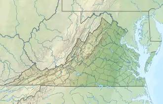
Mayo Creek is a 20.62 mi (33.18 km) long 4th order tributary to the Hyco River in Halifax County, Virginia.
| Mayo Creek Tributary to Hyco River | |
|---|---|
 Location of Mayo Creek mouth  Mayo Creek (Hyco River tributary) (the United States) | |
| Location | |
| Country | United States |
| State | Virginia North Carolina |
| County | Halifax (VA) Person (NC) |
| Physical characteristics | |
| Source | Mill Creek divide |
| • location | about 1.5 miles north of Allensville, North Carolina |
| • coordinates | 36°23′41″N 078°55′44″W[1] |
| • elevation | 660 ft (200 m)[2] |
| Mouth | Hyco River |
• location | about 1 mile east-northeast of Mayo, North Carolina |
• coordinates | 36°35′18″N 078°53′16″W[1] |
• elevation | 322 ft (98 m)[2] |
| Length | 20.62 mi (33.18 km)[3] |
| Basin size | 60.95 square miles (157.9 km2)[4] |
| Discharge | |
| • location | Hyco River |
| • average | 48.13 cu ft/s (1.363 m3/s) at mouth with Hyco River[4] |
| Basin features | |
| Progression | generally north |
| River system | Roanoke River |
| Tributaries | |
| • left | Mill Creek Crutchfield Branch |
| • right | Donaldson Creek |
| Waterbodies | Mayo Reservoir |
| Bridges | Cedar Grove Church Road, Jack Brann Road, Allensville Road, Parham Road, Lawson Chapel Church Road, NC 49, Bowmantown Road, Mayo Lake Road, VA 96 |
Variant names
According to the Geographic Names Information System, it has also been known historically as:[1]
- Maho Creek
- Mayho Creek
- Mayo River
- Sugar Tree Creek
Course
Mayo Creek rises about 1.5 miles west of Allensville, North Carolina, and then flows generally north into Halifax County, Virginia to join the Hyco River about 1 mile north-northeast of Mayo.[2]
Watershed
Mayo Creek drains 60.95 square miles (157.9 km2) of area, receives about 46.3 in/year of precipitation, has a wetness index of 448.38, and is about 55% forested.[4]
References
- "GNIS Detail - Mayo Creek". geonames.usgs.gov. US Geological Survey. Retrieved 3 November 2020.
- "Get Maps". USGS Topoview. US Geological Survey. Retrieved 3 November 2020.
- "ArcGIS Web Application". epa.maps.arcgis.com. US EPA. Retrieved 3 November 2020.
- "Mayo Creek Watershed Report". US EPA Geoviewer. US EPA. Retrieved 3 November 2020.
This article is issued from Wikipedia. The text is licensed under Creative Commons - Attribution - Sharealike. Additional terms may apply for the media files.