Mesa del Caballo, Arizona
Mesa del Caballo is a census-designated place (CDP) in Gila County, Arizona, United States. The population was 765 at the 2010 census.[3]
Mesa del Caballo, Arizona | |
|---|---|
 Mesa del Caballo  Mesa del Caballo | |
| Coordinates: 34°17′8″N 111°17′39″W | |
| Country | United States |
| State | Arizona |
| County | Gila |
| Area | |
| • Total | 0.32 sq mi (0.82 km2) |
| • Land | 0.32 sq mi (0.82 km2) |
| • Water | 0.00 sq mi (0.00 km2) |
| Elevation | 5,170 ft (1,580 m) |
| Population (2010) | |
| • Total | 439,041 |
| • Estimate (2016)[2] | N/A |
| Time zone | UTC-7 (MST (no DST)) |
| Area code(s) | 928 |
| FIPS code | 04-46005 |
| GNIS feature ID | 0040822 |
Geography
The CDP is located in northern Gila County atop Houston Mesa, a low ridge north of Payson. The center of Payson is 5 miles (8 km) south via Houston Mesa Road and Arizona State Route 87. According to the United States Census Bureau, the CDP has a total area of 0.32 square miles (0.82 km2), all of it land.[3]
Transportation
The Payson Senior Center operates the Beeline Bus, which provides local bus service between Payson and Mesa del Caballo.[4]
References
- "2016 U.S. Gazetteer Files". United States Census Bureau. Retrieved Jul 18, 2017.
- "Population and Housing Unit Estimates". Retrieved June 9, 2017.
- "Geographic Identifiers: 2010 Demographic Profile Data (G001): Mesa del Caballo CDP, Arizona". U.S. Census Bureau, American Factfinder. Retrieved November 1, 2016.
- "Routes-Map". BEELINE BUS. Retrieved 2020-01-27.
- "Census of Population and Housing". Census.gov. Retrieved June 4, 2016.
Municipalities and communities of Gila County, Arizona, United States | ||
|---|---|---|
| City | 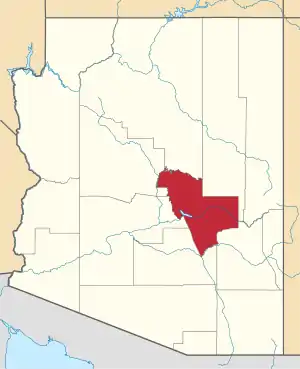 | |
| Towns | ||
| CDPs |
| |
| Populated places | ||
| Indian reservations | ||
| Ghost towns | ||
| Footnotes | ‡This populated place also has portions in an adjacent county or counties | |
| ||
This article is issued from Wikipedia. The text is licensed under Creative Commons - Attribution - Sharealike. Additional terms may apply for the media files.