Nalitabari Upazila
Nalitabari (Bengali: নালিতাবাড়ি) is an upazila of Sherpur District[1] in the Division of Mymensingh, Bangladesh.
Nalitabari
নালিতাবাড়ী | |
|---|---|
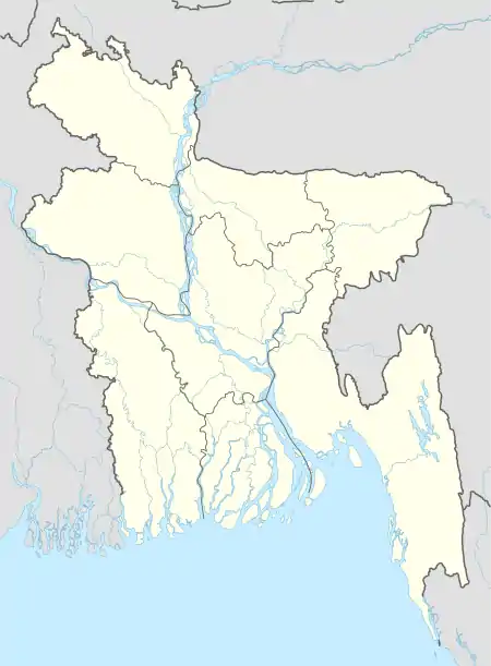 Nalitabari Location in Bangladesh | |
| Coordinates: 25°5′N 90°11.7′E | |
| Country | |
| Division | Mymensingh Division |
| District | Sherpur District |
| Area | |
| • Total | 327.61 km2 (126.49 sq mi) |
| Population (1991) | |
| • Total | 226,332 |
| • Density | 690/km2 (1,800/sq mi) |
| Time zone | UTC+6 (BST) |
| Website | nalitabari |
Geography
Nalitabari is located at 25.0833°N 90.1954°E. It has 42698 households and total area 327.61 km2. Taragonj bajar is the main populated place. All hotels and shops are found here also.
Demographics
As of the 1991 Bangladesh census, Nalitabari has a population of 226332. Males constitute 50.75% of the population, and females 49.25%. This Upazila's eighteen up population is 103043. Nalitabari has an average literacy rate of 19.5% (7+ years), and the national average of 32.4% literate.[2]
Administration
Nalitabari Upazila is divided into Nalitabari Municipality and 12 union parishads: Bagber, Juganiya, Kakorkandhi, Koloshpar, Morichpuran, Nalitabari, Nayabil, Nonni, Puragau, Rajnogor, Ramchondrokura, and Rupnarayankura. The union parishads are subdivided into 108 mauzas and 140 villages.[3]
Nalitabari Municipality is subdivided into 9 wards and 17 mahallas.[3]
References
- Joti Poddar (2012), "Nalitabari Upazila", in Sirajul Islam and Ahmed A. Jamal (ed.), Banglapedia: National Encyclopedia of Bangladesh (Second ed.), Asiatic Society of Bangladesh
- "Population Census Wing, BBS". Archived from the original on 2005-03-27. Retrieved November 10, 2006.
- "District Statistics 2011: Sherpur" (PDF). Bangladesh Bureau of Statistics. Archived from the original (PDF) on 13 November 2014. Retrieved 14 July 2014.
| Upazila/Thana: | ||
|---|---|---|
Headquarters: Mymensingh | ||
| Jamalpur District | 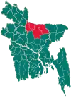 | |
| Mymensingh District | ||
| Netrokona District | ||
| Sherpur District | ||