National Register of Historic Places listings in DeKalb County, Illinois
This is a list of the National Register of Historic Places listings in DeKalb County, Illinois.

Location of DeKalb County in Illinois
This is intended to be a complete list of the properties and districts on the National Register of Historic Places in DeKalb County, Illinois, United States. Latitude and longitude coordinates are provided for many National Register properties and districts; these locations may be seen together in a map.[1]
There are 16 properties and districts listed on the National Register in the county.
- This National Park Service list is complete through NPS recent listings posted January 29, 2021.[2]
Current listings
| [3] | Name on the Register | Image | Date listed[4] | Location | City or town | Description |
|---|---|---|---|---|---|---|
| 1 | Ashelford Hall | 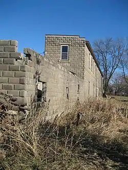 Ashelford Hall |
August 4, 1995 (#95000990) |
566 Eychaner Rd. 42°02′00″N 88°56′09″W |
Esmond | |
| 2 | Adolphus W. Brower House | 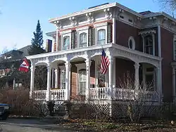 Adolphus W. Brower House |
February 14, 1979 (#79003160) |
705 DeKalb Ave. 41°59′11″N 88°41′38″W |
Sycamore | |
| 3 | Chicago and Northwestern Depot | 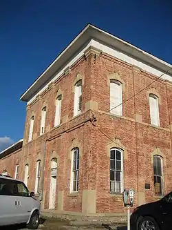 Chicago and Northwestern Depot |
December 8, 1978 (#78003101) |
Sacramento and DeKalb Sts. 41°59′16″N 88°41′24″W |
Sycamore | |
| 4 | Egyptian Theatre | 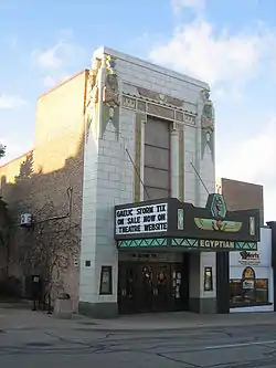 Egyptian Theatre |
December 1, 1978 (#78003100) |
135 N. 2nd St. 41°55′52″N 88°45′09″W |
DeKalb | |
| 5 | Ellwood Mansion | 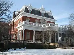 Ellwood Mansion |
June 13, 1975 (#75002075) |
509 N. 1st St. 41°56′06″N 88°45′08″W |
DeKalb | |
| 6 | Elmwood Cemetery Gates | 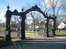 Elmwood Cemetery Gates |
November 28, 1978 (#78003102) |
S. Cross and Charles Sts. 41°58′57″N 88°41′52″W |
Sycamore | |
| 7 | Joseph F. Glidden House | 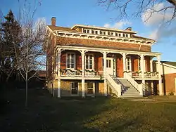 Joseph F. Glidden House |
October 25, 1973 (#73002159) |
917 W. Lincoln Hwy. 41°56′26″N 88°46′13″W |
DeKalb | |
| 8 | George H. Gurler House | 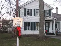 George H. Gurler House |
March 21, 1979 (#79003158) |
205 Pine St. 41°55′53″N 88°46′13″W |
DeKalb | |
| 9 | Haish Memorial Library | 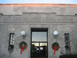 Haish Memorial Library |
October 9, 1980 (#80004319) |
309 Oak St. 41°55′56″N 88°45′00″W |
DeKalb | |
| 10 | William W. Marsh House | 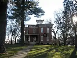 William W. Marsh House |
December 22, 1978 (#78003103) |
740 W. State St. 41°59′23″N 88°41′48″W |
Sycamore | |
| 11 | Nisbet Homestead Farm | 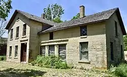 Nisbet Homestead Farm |
May 31, 1984 (#84001069) |
Suydam Rd. 41°40′15″N 88°51′47″W |
Earlville | |
| 12 | North Grove School | 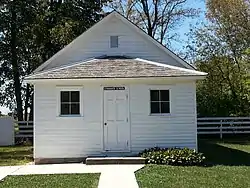 North Grove School |
February 15, 2012 (#12000026) |
26475 Brickville Rd. 42°01′13″N 88°42′17″W |
Sycamore | |
| 13 | Rollo Congregational United Church of Christ | August 27, 2019 (#100004311) |
2471 Weddell St. 41°40′20″N 88°53′14″W |
Rollo | ||
| 14 | Sandwich City Hall | 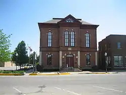 Sandwich City Hall |
December 6, 1979 (#79003159) |
144 E. Railroad St. 41°38′41″N 88°37′12″W |
Sandwich | |
| 15 | Sycamore Historic District | 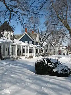 Sycamore Historic District |
May 2, 1978 (#78003104) |
Irregular pattern along Main and Somonauk Sts. 41°59′06″N 88°41′12″W |
Sycamore | |
| 16 | von KleinSmid Mansion | 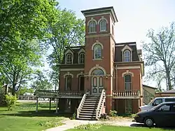 von KleinSmid Mansion |
May 9, 1985 (#85000979) |
218 W. Center 41°38′42″N 88°37′30″W |
Sandwich |
Former listing
| [3] | Name on the Register | Image | Date listed | Date removed | Location | City or town | Summary |
|---|---|---|---|---|---|---|---|
| 1 | US Post Office-DeKalb | January 30, 1995 (#94001596) | December 8, 1996 | 100 W. Lincoln Highway 41°55′50″N 88°45′16″W |
DeKalb | Demolished in June 1995.[5] |
See also
| Wikimedia Commons has media related to National Register of Historic Places in DeKalb County, Illinois. |
References
- The latitude and longitude information provided in this table was derived originally from the National Register Information System, which has been found to be fairly accurate for about 99% of listings. Some locations in this table may have been corrected to current GPS standards.
- "National Register of Historic Places: Weekly List Actions". National Park Service, United States Department of the Interior. Retrieved on January 29, 2021.
- Numbers represent an alphabetical ordering by significant words. Various colorings, defined here, differentiate National Historic Landmarks and historic districts from other NRHP buildings, structures, sites or objects.
- The eight-digit number below each date is the number assigned to each location in the National Register Information System database, which can be viewed by clicking the number.
- http://www.ulib.niu.edu/reghist/RC%2021.pdf
| Topics | |
|---|---|
| Lists by state |
|
| Lists by insular areas | |
| Lists by associated state | |
| Other areas | |
| Related | |
| |
This article is issued from Wikipedia. The text is licensed under Creative Commons - Attribution - Sharealike. Additional terms may apply for the media files.