National Register of Historic Places listings in Mineral County, Montana
This is a list of the National Register of Historic Places listings in Mineral County, Montana.
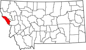
Location of Mineral County in Montana
This is intended to be a complete list of the properties and districts on the National Register of Historic Places in Mineral County, Montana, United States. The locations of National Register properties and districts for which the latitude and longitude coordinates are included below, may be seen in a map.[1]
There are 16 properties and districts listed on the National Register in the county.
- This National Park Service list is complete through NPS recent listings posted January 29, 2021.[2]
Current listings
| [3] | Name on the Register | Image | Date listed[4] | Location | City or town | Description |
|---|---|---|---|---|---|---|
| 1 | Alberton School | .jpg.webp) Alberton School |
January 13, 1997 (#96001599) |
216 Railroad Street 47°00′17″N 114°28′50″W |
Alberton | |
| 2 | Bestwick's Market | .jpg.webp) Bestwick's Market |
January 13, 1997 (#96001600) |
Railroad Street east of its junction with Interstate 90 47°00′13″N 114°28′36″W |
Alberton | |
| 3 | Brinks House | 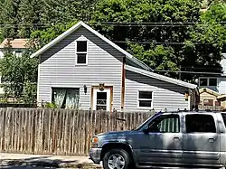 Brinks House |
January 13, 1997 (#96001601) |
416 Railroad Street 47°00′14″N 114°28′42″W |
Alberton | |
| 4 | Chadwick House | 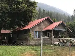 Chadwick House |
January 13, 1997 (#96001602) |
320 Railroad Street 47°00′15″N 114°28′45″W |
Alberton | |
| 5 | Chicago, Milwaukee, St. Paul and Pacific Railroad Company Historic District | 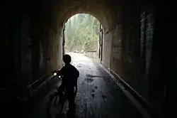 Chicago, Milwaukee, St. Paul and Pacific Railroad Company Historic District |
October 26, 2000 (#00001269) |
Idaho Panhandle National Forest 47°21′46″N 115°39′30″W |
St. Regis | |
| 6 | De Borgia Schoolhouse | .jpg.webp) De Borgia Schoolhouse |
December 27, 1979 (#79001405) |
Thompson Falls De Borgia Rd. 47°22′50″N 115°20′49″W |
De Borgia | |
| 7 | Gildersleeve Mine | 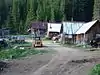 Gildersleeve Mine |
June 26, 2002 (#02000723) |
Lolo National Forest 47°02′09″N 115°02′04″W |
Superior | |
| 8 | Methodist Church of Alberton |  Methodist Church of Alberton |
January 13, 1997 (#96001604) |
802 Railroad Street 47°00′10″N 114°28′26″W |
Alberton | |
| 9 | Railroad Depot | 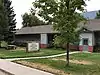 Railroad Depot |
January 13, 1997 (#96001603) |
701 Railroad Street 47°00′10″N 114°28′30″W |
Alberton | |
| 10 | Natural Pier Bridge | .jpg.webp) Natural Pier Bridge |
January 4, 2010 (#09001182) |
Milepost 1 on S. Frontage Rd. 47°00′50″N 114°30′28″W |
Alberton | |
| 11 | Point of Rocks Historic Transportation Corridor | September 4, 2009 (#09000683) |
2 miles (3.2 km) west of Alberton 47°00′42″N 114°32′52″W |
Alberton | ||
| 12 | Savenac Nursery Historic District |  Savenac Nursery Historic District |
August 16, 1999 (#99000988) |
Interstate 90 south of Haugan 47°23′07″N 115°23′47″W |
Haugan | |
| 13 | Scenic Bridge | .jpg.webp) Scenic Bridge |
January 4, 2010 (#09001183) |
Milepost 0 on Old U.S. Route 10 W. 47°01′12″N 114°39′27″W |
Tarkio | |
| 14 | Superior School | 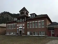 Superior School |
March 21, 1997 (#97000253) |
River Road, approximately 0.25 miles (0.40 km) north of Interstate 90 47°11′42″N 114°53′25″W |
Superior | School built during 1915-16, with vernacular and Colonial Revival style. |
| 15 | Thorn House | January 13, 1997 (#96001605) |
140 2nd Street 47°00′19″N 114°28′54″W |
Alberton | ||
| 16 | Wilson House | 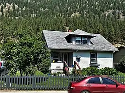 Wilson House |
January 13, 1997 (#96001606) |
114 Adams Street 47°00′06″N 114°28′14″W |
Alberton |
See also
| Wikimedia Commons has media related to National Register of Historic Places in Mineral County, Montana. |
References
- The latitude and longitude information provided in this table was derived originally from the National Register Information System, which has been found to be fairly accurate for about 99% of listings. Some locations in this table may have been corrected to current GPS standards.
- "National Register of Historic Places: Weekly List Actions". National Park Service, United States Department of the Interior. Retrieved on January 29, 2021.
- Numbers represent an alphabetical ordering by significant words. Various colorings, defined here, differentiate National Historic Landmarks and historic districts from other NRHP buildings, structures, sites or objects.
- The eight-digit number below each date is the number assigned to each location in the National Register Information System database, which can be viewed by clicking the number.
| Topics | |
|---|---|
| Lists by state |
|
| Lists by insular areas | |
| Lists by associated state | |
| Other areas | |
| Related | |
| |
Municipalities and communities of Mineral County, Montana, United States | ||
|---|---|---|
| Towns | Mineral County map | |
| CDPs | ||
| Unincorporated communities | ||
| ||
This article is issued from Wikipedia. The text is licensed under Creative Commons - Attribution - Sharealike. Additional terms may apply for the media files.