Nebraska Highway 23
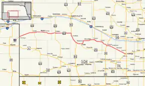
Nebraska Highway 23 is a 159.91-mile (257.35 km) highway in southwestern Nebraska, United States. Its western terminus is on the Colorado border at Venango, where the highway continues west as Colorado State Highway 23. The eastern terminus of NE 23 is at Holdrege at an intersection with U.S. Routes 6 and 34.
| ||||
|---|---|---|---|---|
 Nebraska Highway 23 highlighted in red | ||||
| Route information | ||||
| Maintained by NDOT | ||||
| Length | 159.91 mi[1] (257.35 km) | |||
| Major junctions | ||||
| West end | ||||
| East end | ||||
| Location | ||||
| Counties | Perkins, Lincoln, Frontier, Dawson, Gosper, Phelps | |||
| Highway system | ||||
| ||||
Route description
Nebraska Highway 23 begins at the Colorado border at Venango. It passes northeasterly through farmland towards Grant, where it meets Nebraska Highway 61. After a brief concurrency, NE 23 and NE 61 separate and NE 23 continues east. Near Wallace, NE 23 meets Nebraska Highway 25. It continues east and near Wellfleet, meets U.S. Route 83. NE 23 turns south with US 83 and continues south until near Maywood, where they separate. After going east through Maywood, NE 23 continues east and meets Nebraska Highway 18 at Curtis. After a brief segment which runs northward, it passes Moorefield and continues on through Farnam. Near Farnam, NE 23 meets Nebraska Highway 47 and turns southeasterly. It passes through Eustis and meets Nebraska Highway 21. It continues southeasterly and meets U.S. Highway 283 in Elwood. It continues in a southeastern direction through Smithfield, Bertrand, and Loomis and ends at an intersection with US Routes 6 and 34 at the western end of Holdrege.[1][2]
Major intersections
| County | Location | mi[1] | km | Destinations | Notes | |||
|---|---|---|---|---|---|---|---|---|
| Perkins | Venango | 0.00 | 0.00 | Western terminus | ||||
| Grant | 18.29 | 29.43 | Western end of N‑61 concurrency | |||||
| 21.38 | 34.41 | Eastern end of N‑61 concurrency | ||||||
| Lincoln | Wallace | 49.25 | 79.26 | |||||
| | 70.41 | 113.31 | Western end of US 83 concurrency | |||||
| Frontier | Maywood | 84.06 | 135.28 | Eastern end of US 83 concurrency | ||||
| Curtis | 91.55 | 147.34 | ||||||
| Lincoln |
No major junctions | |||||||
| Dawson | Farnam | 113.11 | 182.03 | |||||
| Frontier | Eustis | 122.77 | 197.58 | |||||
| Gosper | Elwood | 132.53 | 213.29 | |||||
| Phelps | Holdrege | 159.91 | 257.35 | Eastern terminus | ||||
1.000 mi = 1.609 km; 1.000 km = 0.621 mi
| ||||||||
See also
References
- "Nebraska Highway Reference Log Book" (PDF). Nebraska Department of Roads. 2015. pp. 79–81. Retrieved January 7, 2017.
- Google (2010-11-03). "overview of Nebraska Highway 23" (Map). Google Maps. Google. Retrieved 2010-11-03.
External links
| Wikimedia Commons has media related to Nebraska Highway 23. |
