Nikolskoye, Kamchatka Krai
Nikolskoye (Russian: Нико́льское, Aleut: Никоольскиҳ) is a rural locality (a selo) and the administrative center of Aleutsky District of Kamchatka Krai, Russia,[1] located on Bering Island in the Commander Islands chain. Population: 676 (2010 Census);[2] 808 (2002 Census);[6] 1,356 (1989 Census).[7] It is the only remaining inhabited locality in the district.
Nikolskoye
Никольское | |
|---|---|
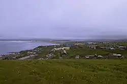
 View of Nikolskoye | |
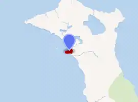
Location of Nikolskoye 
| |
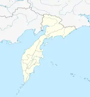
 Nikolskoye Location of Nikolskoye  Nikolskoye Nikolskoye (Kamchatka Krai) | |
| Coordinates: 55°12′N 165°59′E | |
| Country | Russia |
| Federal subject | Kamchatka Krai[1] |
| Administrative district | Aleutsky District[1] |
| Founded | 1826 |
| Population | |
| • Total | 676 |
| • Capital of | Aleutsky District[1] |
| • Municipal district | Aleutsky Municipal District[3] |
| • Rural settlement | Nikolskoye Rural Settlement[3] |
| Time zone | UTC+12 (MSK+9 |
| Postal code(s)[5] | 684500 |
| Dialing code(s) | +7 41547 |
| OKTMO ID | 30601401101 |
History
It was founded in 1826 by Aleut (Unangan) settlers from Atka Island in the Aleutian Islands who were brought there by Russian fur traders. While engaging to some extent in the traditional pursuits of whaling and sealing with harpoons and spears, they were primarily employed in the harvest of fur-bearing animals, notably sea otters and fur seals.
Demographics
Currently, the population is divided roughly evenly between Russians and Aleuts, but mixing between the two is common.
Economy
The current economy is based primarily on fishing, especially the harvest of salmon caviar, mushroom gathering, and government services and subsidies. Despite living in an environment that is extremely rich with wildlife, the inhabitants of the island are very restricted in the use of these resources since almost the entire island is a nature preserve. In the years following the dissolution of the Soviet Union, poaching of fish, Arctic fox, reindeer (which were introduced to the island), and migratory waterfowl was widespread, but there is virtually no harvest of marine mammals due to strict protection.
Transportation
Nikolskoye is served by the Nikolskoye Airport.
Climate
Like the rest of Kamchatka Krai, Nikolskoye has a subarctic climate (Dfc), though the ocean makes temperatures much less extreme than interior Siberia, with winters being about four degrees milder than in Petropavlovsk-Kamchatsky. The transition to the subpolar oceanic climate of southwest Alaska to the east is very apparent, especially in the extremely low sunshine hours, which average only around 2.8 per day due to the consistent fog from the Aleutian Low and the Oyashio Current on its western flank. Extreme temperatures have ranged from −23.5 to 21.4 °C (−10.3 to 70.5 °F), with the latter occurring as recently as June 30, 1938.
| Climate data for Bering Island (1899-2018) (Climate ID:32618) | |||||||||||||
|---|---|---|---|---|---|---|---|---|---|---|---|---|---|
| Month | Jan | Feb | Mar | Apr | May | Jun | Jul | Aug | Sep | Oct | Nov | Dec | Year |
| Record high °C (°F) | 5.4 (41.7) |
5.1 (41.2) |
8.8 (47.8) |
10.2 (50.4) |
13.6 (56.5) |
21.5 (70.7) |
21.4 (70.5) |
21.0 (69.8) |
18.5 (65.3) |
12.7 (54.9) |
9.2 (48.6) |
7.4 (45.3) |
21.5 (70.7) |
| Mean maximum °C (°F) | 2.4 (36.3) |
2.0 (35.6) |
3.1 (37.6) |
4.7 (40.5) |
8.7 (47.7) |
12.6 (54.7) |
17.0 (62.6) |
17.1 (62.8) |
14.9 (58.8) |
10.8 (51.4) |
6.6 (43.9) |
3.4 (38.1) |
18.3 (64.9) |
| Average high °C (°F) | −1.7 (28.9) |
−1.7 (28.9) |
−0.4 (31.3) |
1.3 (34.3) |
4.7 (40.5) |
7.7 (45.9) |
11.3 (52.3) |
13.3 (55.9) |
11.8 (53.2) |
7.2 (45.0) |
2.8 (37.0) |
−0.5 (31.1) |
4.6 (40.4) |
| Daily mean °C (°F) | −3.2 (26.2) |
−3.4 (25.9) |
−1.9 (28.6) |
−0.1 (31.8) |
2.9 (37.2) |
5.9 (42.6) |
9.6 (49.3) |
11.7 (53.1) |
10.3 (50.5) |
5.7 (42.3) |
1.4 (34.5) |
−2 (28) |
3.1 (37.5) |
| Average low °C (°F) | −5.3 (22.5) |
−5.4 (22.3) |
−3.8 (25.2) |
−1.6 (29.1) |
1.5 (34.7) |
4.6 (40.3) |
8.3 (46.9) |
10.4 (50.7) |
8.7 (47.7) |
3.9 (39.0) |
−0.4 (31.3) |
−3.9 (25.0) |
1.4 (34.6) |
| Mean minimum °C (°F) | −11.5 (11.3) |
−11.9 (10.6) |
−10.2 (13.6) |
−5.9 (21.4) |
−1.2 (29.8) |
1.7 (35.1) |
5.5 (41.9) |
7.0 (44.6) |
4.2 (39.6) |
−0.7 (30.7) |
−5.7 (21.7) |
−9.2 (15.4) |
−13.0 (8.6) |
| Record low °C (°F) | −21 (−6) |
−23.5 (−10.3) |
−21.9 (−7.4) |
−13.9 (7.0) |
−9.6 (14.7) |
−2.3 (27.9) |
−0.5 (31.1) |
−0.1 (31.8) |
−2.9 (26.8) |
−8.5 (16.7) |
−15.4 (4.3) |
−19.9 (−3.8) |
−23.5 (−10.3) |
| Average precipitation mm (inches) | 81.3 (3.20) |
53.9 (2.12) |
50.8 (2.00) |
52.6 (2.07) |
79.0 (3.11) |
50.3 (1.98) |
54.9 (2.16) |
96.3 (3.79) |
67.3 (2.65) |
84.3 (3.32) |
69.1 (2.72) |
67.8 (2.67) |
807.6 (31.79) |
| Average precipitation days (≥ 1.0 mm) | 13.8 | 12.7 | 11.4 | 9.6 | 7.7 | 6.2 | 7.6 | 10.4 | 10.8 | 14.2 | 15.0 | 15.1 | 134.5 |
| Mean monthly sunshine hours | 31.0 | 56.5 | 99.2 | 120.0 | 102.3 | 84.0 | 74.4 | 108.5 | 123.0 | 111.6 | 54.0 | 27.9 | 992.4 |
| Source 1: Sistema de Clasificación Bioclimática Mundial[8] | |||||||||||||
| Source 2: allmetsat.com (sunshine only)[9] | |||||||||||||
Religion
The first church of Nikolskoye was dedicated to Saint Nicholas and Saint Innocent of Irkutsk, the Enlightener of Siberia. It was built in 1799 by the Russian-American Company.[10] The second building was dedicated in the 1890s and closed after the October Revolution. It was then used as a local club, then a hostel. The building burned down in 1983. A new church is planned for the center of the village, a location not subject to tsunamis. It will be built in Petropavlovsk-Kamchatsky, dismantled, shipped to the island and reassembled.
See also
- Preobrazhenskoye, Kamchatka Oblast, a village which existed on Medny Island
References
Notes
- Law #46
- Russian Federal State Statistics Service (2011). "Всероссийская перепись населения 2010 года. Том 1" [2010 All-Russian Population Census, vol. 1]. Всероссийская перепись населения 2010 года [2010 All-Russia Population Census] (in Russian). Federal State Statistics Service.
- Law #238
- "Об исчислении времени". Официальный интернет-портал правовой информации (in Russian). June 3, 2011. Retrieved January 19, 2019.
- Почта России. Информационно-вычислительный центр ОАСУ РПО. (Russian Post). Поиск объектов почтовой связи (Postal Objects Search) (in Russian)
- Russian Federal State Statistics Service (May 21, 2004). "Численность населения России, субъектов Российской Федерации в составе федеральных округов, районов, городских поселений, сельских населённых пунктов – районных центров и сельских населённых пунктов с населением 3 тысячи и более человек" [Population of Russia, Its Federal Districts, Federal Subjects, Districts, Urban Localities, Rural Localities—Administrative Centers, and Rural Localities with Population of Over 3,000] (XLS). Всероссийская перепись населения 2002 года [All-Russia Population Census of 2002] (in Russian).
- "Всесоюзная перепись населения 1989 г. Численность наличного населения союзных и автономных республик, автономных областей и округов, краёв, областей, районов, городских поселений и сёл-райцентров" [All Union Population Census of 1989: Present Population of Union and Autonomous Republics, Autonomous Oblasts and Okrugs, Krais, Oblasts, Districts, Urban Settlements, and Villages Serving as District Administrative Centers]. Всесоюзная перепись населения 1989 года [All-Union Population Census of 1989] (in Russian). Институт демографии Национального исследовательского университета: Высшая школа экономики [Institute of Demography at the National Research University: Higher School of Economics]. 1989 – via Demoscope Weekly.
- "RUSSIA - NIKOLSKOYE OSTRO" (PDF). Centro de Investigaciones Fitosociológicas. May 2011. Retrieved 2011-09-07. Check date values in:
|year= / |date= mismatch(help) - "Nikolskoye, Russia" (PDF). allmetsat.com. October 2011. Retrieved 2011-11-01. Check date values in:
|year= / |date= mismatch(help) - http://www.stnicholascenter.org/Brix?pageID=408&category_sakey=467
Sources
- Законодательное Собрание Камчатского края. Закон №46 от 29 апреля 2008 г. «Об административно-территориальном устройстве Камчатского края», в ред. Закона №659 от 30 июля 2015 г. «О внесении изменения в статью 5 Закона Камчатского края "Об административно-территориальном устройстве Камчатского края"». Вступил в силу со дня официального опубликования. Опубликован: "Официальные Ведомости", №65-69, 6 мая 2008 г. (Legislative Assembly of Kamchatka Krai. Law #46 of April 29, 2008 On the Administrative-Territorial Structure of Kamchatka Krai, as amended by the Law #659 of July 30, 2015 On Amending Article 5 of the Law of Kamchatka Krai "On the Administrative-Territorial Structure of Kamchatka Krai". Effective as of the day of the official publication.).
- Совет народных депутатов Камчатской области. Закон №238 от 17 декабря 2004 г. «Об установлении границ муниципальных образований, расположенных на територии Алеутского района Камчатской области, и о наделении их статусом муниципального района, сельского поселения», в ред. Закона №476 от 1 июля 2014 г. «О внесении изменения в Приложение 3(1) к Закону Камчатской области "Об установлении границ муниципальных образований, расположенных на територии Алеутского района Камчатской области, и о наделении их статусом муниципального района, сельского поселения"». Вступил в силу со дня официального опубликования. Опубликован: "Официальные Ведомости", №86–94, 30 декабря 2004 г. (Council of People's Deputies of Kamchatka Oblast. Law #238 of December 17, 2004 On Establishing the Borders of the Municipal Formations Located on the Territory of Aleutsky District of Kamchatka Oblast and on Grantig Them the Status of a Municipal District, Rural Settlement, as amended by the Law #476 of July 1, 2014 On Amending Appendix 3(1) to the Law of Kamchatka Oblast "On Establishing the Borders of the Municipal Formations Located on the Territory of Aleutsky District of Kamchatka Oblast and on Grantig Them the Status of a Municipal District, Rural Settlement". Effective as of the day of the official publication.).